

- Usage in publication:
-
- Shinumo quartzite*
- Modifications:
-
- Original reference
- Dominant lithology:
-
- Quartzite
- Sandstone
- AAPG geologic province:
-
- Southern Rocky Mountain region
Summary:
Shinumo quartzite of Unkar group of Grand Canyon series. Hard, compact cross-bedded sandstone and quartzite, usually of fine and even grain. Thickness 1,564 feet. Conformably underlies Dox sandstone and conformably overlies Hakatai shale, all of which belong to Unkar group. Age is pre-Cambrian (Grand Canyon). Report includes geologic map.
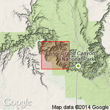
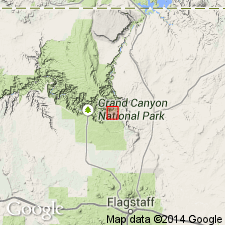
Named from exposures in canyon of Shinumo Creek, north side of Colorado River, Shinumo quadrangle, Grand Canyon, Coconino Co., northern AZ.
Measured section 1,564 ft along Shimumo Creek.
Source: US geologic names lexicon (USGS Bull. 896, p. 1987); supplemental information from GNU records (USGS DDS-6; Denver GNULEX).
- Usage in publication:
-
- Shinumo Quartzite
- Modifications:
-
- Revised
- AAPG geologic province:
-
- Southern Rocky Mountain region
Summary:
Underlies, as the lowest formation of Unkar Group of Grand Canyon Supergroup, the newly named Escalante Creek Member of Dox Formation (redefined). Shown on geologic map of eastern Grand Canyon, Coconino Co, AZ, Southern Rocky Mountain region. Is of late Precambrian age.
Source: GNU records (USGS DDS-6; Denver GNULEX).
- Usage in publication:
-
- Shinumo Quartzite*
- Modifications:
-
- Age modified
- Paleomagnetics
- Overview
- AAPG geologic province:
-
- Southern Rocky Mountain region
Summary:
Is one of the formations of the Unkar Group of the Grand Canyon Supergroup. Unconformably overlies Hakatai Shale of Unkar. Underlies Dox Sandstone of Unkar. Term "Quartzite" preferred to "Sandstone" because Shinumo is a quartzite at most localities. Is 324 to 475 m thick. Divided into lower, lower middle, upper middle, and upper members. Lower member is fluviatile, possibly tidal flat in origin. Middle member is nearshore marine, tidal flat, and supratidal flat in origin. Upper member deposited as part of mouth bar system in a lower deltaic plain and delta front of a tidal complex. Age changed from Proterozoic Y to Middle Proterozoic, the age term applied to rocks older than 900 Ma and younger than 1,600 Ma. Shown (columnar section) as younger than 1,200 Ma. Paleomagnetic data shows Shinumo correlates with lower part of Keweenawan Supergroup of Lake Superior region. Thought to be a correlative of the Dripping Spring Quartzite. Used in Southern Rocky Mountain region of northern AZ.
Source: GNU records (USGS DDS-6; Denver GNULEX).
For more information, please contact Nancy Stamm, Geologic Names Committee Secretary.
Asterisk (*) indicates published by U.S. Geological Survey authors.
"No current usage" (†) implies that a name has been abandoned or has fallen into disuse. Former usage and, if known, replacement name given in parentheses ( ).
Slash (/) indicates name conflicts with nomenclatural guidelines (CSN, 1933; ACSN, 1961, 1970; NACSN, 1983, 2005, 2021). May be explained within brackets ([ ]).