The National Geologic Map Database is migrating to a new infrastructure. We apologize for any service disruptions during this process.
|
|---|


This information is made available for our cooperators in the State geological surveys and universities, to assist with entry and modification of information in the National Geologic Map Database's Map Catalog. Please contact us with any questions or comments.
This is your database!As stipulated in the Geologic Mapping Act of 1992, the NGMDB is a National Archive built through collaboration between the State geological surveys and the USGS. It is a resource for all users, in all states, and it serves to support the activities, business, and products of all cooperators. The site is visited by tens of thousands of users each month and, through the Catalog's Product Description Pages, these users are linked to your agency's Web site and publications. The NGMDB facilitates access and visibility for your agency - we encourage you to consider it as an extension of your Web site's services. Please contact us regarding how we might best serve your agency.
What kind of publications are appropriate?The NGMDB Map Catalog is a comprehensive source for geoscience maps and reports of the Nation. Despite the seemingly narrow focus implied by the name "National Geologic Map Database", authorization in the Geologic Mapping Act stipulated that its scope be somewhat broader in order to include the wider range of geoscience information that is relevant and needed to address the societal issues stipulated in the Act. And so we encourage our partners to contribute bibliographic records for any and all geoscience themes.
These maps and reports may be in:
- Formal or Open-file series
- State Geological Survey map series
- Book publications
- Student theses
- "Gray literature".
You also are encouraged to include publications that don't contain a map but do contain descriptions of the geology in specific areas (e.g., a state park) that have a geographic footprint. Also, please include maps that have been superseded but are of historical significance or are still requested by users (e.g., older versions of state geologic maps).
Adding Map Catalog Records
NGMDB partners may log into the NGMDB Connect Website and submit records to the Map Catalog database. There, you will have access to our online record Input Form and be able to view a complete history of the records you have entered. To obtain an NGMDB Connect account, please send a request to [email protected]. Records submitted through the Input Form will be inspected by a staff member, and made available on our Website as soon as possible. If you have questions about submitting records, please consult the online documentation available on the NGMDB Connect Website, or contact us directly.
Modifying Map Catalog records
At some time in the future, you may want to modify records that you've contributed to this Catalog, or you may find an error in a record for another agency's publication.
When to modify a record- Errors in the citation or bounding coordinates
- The publication is now out of print or has been superseded,
- The publication is now available in digital form, or
- The URL to the publication has changed.
If there are many publication records that need to be corrected (e.g., your Web site was redesigned, and many of the URLS to publications have changed, then please contact us at [email protected] and advise us of the changes needed.
If only a single publication record needs to be modified, please use the "Corrections to this entry?" link on its Product Description Page. The popup Corrections form lets you designate the "Type of Correction" (e.g., Broken Web link, Citation error, Superseded by another publication, and so on).
When a product goes out of printPlease use the "Corrections to this entry?" link on its Product Description Page (PDP). When you click the link, the Corrections form will open. Choose "Other" in the Type of Corrections dropdown, and enter "Out of Print" in the Corrections text area, adding additional notes as needed. Submit the form and we will update the record accordingly. An updated PDP for an out-of-print record is shown here. To help the user find the out-of-print product, the revised PDP will show a list of depository libraries. Our state-by-state listing of depository libraries may be out-of-date, and we would appreciate all additions and corrections to this list.
When a product is supersededIf the superseding publication has not yet been entered into the NGMDB Map Catalog, fill in the Comments section of the NGMDB Web Input Form to let us know that the older NGMDB record should be marked as being "superseded".
Otherwise, please use the "Corrections to this entry?" link on the "superseded" records Product Description Page. When you click the link, the Corrections form will open. Choose "Other" in the Type of Corrections dropdown, and enter "Superseded" or "Supersedes" in the Corrections text area as appropriate. Please include the citation information of the newer publication, or a URL to a NGMDB Product Description Page. Submit the form and we will update the records for you.
Guidelines for Entering Catalog Records
Accuracy
The most important attribute of this bibliographical database is accuracy. A typographical error that is lost among 100 entries will shine like a headlight when that citation appears alone on a screen. Users will not notice that 1000 words were spelled correctly but will clearly remember every word incorrectly spelled. Misspelling means that important publications will not be retrieved by author or title keyword. Errors in coordinates mean that a major map of an area will never appear to searchers or will display incongruously for the wrong area.
Many types of systematic errors can be caught by computer programs developed by the NGMDB staff, such as incongruous scales, duplicate entries, common misspellings, and inconsistent author names. However nothing replaces care, correct calculations, and proofing by the indexer with the publication in hand. A few extra minutes checking entries against the publication being indexed are well worth the time for the validity of the database.
For accuracy, enter information directly from the publication rather than just copying entries from GeoRef or another source. When resolving differences in entries, prefer information obtained directly from the publication to information in another database, i.e., rely on your own choice of title based on these rules even if GeoRef gives another title choice.
Be careful of exact spacing and punctuation type between different parts of a field, i.e. two different author names in the AUTHOR field. The "[semicolon][space]" between two names allows the programmer to separate author names to be searched individually. Forgetting to use the right punctuation means the second name will not be located on an author search.
Choices of maps and editions
In general, enter latest editions only -- not earlier editions. In general, do not include reprints or re-issues without significant corrections by the same publisher. However, some maps may be re-issued by different publishers, released as commemorative editions, released in different scales or formats, or released with major changes. These and the earlier versions should all be entered. One version may be easier for the user to locate.
If a preliminary version was released, for example, in the USGS Open-File series, and a final version is published in another series, include both the preliminary versions and the final version. Preliminary versions may include maps that differ in scale and show additional or different information from the final version. The indexer will not have time or the opportunity to check word-by-word and map-section-by-map-section to determine if there are significant differences. Providing both will allow the user to choose to look at both or make a choice. (The term 'preliminary versions' does not include draft maps used to produce a released version which the indexer may encounter since these were never released and are rarely available to anyone but the people involved in producing a publication.)
This is a MAP database, not a comprehensive database of all geologic publications. Physically large maps, large foldout maps, and maps on plates folded in the pocket of a publication that are maps of areas depicting geology, geophysics, chemistry, hazards, and earth resources are obvious entries and the chief value of the database. Small maps require the indexer to make decisions about the value of the entry to potential users, weighing to some degree the time required for entry. When trying to decide if a publication, such as an USGS Circular, has a large enough map to deserve entry in the database, consider if the user would be disappointed to go to some trouble to get the publication and find the map in question. Sketch maps, outline maps, location maps, topographic maps, and page-sized or smaller maps of large areas with little subject information should not be entered in a map database where the user is looking for graphical information. The user can locate the text through other databases. Many site-specific reports have small maps that can lead the reader to important research in a map-defined area, and the indexer can choose to enter the publication. For example, a geochemistry study might have fairly insignificant maps (page-size) that plot sample locations, but would have a wealth of information in tables and text relating to the locations marked on the map. As more maps are included, a database query will bring up a fairly complete list of publications definable as site-specific with easily defined science themes.
Digital databases on disks, the Web, or CD-ROMs present additional problems in selecting for entry into the database. Paper printouts or screen views without the use of special software may not show map format. The file designed to use as a data layer overlaying a GIS produced map may not have map layout, but represent a series of data points. Information on boundary coordinates and scale may not be apparent, especially without special equipment and software. Because of the increasing importance of this location specific information, database managers have decided to include the information on these digital products. The indexer should enter approximate information about coordinates and scale drawn, if necessary, from the title.
To summarize, map entry selection should include these priorities:
- Include all publications published primarily as maps.
- Include all publications that have a map(s) that convey significant information on the maps themselves.
- Include publications, including digital databases, which have significant information in the publication itself (in the form of tables, lists, background information of data points) that is map related or map located.
- Include site-specific reports where a map in the report defines the publications area of study and has some science information, even if it is only identifying the location of sample sites.
Including coordinates and information for every map accompanying a publication may be desirable but would be a time-consuming process, and might not truly benefit the user who is seeking to find a listing of available publications. The user may or may not be helped by 10 entries for the same publication differentiated by a plate number. Multi-entry records could be confusing and take up excessive time of the indexer.
A) When a publication includes text and maps, use the overall title of the publication not the title that appears on a map, a figure, or a plate. Try to make your citation have the same title and author that a library or Georef cataloger would use to identify the publication. This would be helpful because, in most situations, the user will not be able to locate the publication in a library or purchase from a sales office if they have just the map title instead of the title of the whole publication.
B) However, sometimes a single publication will include a series of chapters, each perhaps containing several maps each with different authorships. In this case, the name of the publication should be cataloged under the "Larger Work" field, and the title and author of each chapter with a map are indexed in the "Title" and "Author" fields. Chapter numbers can be included as annotation in the title -- put this information in brackets at the end of the title to make it easier for the researcher to find, i.e. "[Chapter 7]". The user might need to check the "larger Work" field to find the publication in a library catalog.
An example of a publication with multiple chapters, titles, authors, and themes is:
- The geomorphic and structural development of Hawaiian submarine rift zones [Chapter 5] by Fornari, D.J.
- Hawaiian radiocarbon dates [Chapter 10] by Rubin, Meyer; Garulinski, L.K.; McGeehin, J.P.
- Stratigraphy of Kilauea Volcano [Chapter 11] by Easton, R.M.
For all the publications cited above the larger work is: Volcanism in Hawaii, volume 1: USGS professional Paper 1350.
C) In general, where a publication's maps are contiguous, define the bounding coordinates to include all maps. If possible, avoid multiple entries of publications.
D) Occasionally, publications may include maps of non-contiguous areas making multiple entries the best solution, such as a study of two or more widely separated quadrangles, stream basins, mining districts etc. For these maps, add a brief description of each map area that is indexed using square brackets at the end of each citation. In cases of multiple entries for a publication, the authors, series, and series numbers would be the same but the lat/long, and county information would be different.
For example the titles might read:
- Ice volumes on Cascade volcanoes: Mount Rainier, Mount Hood, Three Sisters, and Mount Shasta [plate 3, Mt. Hood]
- Ice volumes on Cascade volcanoes: Mount Rainier, Mount Hood, Three Sisters, and Mount Shasta [plate 4, Three Sisters]
OR:
- Geology of damsites on Flathead River, mouth to Flathead Lake, Lake and Sanders Counties, Montana [Buffalo damsite #1]
- Geology of damsites on Flathead River, mouth to Flathead Lake, Lake and Sanders Counties, Montana [Knowles damsite]
E) When several plates are included in a single entry, select as the map scale that of the most comprehensive, detailed map, or the map that seems to be the report's focus. The indexer must decide which map primarily gives the information that the author is conveying, but include multiple themes to cover all subjects for all maps in the report.
If you have a publication entitled "mineral resources of the ... area of Montana" with Plate 1 showing mines and deposits of the whole area and Plate 2 providing several small map insets of specific mines, give the coordinates for the area on the first plate.
On the other hand, if a publication includes a very generalized map showing a large area and a detailed map of a specific quadrangle or area named in the overall title, give the coordinates of the more specific area. For example, if you have Plate 1 of a publication showing a very generalized geologic map of Yellowstone National Park and its surroundings, but the title of the publication is "Geology of the ..."X"... Quadrangle, Yellowstone National Park with Plate 2 showing the geologic information for that quadrangle, give the coordinates for Plate 2.
Determining map coverageIdeally the exact outline of the map coverage would be given with GIS software, but at present, the outline of the map is expressed as coordinates of the farthest points of subject coverage forming a four-sided figure. (See Figure 1). In other words, the smallest virtual rectangle that encompasses the map area is drawn with the sides parallel to north-south and east-west. In many cases, this means the searcher looking for a geologic map of a small defined area may pull up records of maps that have no actual subject coverage for the area of interest.
Mathematical calculations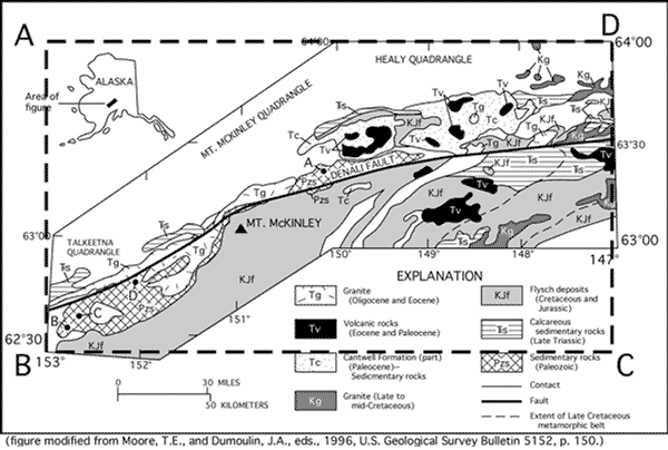
Mathematical calculations will be needed for such information as:
- extrapolation of latitude and longitude, i.e. calculating degrees when exact numbers at corners are not given but have to be calculated from numbers given at other points of the map
- calculating scale when none is given
- calculating coverage on skewed perspectives, i.e. when the map degrees do not match north and south with top and bottom of the map
- changing to natural scale, i.e. 1:25,000 from miles to inch, etc.
The calculations require a clear understanding of proportion and ratios. Indexers need to do these calculations and, if they can not, need to identify someone with the skills who can teach the skill or do that part of the work.
Contact the USGS indexer, Charles Mayfield for special problems in calculations.
General guide for making choicesKeep the user in mind when resolving problems. Strict interpretation of rules assures uniformity, but a unique map or a situation that tests the rule needs to be resolved in favor of making access easier for the user.
Outside contactsEncourage people with an interest in adding to the database, making their own new database compatible with the map index database, or holding older files which may load into the map index to contact Dave Soller. There are many maps all needing to be added as quickly as possible and help is appreciated. Be aware that dBase, Paradox, and certain other relational database files may be compatible with the Oracle format and can be substituted without expert programming.
Publishers, Series Names, and Order Contacts
We maintain a listing of Publishers, Series Names, and Order Contacts in the Map Catalog. This listing is intended to simplify the management of, and access to, map catalog records. The Input Form contains a mechanism for adding a new publishers, series names, and order contacts to the NGMDB as records are submitted. These data will be checked and verified for correctness along with all records submitted.
Here are up to date listings of currently available Publishers, Series Names, and Order Contacts stored in the NGMDB:
Publisher, Publisher Acronym, Series Name
Map Themes
Geochronology (geochron) -- Radiometric, magnetostratigraphic, and related types of age estimates, shown on a map or spatially referenced in a database
Paleontology (paleo) -- Fossil localities, descriptions and ages, shown on a map or spatially referenced in a database
Geochemistry (geochem) -- Geochemical analysis shown on a map or spatially referenced in a database
Geology
Bedrock (geolgenbed) -- Bedrock geologic map
Surficial (geolgensur) -- Surficial geologic map
Structure contours (geolstruc) -- Maps of structure or thickness of buried geologic units (see Figure 10)
Engineering (geoleng) -- Maps of soils or engineering properties of buried geologic units
Other (geolother) -- Other assorted map information
Geophysics
Magnetics (geopmag) -- Maps of the magnetic field induced in rocks
Gravity (geopgrav) -- Maps of variations in Earth's gravity field
Radiometric (geoprad) -- Maps of natural radioactivity of rocks and soil
Other (geopother) -- Other assorted geophysical information
Marine Geology
Geophysics (margeop) -- Geophysical maps of submerged rocks and sediment
Coastal (margcoast) -- Maps of the coastal zone (e.g. areas of erosion or sedimentation)
GLORIA: (margloria) -- Images of the ocean floor as detected by the GLORIA surveys
Other (marother) -- Other assorted marine information
Resources
Metals (resmet) -- Maps of metallic resource (e.g. copper)
Nonmetals (resnonmet) -- Maps of non-metallic resources (e.g. sand and gravel)
Petroleum (resergpet) -- Petroleum-related map (oil, gas, oil shale, tar sands, etc.)
Coal (resergcoal) -- Map showing coal deposits
Other energy resources that are not coal or petroleum (resergother) -- Map of energy resources that does not include petroleum or coal
Water (reswat) -- Maps of ground water aquifers, water quality, etc.
Other (resother) -- Other assorted map information (e.g. geothermal resources)
Hazards
Earthquakes (hazeq) -- Maps related to earthquake hazards (e.g. faults, earthquake zones)
Volcanoes (hazvolc) -- Maps related to volcano hazards (e.g. eruption history)
Landslides (hazland) -- Maps of existing landslides or landslide potential
Environmental (hazenvir) -- Maps specifically noting environmental hazards
Other (hazother) -- Various hazards, not restricted to a single hazard
Keywords in titles that help to identify themes:
| 1st ORDER TERMS | 2nd ORDER TERMS | KEYWORDS IN TITLE OR TEXT |
|---|---|---|
| None | Geochronology (geochron) | Age determination of Dating Isochron Isotope geochronology Potassium-argon dating Radiocarbon dating Radiometric dating Magnetostratigraphy |
| None | Paleontology (paleo) | Fossil plants, Fossil animals, Fossil record, Micropaleontology, Conodonts, Calcareous microfossils, Foraminifera, Radiolarians, Ostracods, etc. Palynology Pollen record Fossil spores Paleobotany Paleoecology Trace fossils Radiolarians Dinosaurs |
| None | Geochemistry (geochem) | Geochemical anomaly of Geochemical analysis of Chemical analysis of, Chemical composition Phase equilibrium Isotope geochemistry, Igneous and metamorphic geochemistry Determinative geochemistry Petrologic composition |
| Geology | Bedrock and/or Surficial NOTE: Keywords (to right) might be insufficient to assign a map to a category. After inspection, the map may be assigned to geolgenbed and/or geolgensur. | Areal geology of General geology of Geologic map of Lithology, lithofacies Paleogeography of Preliminary geologic map of Reconnaissance geologic Stratigraphy of Tectonics of Thrust tectonics of |
| Geology | Bedrock (geolgenbed) | Bedrock geologic map of Petrofacies of Petrology of Structural geology Ophiolites Arc deposits Island arcs Precambrian geology of |
| Geology | Surficial (geolgensur) | Glacial deposits of Surficial geologic map of Quaternary geologic map of Drift deposits |
| Geology | Stucture contours (geolstruc) | Structure contours of Structure of Isopach Thickness of Paleotectonics Contours Depth to bedrock Basement map |
| Geology | Engineering (geoleng) | Engineering geology of Engineering properties of Environmental geology of Military geology of Geology for planning Rock mechanics Soil mechanics of Urban geology of Geotechnical properties of (can also mean hazards, see below) Nuclear reactor or Power plant siting |
| Geology | Other (geolother) | None |
| Geophysics | Magnetics (geopmag) | Aeromagnetic Archaeomagnetism Filtered magnetic Geomagnetism Isoclinic line Isodynamic line Isogonic line Magnetic anomaly Magnetic declination Magnetic inclination Paleomagnetism Remanent magnetism Pseudogravity |
| Geophysics | Gravity (geopgrav) | Bouguer gravity Free-air anomaly Gravimetric Gravity field Gravity potential Isanomalic map Isogal map Isogram map Isostatic anomaly |
| Geophysics | Radiometric (geoprad) | Aeroradioactivity map Natural radioactivity of Radiometric |
| Geophysics | Other (geopother) | None |
| Marine Geology | Geophysics (margeop) | Marine geophysics |
| Marine Geology | Coastal (margcoast) | Coastal erosion along Coastal changes of |
| Marine Geology | Gloria (margloria) | None |
| Marine Geology | Other (marother) | Seabed composition or materials |
| Resources | Metals (resmet) | Assessment of Economic geology of Mineral resources of Mineral deposits of Mines of Prospects of Resource appraisal of Strategic metals of Metals (actinide series, alkali metals, aluminum, antimony, barium, beryllium, bismuth, cadmium, calcium, cerium, cesium, chromium, cobalt, columbium, copper, dysprosium, erbium, europium, francium, gallium, germanium, hafnium, gold, indium, iridium, iron, lanthanide series, lead, lithium, magnesium, magnetite, manganese, marble, mercury, metal ores, molybdenum, nickel, niobium, osmium, palladium, platinum, plutonium, protactinium, potassium, precious metals, quicksilver, radium, rare earth metals, rhenium, rhodium, rubidium, ruthenium, scandium, silver, sodium, steel, strontium, tantalum, technetium, thallium, thorium, tin, titanium, tungsten, uranium, vanadium, wolfram, yttrium, zinc, zirconium, etc.) |
| Resources | Nonmetals (resnonmet) | Resource assessment of Economic geology of Mineral resources of Mineral deposits of Mines of Prospects of Resource appraisal of Strategic minerals Nonmetals (Abrasive materials, actinolite, agate, aggregates, alum, alunite, amber, amphiboles, apatite, argon, arsenic, asbestos, astatine, bauxite, bentonite, barites, biotite, boron, brick, bromine, building stone, carbonates, cement, ceramic materials, chlorine, chrysotile, clay, clay products, concrete, conglomerates, corundum, diamonds, diatomite, dolomite, emerald, emery, feldspar, fertilizers, fluorine, fluorite, fluorspar, fuller's earth, garnet, gems, gemstones, glass, granite, gravel, gypsum, halogens, helium, hydrogen, illite, iodine, inert gases, jade, kaolin, krypton, kyanite, laterite, lepidolite, lime, limestone, marble, margarite, mica, mineral paints, micaceous minerals, monazite, muscovite, onyx, neon, nitrates, nitrogen, ochre, opal, ornamental stone, oxygen, paragonite, pearls, phosphates, phosphorus, pigments, potash, potter's clay, potter's earth, pottery materials, porcelain, precious stones, pumice, quartz, quartzite, radon, refractory materials, ruby, salt, sand, sapphire, selenium, serpentinite, silicates, silicon, slate, smectite, soapstone, talc, tellurium, tripolite, vermiculite, volcanic ash, xenon, zeolite) |
| Resources | Energy (resenergy) | Energy resources of Economic geology of Fuel resources of Mineral resources of Mineral deposits of Mines of Prospects of Fuels of |
| Resources | Energy Petroleum (resergpet) | Map of fuel oil, natural gas, oil, oil shales, petroleum, oil wells, oilfields, shale, tar sands |
| Resources | Energy Coal (resergcoal) | Coal resources of Anthracite coal resources of Bituminous coal resources of Coal mines of |
| Resources | Energy Other energy resources(resergother) | Uranium resources of Radioactive energy resources of Geothermal resources map of Hot springs maps of Peat resources of |
| Resources | Water (reswat) | Artesan wells Ground water resources Hydrogeologic map of Hydrologic resources Hydrology of Lakes of Mineral waters of Springs Water resources of Water wells of |
| Resources | Other (resother) | Geothermal map of Hot springs Land use |
| Hazards | Earthquakes (hazeq) | Earthquake hazards map Ground acceleration Liquefaction potential Earthquake zones Microseismic regions Fault map (This is as hazards not maps of faults as structural forms) Seismic or seismology (beware of confusing with seismic prospecting methods and seismic wave measurements ) Seismic hazards of Seismicity of Active faults of Seismic ground response |
| Hazards | Volcanoes (hasvolc) | Lava flows Volcanic hazards Historic eruptions Eruptive history Ash fall pattern |
| Hazards | Landslides (hazland) | Debris flows Landslides Mass movement Mudflow Landslip Landslide potential Slope stability |
| Hazards | Environmental (hazenvir) | Contamination of Environmental geology of (Can also mean engineering geology, see above) Environmental impact of Pollution of Reclamation of Waste disposal Nuclear plant hazards Subsurface repositories |
| Hazards | Other (hazother) | Flooding Salt-water intrusion Storm damage of Land subsidenceSubsidence Swelling clays Sinkholes Karst Toxic waste disposal Contaminated groundwater Mine and tunnel failures |
USGS Map Series Reference
General Rule: Use singular form except for the words "Water-Resources", "Studies", and "Investigations". Capitalize first letters of all words. Use dashes with "Open-File", "Water-Resources", and "Water-Supply".
The I-maps and the MF-maps are consistently numbered, but the series name often varies. It is more important to retain the designation I or MF linked to the number in these two series than it is for other series.
Bulletin
Circular
DDS = Digital Data Series
GF = Geologic Atlas of the United States Folio
(This series is commonly called Geologic Folios, but the selected name above is used in the database)
GP = no.1-5, 1945-1946 Geophysical Investigations Preliminary Map
GQ = Geologic Quadrangle Map
HA = Hydrologic Investigations Atlas
HU = Hydrologic Unit Map
I = 1+ 1954-1973, Miscellaneous Geologic Investigations Map
No. 800+ , smaller issue numbers published 1974-1996 [no clear-cut division]
Miscellaneous Investigations Series Map
(Don't use Miscellaneous Investigations Map)
August, 1996 + Geologic Investigations Map
MF = no. 1-306, 1950-1973, Mineral Investigations Field Studies Map
no. 307+, 1971+ Miscellaneous Field Studies Map
Monograph
MR = Mineral Investigations Resource Map
OC = no.1-39, 1944-1950, Oil and Gas Investigations Preliminary Chart
no. 40+, 1950+ Oil and Gas Investigations Chart
OM = no. 1-109, 1943-1950, Oil and Gas Investigations Preliminary Map
no. 110+, 1950+ , Oil and Gas Investigations Map
PP = Professional Paper
WRI = 1972-1982 Water-Resources Investigations
1983- Water-Resources Investigations Report
(Do not use Water-Resources Investigations Open-File Report or Water-Resources Investigation Report)
WSP = no.1-214, 1896-1907, Water-Supply and Irrigation Paper
no. 215- Water-Supply Paper
References
Bates, R.J., and Jackson, J.A., 1987, Glossary of geology (3rd ed.): Alexandria, Va., American Geological Institute, 788 p.
National Computer Systems Laboratory (U.S.), 1990, Counties and equivalent entities of the United States, its possessions and associated areas: Federal information processing standards publication, FIPS PUB 6-4, 31 p. (Corrections issued as http://www.itl.nist.gov/fipspubs/fip6-4.htm)
Rand McNally commercial atlas and marketing guide. Latest edition owned (or other atlas giving clearly marked county boundaries).
Thompson, M.M., 1988, Maps for America, cartographic products of the U.S. Geological Survey and others (3rd ed.): Washington, D.C., U.S. Geological Survey. 265 p.
U.S. Federal Geographic Data Committee, 1994, Content standards for digital geospatial metadata: Washington, D.C.: FGDC, 332 p. (Also 1998 ed.) [ PDF ]
U.S. Geological Survey, 1981, Suggestions to authors of the reports of the U.S. Geological Survey; edited and revised by Wallace R. Hansen (7th ed.): Washington, D.C., U.S. Geological Survey. 289 p.
Gersmehl, P.J., 1991, The Language of maps (14th ed.) : Indiana, PA, National Council for Geographic Education, Indiana University of Pennsylvania. 196 p.
Maltman, Alex, 1990, Geological maps, an introduction: New York, Van Nostrand Reinhold. 184 p.
Spencer, E.W., 1993, Geologic maps, a practical guide to the interpretation and preparation of geologic maps: New York, Macmillan. 147 p.
Contacts
Our Personnel page provides a listing of NGMDB project members.