The National Geologic Map Database is migrating to a new infrastructure. We apologize for any service disruptions during this process.
|
|---|


- Usage in publication:
-
- Zullinger Formation
- Modifications:
-
- Areal extent
- Dominant lithology:
-
- Limestone
- Dolomite
- AAPG geologic province:
-
- Appalachian basin (Eastern Overthrust area)
Summary:
Pg. 8 (table 1), 11 (table 3), 57. Zullinger Formation of Conococheague Group. Consists of cyclically-bedded stromatolitic-mechanical limestone, interbanded limestone and dolomite, interlaminated limestone and dolomite, and thin dolomite. Several thin local quartz sand beds. Thickness 2,500 feet. Underlies Shadygrove [Shady Grove] Formation (new). Overlies Elbrook Formation. Age is Late Cambrian.
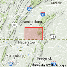
Described from Cumberland Valley, southeastern Franklin Co., central southern PA.
Source: US geologic names lexicon (USGS Bull. 1350, p. 846).
- Usage in publication:
-
- Zullinger Formation
- Modifications:
-
- Principal reference
- Dominant lithology:
-
- Limestone
- Dolomite
- AAPG geologic province:
-
- Appalachian basin
Summary:
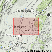
Named for Zullinger, Franklin Co., PA. Type section is road cuts 1 mile west of Zullinger on State Highway 16. Zullinger used to be lower part of Conococheague Formation. This paper raised the Conococheague to group rank and divided it into a lower Zullinger Formation and an upper Shadygrove Formation. Zullinger is composed of blue-gray limestone frequently interbedded within dark blue-gray dolomite. Basal 115 feet is 3 to 4 foot thick beds of interbanded limestone and dolomite with subordinate interbeds of mechanical and algal limestone. Above this are 5 feet of sandy dolomite and 87 feet of algal and mechanical limestone. Algal pipes and clastic filled channels are prominent. The main body of the formation is composed of approximately 1550 feet of cyclical carbonates. Thickness of formation is probably 2500 feet. Conformably overlies Elbrook Formation; underlies Shadygrove Formation. Trilobites suggest late Dresbachian to Trempealeauan age (Late Cambrian), however, stratigraphic column shows Middle and Upper Cambrian. Geologic map included in report.
Source: GNU records (USGS DDS-6; Reston GNULEX).
- Usage in publication:
-
- Zullinger Formation*
- Modifications:
-
- Overview
- AAPG geologic province:
-
- Appalachian basin
Summary:
Used Zullinger Formation on correlation chart for PA. Upper Cambrian.
Source: GNU records (USGS DDS-6; Reston GNULEX).
For more information, please contact Nancy Stamm, Geologic Names Committee Secretary.
Asterisk (*) indicates published by U.S. Geological Survey authors.
"No current usage" (†) implies that a name has been abandoned or has fallen into disuse. Former usage and, if known, replacement name given in parentheses ( ).
Slash (/) indicates name conflicts with nomenclatural guidelines (CSN, 1933; ACSN, 1961, 1970; NACSN, 1983, 2005, 2021). May be explained within brackets ([ ]).