

- Usage in publication:
-
- Zuckerman member
- Modifications:
-
- Original reference
- Dominant lithology:
-
- Sandstone
- Limestone
- AAPG geologic province:
-
- South Oklahoma folded belt
Summary:
Pg. 46. Zuckerman member of Hoxbar formation [misspelled Zuckermann in text]. Name proposed for member of the Hoxbar formation (raised in rank) in the Ardmore basin of southern Oklahoma. Chiefly white to buff, coarsely crystalline calcareous sandstone, with a finer-grained layer at the top and a local development of intraformational(?) conglomerate of gray limestone pebbles up to 1/4 inch in diameter in a calcareous matrix. Thickness 30+/- feet. Lies 400 to 500 feet above the Daube limestone [member (new) of the Hoxbar]. Underlies 500+/- feet of beds belonging to the Hoxbar. Age is Pennsylvanian. Report includes geologic map, columnar section.
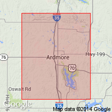
Type locality not designated. Named from abandoned coal mine of Westheimer, Munzesheimer, Daube, and Zuckerman, in T. 5 S., R. 2 E., Carter Co., central southern OK.
Source: US geologic names lexicon (USGS Bull. 896, p. 2395); supplemental information from GNU records (USGS DDS-6; Denver GNULEX).
For more information, please contact Nancy Stamm, Geologic Names Committee Secretary.
Asterisk (*) indicates published by U.S. Geological Survey authors.
"No current usage" (†) implies that a name has been abandoned or has fallen into disuse. Former usage and, if known, replacement name given in parentheses ( ).
Slash (/) indicates name conflicts with nomenclatural guidelines (CSN, 1933; ACSN, 1961, 1970; NACSN, 1983, 2005, 2021). May be explained within brackets ([ ]).