- Usage in publication:
-
- Zeandale limestone*
- Modifications:
-
- Named
- Dominant lithology:
-
- Limestone
- Shale
- Sandstone
- Coal
- AAPG geologic province:
-
- Nemaha anticline
Summary:
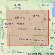
Pg. 2274 (fig. 1), 2276. Zeandale limestone of Wabaunsee group. Defined to include strata between Pillsbury shale (new) above and Willard shale below. Thickness ranges from 19 to 53 feet and averages about 25 feet. Comprises (ascending) Tarkio limestone, Wamego shale, and Maple Hill limestone members. Age is Late Pennsylvanian (Virgilian).
Type section: exposure along north-south farm access road south of Deep Creek, about 1 mi (1.6 km) east and 0.25 mi (0.4 km) south of Zeandale, in SE/4 NE/4 NE/4 sec. 28, T. 10 S., R. 9 E., Riley Co., northeastern KS. Named from town of Zeandale on south side of Kansas River, Riley Co., northeastern KS.
Source: US geologic names lexicon (USGS Bull. 1200, p. 4336-4337).

- Usage in publication:
-
- Zeandale Limestone
- Modifications:
-
- Overview
- AAPG geologic province:
-
- Nemaha anticline
Summary:
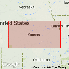
(Paleozoic Era; Pennsylvanian System by J.M Jewett, H.G. O'Connor, and D.E. Zeller, p. 41.) Zeandale Limestone of Richardson subgroup [informal] of Wabaunsee Group. Comprises (ascending) Tarkio Limestone Member, Wamego Shale Member, and Maple Hill Limestone Member. Thickness from 19 to 35 feet. Underlies Pillsbury Shale of Richardson subgroup; overlies Willard Shale of Nemaha subgroup [informal], both of Wabaunsee Group. Willard is not differentiated from overlying shale beds (Wamego Shale Member) south of point where the Tarkio Limestone Member disappears. Age is Late Pennsylvanian (Virgilian).
["Subgroup" not recognized as a formal stratigraphic rank term (CSN, 1933; ACSN, 1961, 1970; NACSN, 1983, 2005, 2021). Considered informal and should not be capitalized.]
Source: Publication.

- Usage in publication:
-
- Zeandale Formation
- Modifications:
-
- Overview
- AAPG geologic province:
-
- Nemaha anticline
Summary:
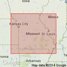
Pg. 323. Zeandale Formation of Richardson subgroup [informal] of Wabaunsee Group. Previously known as the lower part of the McKissick Grove shale or McKissick shale in Nebraska, and possibly Kansas, Moore and Mudge (1956) named this unit the Zeandale Formation. Thompson (1995, Missouri Div. Geol. and Land Survey, v. 40 (revised), p. 130) added "The Zeandale Formation includes (from the base upward): the Tarkio, Wamego, and Maple Hill Members. The formation is well-exposed along the Missouri River bluffs south of Rock Port in Atchison County. The Zeandale Formation is about 25 [feet] thick." The Zeandale Formation overlies the Willard Shale, and is overlain by the Pillsbury Shale.
["Subgroup" not recognized as a formal stratigraphic rank term (CSN, 1933; ACSN, 1961, 1970; NACSN, 1983, 2005, 2021). Considered informal and should not be capitalized.]
Source: Publication.
For more information, please contact Nancy Stamm, Geologic Names Committee Secretary.
Asterisk (*) indicates published by U.S. Geological Survey authors.
"No current usage" (†) implies that a name has been abandoned or has fallen into disuse. Former usage and, if known, replacement name given in parentheses ( ).
Slash (/) indicates name conflicts with nomenclatural guidelines (CSN, 1933; ACSN, 1961, 1970; NACSN, 1983, 2005, 2021). May be explained within brackets ([ ]).

