The National Geologic Map Database is migrating to a new infrastructure. We apologize for any service disruptions during this process.
|
|---|


- Usage in publication:
-
- Yogo limestone*
- Modifications:
-
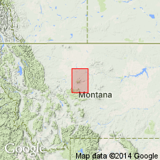
- Areal extent
- AAPG geologic province:
-
- Sweetgrass arch
Summary:
The brick-red shales and limestones constituting Dry Creek shale are overlain by 100 feet of Yogo limestone. [Age is Late Devonian.]
Source: US geologic names lexicon (USGS Bull. 896, p. 2388).
- Usage in publication:
-
- Yogo limestone*
- Modifications:
-
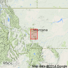
- Areal extent
- Dominant lithology:
-
- Limestone
- Shale
- AAPG geologic province:
-
- Montana folded belt
- Sweetgrass arch
Summary:
Yogo limestone. Gray or mottled limestone with a few layers of shale. Uppermost member of Barker formation [a name applied to all Cambrian rocks of area]. Overlies Dry Creek shale and underlies Jefferson limestone. [Age is Late Cambrian.]
[Origin of name not stated, but Barker formation is mapped at and around village of Yogo, also along Yogo Creek (both in north part of this quadrangle), at both of which places it is overlain by Jefferson limestone.]
Source: US geologic names lexicon (USGS Bull. 896, p. 2388).
- Usage in publication:
-
- Yogo limestone*
- Modifications:
-
- Principal reference
- Dominant lithology:
-
- Limestone
- Shale
- AAPG geologic province:
-
- Montana folded belt
- Sweetgrass arch
Summary:
Pg. 286. Yogo limestone of Little Belt Mountains generally consists of thin-bedded limestone flags alternating with crumbly gray or greenish shale but grades into rather pure thick-bedded limestones. Entire section is well shown at head of Sheep Creek, [Meagher County], and south of Monarch, [Cascade County, Montana]. [Age is Late Cambrian].
[On p. 328 Weed gave section exposed in Sheep Mountain, Yogo Creek Valley, north of Yogo, which showed 10 feet of Yogo limestone underlying Jefferson limestone and overlying Dry Creek shale. On p. 330 he gave a section at mouth of Bear Creek, Yogo Gulch, which listed 65 feet of Yogo between the Jefferson limestone and Dry Creek shale. Type locality of Dry Creek shale is in northeast corner of Three Forks quadrangle. See definition.]
Source: US geologic names lexicon (USGS Bull. 896, p. 2388).
- Usage in publication:
-
- Yogo limestone*
- Modifications:
-
- Overview
- AAPG geologic province:
-
- Montana folded belt
- Sweetgrass arch
Summary:
Pg. 91. Yogo limestone of Helena district, south-central Montana, consists of light-colored thin-bedded limestones, with crinkly bands and films of jasper, in many places composed of limestone pebbles held in a glauconitic matrix. It corresponds to so-called "Pebbly" limestone of Three Forks folio [which rests on Dry Creek shale].
Source: US geologic names lexicon (USGS Bull. 896, p. 2388).
- Usage in publication:
-
- Yogo limestone†
- Modifications:
-
- Abandoned
- AAPG geologic province:
-
- Central Montana uplift
- Montana folded belt
- Sweetgrass arch
- Yellowstone province
Summary:
Pg. 1272, 1282, 1285, 1336, 1337. Proposed that Yogo limestone be discarded. Original description has no meaning because Cambrian rocks could not be found in any section in Montana or Yellowstone Park between Dry Creek shale and overlying Devonian limestone or dolomites. Name Yogo has no basis in observable fact and must be discarded. Defined Dry Creek shale as unconformably overlain by Devonian rocks. In upper part of Dry Creek he included a great thickness of limestones.
Weed (1900) in report from Little Belt Mountains, Montana, placed Cambrian age Yogo above Dry Creek shale. At Dry Wolf Creek section, [Deiss?, in this report?] identified a Devonian brachiopod spirifer from within 1 foot above top of Dry Creek shale. Rocks assigned to Yogo by Weed are actually Devonian limestones.
Source: US geologic names lexicons (USGS Bull. 896, p. 2388; USGS Bull. 1200, p. 4327-4328); supplemental information from GNU records (USGS DDS-6; Denver GNULEX).
- Usage in publication:
-
- Yogo limestone
- Modifications:
-
- Age modified
- Areal extent
- AAPG geologic province:
-
- Montana folded belt
- Sweetgrass arch
- Central Montana uplift
- Williston basin
Summary:
Pg. 1413-1415. Yogo limestone. In work on Little Belt Mountains, Weed (1900) described thin-bedded limestones interbedded with gray or greenish-gray shale and grading into rather pure thick-bedded limestone. To these beds, he gave name Yogo limestone and assigned them to Cambrian. It is evident that Weed considered Yogo limestone equivalent to Peale's (1893, USGS Bull. 110) pebbly limestone of Three Forks area. It now seems clear that Weed's Yogo limestone is equivalent to basal Devonian of this paper, plus a variable part of the base of limestone member of Jefferson formation. If the basal Devonian unit is proved to be a cartographic unit [mappable], Yogo, suitably revised, would have priority as formational name. Deiss (1936) found no Cambrian fossils above Dry Creek shale in Belt Creek section; hence no Yogo in the section. He believed that name Yogo should be discarded. Present authors agree that there may be no Cambrian above Dry Creek shale in central Montana, but this fact does not invalidate term Yogo. If formation is a lithologic unit, its identity is not destroyed because it was first assigned to wrong geologic age.
[Basal Devonian unit recognized in Big and Little Belt Mountains (Montana folded belt province and Sweetgrass arch); Judith Mountains (Central Montana uplift); and Little Rocky Mountains (Williston basin). Measured section of basal Devonian unit at Yogo Creek, Little Belt Mountains, Judith Basin County, Montana, described. Is 40 feet thick; overlies thin (8 feet) beds of undetermined age which, in turn, overlie Cambrian Dry Creek shale; conformably and transitionally underlies Jefferson formation. Age is considered to be Late Devonian (Senecan), based on correlation and upward transition of Cambrian shale into Devonian age fossil-bearing beds. Report includes cross section, correlation chart.]
Source: US geologic names lexicon (USGS Bull. 1200, p. 4327-4328); supplemental information (in brackets) from GNU records (USGS DDS-6; Denver GNULEX).
- Usage in publication:
-
- Yogo limestone*
- Modifications:
-
- [Not used]
- AAPG geologic province:
-
- Montana folded belt
- Sweetgrass arch
- Central Montana uplift
- Williston basin
Summary:
Pg. 2212. Yogo limestone, if used as originally defined by Weed does not exist. Even if used in restricted sense as indicated by Sloss and Laird, Yogo can only be lithologic and stratigraphic equivalent of beds in upper part of their basal Devonian unit --beds which because of their transitional character are more difficult to separate from overlying Jefferson than the prominent red and yellow dolomites and mudstones of lower part of basal Devonian unit.
Source: US geologic names lexicon (USGS Bull. 1200, p. 4327-4328).
For more information, please contact Nancy Stamm, Geologic Names Committee Secretary.
Asterisk (*) indicates published by U.S. Geological Survey authors.
"No current usage" (†) implies that a name has been abandoned or has fallen into disuse. Former usage and, if known, replacement name given in parentheses ( ).
Slash (/) indicates name conflicts with nomenclatural guidelines (CSN, 1933; ACSN, 1961, 1970; NACSN, 1983, 2005, 2021). May be explained within brackets ([ ]).