

- Usage in publication:
-
- Yeso formation*
- Modifications:
-
- Original reference
- Dominant lithology:
-
- Sandstone
- Shale
- Limestone
- Gypsum
- AAPG geologic province:
-
- Orogrande basin
Summary:
Yeso formation of Manzano group. Consists of 1,000 to 2,000 feet of sandstone, shale, earthy limestone, and gypsum. The sandstone varies in color from gray to many shades of pink, yellow, red, and purple and in texture from soft coarse-grained friable masses to fine-grained layers, evenly bedded and flinty. The shales, frequently gypsiferous, are soft, pink to yellow in color, and beds of massive white gypsum 100 to 200 feet thick occur in many places. Is middle formation of Manzano group. Underlies San Andreas [San Andres] limestone and lies with apparent conformity on Abo sandstone. [See also under San Andres limestone.] Until further information is available [San Andres] limestone cannot be definitely separated from Yeso formation except in type locality of [San Andres] Mountains. [Age is Late Carboniferous (Pennsylvanian).]
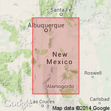
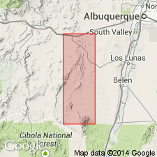
Typically exposed on Mesa del Yeso, a small table-land 12 mi northeast of Socorro, [Socorro Co.], central NM. [In several sections the top member of Yeso formation is shown as consisting of 200 to 275 feet of pink, yellow, and white sandstone.]
Source: US geologic names lexicon (USGS Bull. 896, p. 2387).
- Usage in publication:
-
- Yeso member*
- Modifications:
-
- Revised
- AAPG geologic province:
-
- Orogrande basin
- San Juan basin
Summary:
Pg. 176-182. Yeso member of Chupadera formation of Manzano group. [The name Chupadera formation was adopted by the USGS for this report in July 1919, but report was not published unitl March 31, 1922.] The name Chupadera formation is here introduced for upper part of Manzano group, which Lee divided into Yeso formation and San Andreas [San Andres] limestone. In mapping these deposits it was found that while Lee's subdivisions were discernible in places, it was impracticable to separate them generally. Although limestone is conspicuous feature of San Andres limestone much of that subdivision consists of thick beds of gypsum and sandstone which are not well exposed in the type localities. In future, wherever Lee's subdivisions can be recognized they will be treated as members of Chupadera formation, instead of as distinct formations. [Age is Permian.]
Source: US geologic names lexicon (USGS Bull. 896, p. 2387, Chupadera entry p. 442).
- Usage in publication:
-
- Yeso member
- Modifications:
-
- Revised
- AAPG geologic province:
-
- Estancia basin
- Orogrande basin
- Palo Duro basin
Summary:
Yeso member of Chupadera formation. Abandoned Picacho limestone of Pecos Valley region for San Andres limestone member of Chupadera formation, and replaced Nogal formation of that area with Hondo sandstone member of Chupadera formation (above) and Yeso member of Chupadera formation (below). The recognition of Hondo sandstone involves a slight redefinition of both San Andres and Yeso as heretofore used. [Age is Permian.]
Source: US geologic names lexicon (USGS Bull. 896, p. 2387).
- Usage in publication:
-
- Yeso formation
- Modifications:
-
- Principal reference
- Revised
- Dominant lithology:
-
- Limestone
- Sandstone
- Gypsum
- AAPG geologic province:
-
- Orogrande basin
- Permian basin
Summary:
Pg. 1655 (fig. 1), 1657-1661. Yeso formation of Manzano group. Lee (1909) named the Yeso as middle formation of Manzano group. Name is derived from Mesa del Yeso, a small tableland 12 miles northeast of Socorro. Lee stated that Yeso beds were typically exposed on this mesa. However section he described in text, columnar section, and faunal list lies 2 miles southeast of this Mesa del Yeso. Section given in present report was measured in immediate vicinity of Lee's section and some parts are no doubt identical with his. Lee's description of Yeso is unsatisfactory because: (1) type locality is not completely designated; (2) section is measured in such general terms that it is not suitable for present stratigraphic needs; (3) at top of Lee's section, and included by him in Yeso, is a 75-foot limestone, top of which is an exposed erosion surface. This limestone is now known to be basal San Andres; (4) below this bed, Lee also included in Yeso 200 feet of sandstone, part of which is now separated as Glorieta sandstone; and (5) a limestone layer at base of Yeso is described as highly fossiliferous and 50 feet thick. Such a layer is not believed to occur at or near base of formation. In present report, base of Yeso is placed at base of a limestone bed, this bed is only 7 to 10 feet thick and is barren of fossils. Prominent exposure of San Andres limestone is present three-eighths mile west of base of Yeso type section as herein described, the position of which is result of faulting. Because this stratum is about 50 feet thick and contains many fossils, it is thought that Lee may have mistakenly included it in basal Yeso. As redescribed herein, Yeso consists of at least four units. Lowest is general zone of clastic material, characterized by pink and orange sandstone; middle evaporites; Canas member (new); Joyita member (new). Thickness 592.7 feet at type section; thickens toward both northwest and southeast from type section. Overlies Abo formation; underlies Glorieta sandstone. Darton (1922, USGS Bull. 726) reduced Yeso to member status in Chupadero formation, a term he introduced to include beds of Yeso and San Andres age. Term Chupadero has been abandoned by the USGS and Yeso is now considered formation in Manzano group. [Fossiliferous. Age is Early Permian (Leonard).]
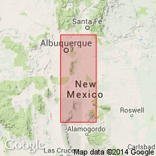
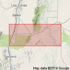
Type section: base of section is 11.2 mi N. 46 deg. E. of Socorro at point on Socorro quadrangle where its eastern edge is intersected by the 34 deg. 10 min. parallel. Section measured northeast from this point, in canyons and cuesta escarpments in secs. 4 and 5, T. 2 S., R. 2 E., and in sec. 33, T. 1 S., R. 2 E., Socorro Co., central NM. Top of section is 2.25 mi southeast of Mesa del Yeso on high isolated butte. [Also exposed in Sierra and Otero Cos.; extends into subsurface of Permian basin.]
Source: US geologic names lexicon (USGS Bull. 1200, p. 4325-4326).
- Usage in publication:
-
- Yeso formation*
- Modifications:
-
- Revised
- AAPG geologic province:
-
- Orogrande basin
- San Juan basin
Summary:
Yeso formation. In Lucero uplift, Valencia, Socorro, and Bernalillo Counties, [central New Mexico], subdivided into (ascending) Meseta Blanca member, 0 to 209 feet, and Los Vallos member (new), 820 to 1,020 feet. Overlies Abo formation; underlies San Andres formation. [Age is Permian.]
Source: US geologic names lexicon (USGS Bull. 1200, p. 4325-4326).
- Usage in publication:
-
- Yeso formation*
- Modifications:
-
- Revised
- AAPG geologic province:
-
- Estancia basin
- Orogrande basin
Summary:
Yeso formation. In La Joya area, Los Pinos Mountains, and northern Chupadera Mesa, subdivided into (ascending) Meseta Blanca, Torres (new), Canas gypsum, and Joyita sandstone members. Thickness as much as 1,015 feet. Overlies Abo formation; underlies San Andres formation. Age is Permian (Leonard).
Source: Publication; US geologic names lexicon (USGS Bull. 1200, p. 4325-4326).
- Usage in publication:
-
- Yeso formation*
- Modifications:
-
- Revised
- AAPG geologic province:
-
- San Juan basin
Summary:
Yeso formation. In Sandoval and Rio Arriba Counties, [north-central] New Mexico, subdivided into Meseta Blanca member at base and San Ysidro member above (both new). Overlies Abo formation; underlies Glorieta sandstone member of San Andres. [Age is Permian.]
Source: US geologic names lexicon (USGS Bull. 1200, p. 4325-4326).
- Usage in publication:
-
- Yeso formation*
- Modifications:
-
- Areal extent
- AAPG geologic province:
-
- Las Vegas-Raton basin
Summary:
Yeso formation. Brownish-pink siltstone. Exposed in extreme southwestern part of mapped area, south of Lucero, Mora County, northeastern New Mexico. Distinguished from underlying Sangre de Cristo formation by its lighter color and finer texture. Age is Permian.
[Shown in stratigraphic section of Mora River Gap area (south of mapped area). Underlies Glorieta sandstone member of San Andres formation; overlies and intertongues with Sangre de Cristo formation.]
Source: Publication.
- Usage in publication:
-
- Yeso formation*
- Modifications:
-
- Revised
- AAPG geologic province:
-
- Orogrande basin
Summary:
Pg. 696 (fig. 4), 697. Yeso formation. In Otero County, [southern] New Mexico, includes Otero Mesa member (new; rocks previously included in Abo sandstone). Overlies Lee Ranch tongue (new) of Abo sandstone; west of Otero Mesa overlies Hueco limestone. Age is Early Permian (Leonard).
Source: Publication; US geologic names lexicon (USGS Bull. 1200, p. 4325-4326).
- Usage in publication:
-
- Yeso Formation
- Modifications:
-
- Revised
- AAPG geologic province:
-
- San Juan basin
Summary:
Revised in that some flat-bedded and thinly bedded siltstones or very fine sandstones of the Meseta Blanca Member of the Yeso Formation in the Nacimiento Mountains north of Albuquerque in the San Juan basin are removed from the Yeso Formation and reassigned to the De Chelly Sandstone. De Chelly, therefore, becomes the regional term for the sandstones of this interval. Yeso gradationally overlies De Chelly Sandstone. Overlain by Glorieta Sandstone in eastern exposures and by Coconino Sandstone in western exposures. Isopach map. Nomenclature chart. Cross section. History of usage and lithology summarized. Basis for Permian age are the fusulinids and invertebrates found in southeast NM and west TX.
Source: GNU records (USGS DDS-6; Denver GNULEX).
For more information, please contact Nancy Stamm, Geologic Names Committee Secretary.
Asterisk (*) indicates published by U.S. Geological Survey authors.
"No current usage" (†) implies that a name has been abandoned or has fallen into disuse. Former usage and, if known, replacement name given in parentheses ( ).
Slash (/) indicates name conflicts with nomenclatural guidelines (CSN, 1933; ACSN, 1961, 1970; NACSN, 1983, 2005, 2021). May be explained within brackets ([ ]).