

- Usage in publication:
-
- Yellowpine limestone member*
- Modifications:
-
- Named
- Dominant lithology:
-
- Limestone
- AAPG geologic province:
-
- Great Basin province
Summary:
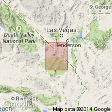
Included as uppermost member of Monte Cristo limestone (new). Consists of several beds of dark-gray limestone that locally weather as massive ledge. In places is altered to dolomite. Thickness varies from 60 to 120 feet. Contains productive ore bodies of several mines. Distinctive feature is presence of corals of Zaphrentis group, 3 to 6 inches long. Overlies Arrowhead limestone member (new) of Monte Cristo limestone. Unconformably underlies Bird Spring formation (new). Age is probably middle[!] Mississippian.
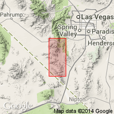
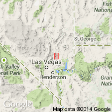
Type locality not designated. Named from exposures near Yellow Pine mine, in sec. 20, T. 24 S., R. 58 E., Goodsprings quadrangle, Clark Co., NV-San Bernardino Co., CA.
Source: Modified from GNU records (USGS DDS-6; Menlo GNULEX).
- Usage in publication:
-
- Yellowpine limestone member*
- Modifications:
-
- Mapped
- AAPG geologic province:
-
- Great Basin province
Summary:
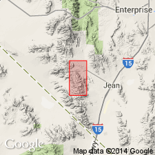
Is structurally and lithologically described with maps and cross sections near each of mines in Yellow Pine district, Nevada. Age is Mississippian (indicated on map).
Source: GNU records (USGS DDS-6; Menlo GNULEX).
- Usage in publication:
-
- Yellowpine limestone member*
- Modifications:
-
- Areal extent
- AAPG geologic province:
-
- Great Basin province
Summary:
Geographically extended into Nopah Range, Inyo County, California, where unit is described as dark-gray crinoidal limestone, 100 feet thick. Overlies Bullion limestone member of Monte Cristo limestone. (Arrowhead limestone member not recognized in area). Underlies Bird Spring formation. Age is Mississippian (indicated on stratigraphic section).
Source: GNU records (USGS DDS-6; Menlo GNULEX).
- Usage in publication:
-
- Yellowpine limestone member*
- Modifications:
-
- Areal extent
- AAPG geologic province:
-
- Great Basin province
Summary:
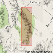
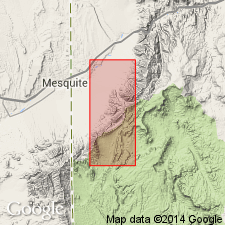
Yellowpine limestone member of Monte Cristo limestone recognized in much of north half of Ivanpah [1 degree] quadrangle, and is also present on Old Dad Mountain, San Bernardino County, California, in southwest corner of quadrangle. Is massive unit, 120 feet thick in Goodsprings quadrangle, generally thinner to west and south. Fossils are uncommon. Age of Monte Cristo limestone is considered to be Early Mississippian, based on fossils identified by G.H. Girty in 1928.
Source: GNU records (USGS DDS-6; Menlo GNULEX).
- Usage in publication:
-
- Yellowpine Limestone
- Modifications:
-
- Revised
- AAPG geologic province:
-
- Great Basin province
Summary:
Yellowpine Limestone Member of Hewett (1931) raised in rank to Yellowpine Limestone of Monte Cristo Group. Characterized by medium-grained, black limestone which weathers dark-gray and occurs in beds as much as 10 feet thick. Is 98.1 feet thick at Hidden Valley, 90 feet thick at Battleship Wash, and 170 feet thick at Bitter Spring Gap in Muddy Mountains. Contains abundant LITHOSTROTIONELLA sp. and solitary rugose corals. Age is Mississippian (indicated on composite columnar section).
Source: GNU records (USGS DDS-6; Menlo GNULEX).
- Usage in publication:
-
- Yellowpine Member*
- Modifications:
-
- Areal extent
- AAPG geologic province:
-
- Plateau sedimentary province
Summary:
Extended into northwest Mohave County, Arizona, Plateau sedimentary province. [Extended from Muddy and northern Black Mountains, Clark County, Nevada.] Is uppermost of five members of Monte Cristo Limestone. Individual members not separately mapped. Conformably overlies Arrowhead Member of Monte Cristo; unconformably underlies Bird Spring Formation. Age of unit is not specified; age of Monte Cristo is Early and Late Mississippian.
Source: GNU records (USGS DDS-6; Denver GNULEX).
For more information, please contact Nancy Stamm, Geologic Names Committee Secretary.
Asterisk (*) indicates published by U.S. Geological Survey authors.
"No current usage" (†) implies that a name has been abandoned or has fallen into disuse. Former usage and, if known, replacement name given in parentheses ( ).
Slash (/) indicates name conflicts with nomenclatural guidelines (CSN, 1933; ACSN, 1961, 1970; NACSN, 1983, 2005, 2021). May be explained within brackets ([ ]).