- Usage in publication:
-
- Yellow Hill limestone*
- Modifications:
-
- Original reference
- Dominant lithology:
-
- Limestone
- AAPG geologic province:
-
- Great Basin province
Summary:
Yellow Hill limestone. Medium-bedded gray limestones, weathering light-gray, in part conglomerate, passing up into fine-grained gray limestones, in beds 2 or 3 inches to 1 foot thick, which cap Yellow Hill and are well exposed in its west face. The lowest part of formation is on east slope of Yellow Hill. Conglomerate layers are common in formation, which weathers to gray or yellowish slabs and debris. Thin-bedded layers alternate with thicker beds and give a fluted cliff face on weathering. Total calculated thickness 670 feet. Fossils [listed] are late Beekmantown, according to E. Kirk. Faults bound the formation, so that neither base nor summit is shown and it is impossible to say whether this Ordovician formation is conformable on Upper Cambrian Menha limestone. Age is Early Ordovician (Beekmantown).
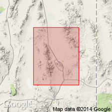
Yellow Hill is near center of Ely Springs Range, Pioche region, eastern Nevada.
Source: US geologic names lexicon (USGS Bull. 896, p. 2385).
For more information, please contact Nancy Stamm, Geologic Names Committee Secretary.
Asterisk (*) indicates published by U.S. Geological Survey authors.
"No current usage" (†) implies that a name has been abandoned or has fallen into disuse. Former usage and, if known, replacement name given in parentheses ( ).
Slash (/) indicates name conflicts with nomenclatural guidelines (CSN, 1933; ACSN, 1961, 1970; NACSN, 1983, 2005, 2021). May be explained within brackets ([ ]).

