

- Usage in publication:
-
- Yegua Formation
- Modifications:
-
- Mapped 1:250k
- Dominant lithology:
-
- Clay
- AAPG geologic province:
-
- Gulf Coast basin
Summary:
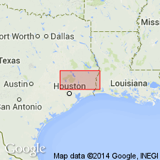
Pamphlet [p. 3]. Yegua Formation. Portion cropping out mostly clay, silty, gray and brown; weathers light gray and brown. Fossil wood abundant. Thickness 600 to 1,000 feet crops out within map area. Lies below Caddell Formation. [Is oldest unit mapped in this sheet.] Age is Eocene.
[Mapped in Grimes, Madison, and Walker Cos., TX.]
Source: Publication.
- Usage in publication:
-
- Yegua Formation*
- Modifications:
-
- Overview
- AAPG geologic province:
-
- Gulf Coast basin
Summary:
Pg. D4 (table 1), D22-D24. Yegua Formation of Claiborne Group. Sand with some interbedded clays, thin lignites, and silts of nonmarine origin. In southern Texas is chiefly clay, with minor beds of sandstone, some thin beds of concretionary limestone, and lenses rich in oyster shells. Overlies Laredo Formation (Cook Mountain of Trowbridge, 1932, and Lonsdale and Day, 1937) of Claiborne Group. Underlies Caddell Formation of Jackson Group; contact placed at base of lenticular white volcanic ash that grades laterally into ashy sandstone, sandstone, and clay along a slight but distinct escarpment. The assignment of this bed and its associated beds of sandstone and bentonite to the Jackson moves the Yegua-Jackson contact nearly 10 miles to northwest of contact shown on geologic map of Texas (Darton and others, 1937). Age is middle Eocene.
Source: Publication.

- Usage in publication:
-
- Yegua Formation
- Modifications:
-
- Mapped 1:250k
- Dominant lithology:
-
- Sand
- AAPG geologic province:
-
- Gulf Coast basin
Summary:
Yegua Formation. Lower 60 to 70 feet present; sand, fine-grained, silty, light-gray, weathers yellowish brown; formation outside Waco sheet 600 to 1,000 feet thick. Lies above Cook Mountain Formation. Age is Eocene.
Mapped along southern edge of map sheet in Madison Co., eastern TX.
Source: Publication.

- Usage in publication:
-
- Yegua Formation
- Modifications:
-
- Mapped 1:250k
- Dominant lithology:
-
- Sandstone
- Clay
- Lignite
- AAPG geologic province:
-
- Gulf Coast basin
Summary:
Yegua Formation. Sandstone, clay, and lignite; sandstone, mostly quartz, some chert, fine-grained, subangular to subrounded, indurated to friable, calcareous, glauconitic, massive, laminated, cross-bedded; clay, lignitic, sandy, bentonitic, silty, mostly well laminated, chocolate brown to reddish brown, lighter colored upward; lentils of lignite common; flat ironstone concretions and spherical calcareous concretions a foot or more in diameter common; some fossil wood. Thickness about 1,000 feet. Overlies Cook Mountain Formation (Eocene); underlies Caddell Formation (Eocene). Age is Eocene.
Mapped in Wilson, Karnes, Gonzales, Fayette, and Bastrop Cos., southeastern TX.
Source: Modified from GNU records (USGS DDS-6; Denver GNULEX).

- Usage in publication:
-
- Yegua Formation
- Modifications:
-
- Mapped 1:250k
- Dominant lithology:
-
- Sandstone
- Clay
- AAPG geologic province:
-
- Gulf Coast basin
Summary:
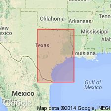
Yegua Formation. Sandstone and clay; sandstone, mostly quartz, some chert, fine-grained, indurated to friable, calcareous, glauconitic, massive, laminated, cross-bedded, produces loose, ferruginous yellow-orange and reddish-brown soil; clay, lignitic, sandy, bentonitic, silty, mostly well laminated, chocolate brown to reddish brown, lighter colored upward, produces dark-gray soil; some fossil wood. Thickness about 400 to 1050 feet, thickens southward. [Southwest of Frio River, overlies Laredo Formation and underlies Jackson Group, undivided. Northeast of Frio River, overlies Cook Mountain Formation and underlies Caddell Formation of Jackson Group.] Age is Eocene.
[Mapped in Webb, La Salle, McMullen, Frio, Atascosa, and Wilson Cos., southern TX.]
Source: Publication.

- Usage in publication:
-
- Yegua Formation
- Modifications:
-
- Mapped 1:250k
- Dominant lithology:
-
- Sandstone
- Clay
- AAPG geologic province:
-
- Gulf Coast basin
Summary:
Pamphlet [p. 2]. Yegua Formation. Sandstone and clay; sandstone, mostly quartz, some chert, fine-grained, indurated to friable, calcareous, glauconitic, massive, laminated, cross-bedded, produces loose, ferruginous yellow-orange and reddish-brown soil; clay, lignitic, sandy, bentonitic, silty, mostly well laminated, chocolate brown to reddish brown, lighter colored upward, produces dark gray soil; some fossil wood; thickness 1000+/- feet. Overlies Cook Mountain Formation; underlies Caddell Formation and younger sediments. Age is Eocene.
[Mapped in southeastern corner of map sheet, Wilson, Atascosa, and Karnes Cos., southern TX.]
Source: Publication.
For more information, please contact Nancy Stamm, Geologic Names Committee Secretary.
Asterisk (*) indicates published by U.S. Geological Survey authors.
"No current usage" (†) implies that a name has been abandoned or has fallen into disuse. Former usage and, if known, replacement name given in parentheses ( ).
Slash (/) indicates name conflicts with nomenclatural guidelines (CSN, 1933; ACSN, 1961, 1970; NACSN, 1983, 2005, 2021). May be explained within brackets ([ ]).