

- Usage in publication:
-
- Yavapai Schist*
- Modifications:
-
- Original reference
- Dominant lithology:
-
- Phyllite
- Slate
- Schist
- AAPG geologic province:
-
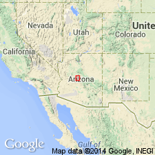
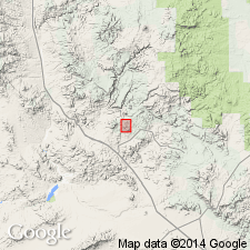
- Southwestern Basin-and-Range region
Summary:
Yavapai schist. Most abundant rock is an argillaceous phyllite varying to slate, mica schist, and chlorite schist, but the formation as mapped locally includes gneisses, granulites, hornfels, and epidote and hornblende schists, also conglomerate and sandstone bands and lenses and zones of intense metamorphism. The variations of the normal schist are separately mapped. Greater part of formation is clearly sedimentary. Thickness 5,000 to 7,000 feet. Is = Vishnu schist of Grand Canyon, and is same as "Arizonian" of Blake. Is oldest formation in area (Bradshaw Mountains, central Arizona). Assigned to Algonkian (Precambrian), but Archean rocks may be present in area.
Named for extensive development in Yavapai County.
Source: US geologic names lexicon (USGS Bull. 896, p. 2383).
- Usage in publication:
-
- Yavapai group
- Modifications:
-
- Revised
- AAPG geologic province:
-
- Southwestern Basin-and-Range region
Summary:
Pg. 1119-1120, table 1. [See also, 1937 [abs.], GSA Proceedings, 1936, p. 112.] Precambrian schists in central Arizona, which show recrystallization only in vicinity of intrusive bodies, collectively termed Yavapai group and subdivided into (ascending): Yaeger greenstone (new), Red Rock rhyolite (new), and Adler [Alder] sedimentary series (new). Term Yavapai group preferred because Yavapai formation is only locally schistose.
Source: US geologic names lexicon (USGS Bull. 1200, p. 4319).
- Usage in publication:
-
- Yavapai series*
- Modifications:
-
- Revised
- AAPG geologic province:
-
- Southwestern Basin-and-Range region
Summary:
Pg. 7, pl. 3. Yavapai series. Series composed of many formations in Jerome area [Yavapai County, Arizona (Southwestern Basin-and-Range region)] and divided into two groups. In Bagdad area [Yavapai County, Arizona] series comprises three formations (ascending): Bridle formation, Butte Falls tuff, and Hillside mica schist (all new). Age is Precambrian, [based on 1,600 m.y. radiometric date for Lawler Peak granite (new), which intrudes all units of the Yavapai series. Report includes geologic map.]
Source: US geologic names lexicon (USGS Bull. 1200, p. 4319); supplemental information from GNU records (USGS DDS-6; Denver GNULEX).
- Usage in publication:
-
- Yavapai series*
- Modifications:
-
- Revised
- AAPG geologic province:
-
- Southwestern Basin-and-Range region
Summary:
Pg. 8-9, pl. 1. Yavapai series. Wilson (1939) suggested that Yavapai schist be modified to Yavapai group. Yavapai series is used in this report to replace Yavapai schist. Series includes all older Precambrian volcanic and sedimentary rocks in Prescott-Jerome area [Yavapai County, Arizona (Southwestern Basin-and-Range region)]. Separated into two major subdivisions: eastern Ash group (new) of seven formations and western Alder group of six formations. The two groups separated by the Shylock fault and no statement can be made as to their respective ages. Represents nonmarine accumulation of lava flows, pyroclastic ejecta, reworked volcanic debris, and terrigenous sediment deposited on broad flood plains or in lakes or both. Some rocks may be marine, especially the pillow lavas, bedded chert, and jasper-magnetite beds. Report includes geologic map.
Source: US geologic names lexicon (USGS Bull. 1200, p. 4319); supplemental information from GNU records (USGS DDS-6; Denver GNULEX).
- Usage in publication:
-
- Yavapai Series*
- Modifications:
-
- Revised
- Geochronologic dating
- AAPG geologic province:
-
- Southwestern Basin-and-Range region
Summary:
Yavapai Series. Revised in Jerome-Prescott area, Yavapai County, Arizona (Southwestern Basin-and-Range region), from Yavapai Supergroup to provincial time-stratigraphic term Yavapai Series. Revised to include (in ascending order) Ash Creek Group and Big Bug Group (new, replaces Alder Group). Indicates length of time represented by the Ash Creek and Big Bug Groups. Is defined as the time interval from 1,770 +/-10 to 1,820+ Ma. Age is Precambrian. Report includes geologic map.
Source: Modified from GNU records (USGS DDS-6; Denver GNULEX).
- Usage in publication:
-
- Yavapai series
- Modifications:
-
- Not used
Summary:
The term Yavapai series is not mapped nor used in the Bagdad area, western Yavapai County, Arizona (Southwestern Basin-and-Range region). Previously included Bridle Formation, Butte Falls Tuff, and Hillside Mica Schist. Stratified [meta]volcanic rocks in the Bagdad mining area are assigned to rocks of Early Proterozoic age which all could be younger than the volcanic rocks of the Yavapai series in the Jerome-Prescott area to the east.
Source: GNU records (USGS DDS-6; Denver GNULEX).
For more information, please contact Nancy Stamm, Geologic Names Committee Secretary.
Asterisk (*) indicates published by U.S. Geological Survey authors.
"No current usage" (†) implies that a name has been abandoned or has fallen into disuse. Former usage and, if known, replacement name given in parentheses ( ).
Slash (/) indicates name conflicts with nomenclatural guidelines (CSN, 1933; ACSN, 1961, 1970; NACSN, 1983, 2005, 2021). May be explained within brackets ([ ]).