The National Geologic Map Database is migrating to a new infrastructure. We apologize for any service disruptions during this process.
|
|---|


- Usage in publication:
-
- Yauco Mudstone*
- Modifications:
-
- Principal reference
- Reference
- Dominant lithology:
-
- Mudstone
- AAPG geologic province:
-
- Caribbean region
Summary:
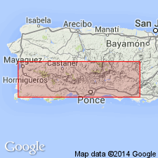
Type locality and two reference localities designated. One reference locality is exposures in quarry on Route 373 about 300 m east of intersection with Route 128, 30,970 N.; 107,220 E., Yauco quadrangle. Another reference locality is on Route 128 north of type locality at 31,470 N.; 106,730 E.
Source: GNU records (USGS DDS-6; Reston GNULEX).
- Usage in publication:
-
- Yauco Formation*
- Modifications:
-
- Revised
- AAPG geologic province:
-
- Caribbean region
Summary:
The Yauco is here redefined Yauco Formation. The Rio Blanco Formation is abandoned because the interbedded sequence of Cretaceous and Tertiary rocks mapped as Rio Blanco in the Penuelas quad. includes lithofacies of the Yauco and Lag Garzas Formations which are sufficiently different to map separately in most areas. Age is Campanian(?) and Maastrichtian Campanian(?).
Source: GNU records (USGS DDS-6; Reston GNULEX).
- Usage in publication:
-
- Yauco Formation*
- Modifications:
-
- Age modified
- AAPG geologic province:
-
- Caribbean region
Summary:
Lithofacies characteristic of the Anon, Maricao, and Yauco are interbedded in the Monte Guilarte quadrangle. Age is Late Cretaceous (Campanian, Maastrichtian) through Eocene(?).
Source: GNU records (USGS DDS-6; Reston GNULEX).
- Usage in publication:
-
- Yauco Formation*
- Modifications:
-
- Revised
- AAPG geologic province:
-
- Caribbean region
Summary:
The name Mayaguez Group is abandoned because it is no longer valid in the sense in which it was originally defined by Mattson (1960). His Mayaguez contained 7 lithofacies: the Parguera Limestone, here revised; the Brujo Limestone, here abandoned because it is identical to the Cotui Limestone; Melones Limestone, revised; the Yauco Mudstone, revised; the Sabana Grande Andesite, revised; El Rayo Volcanics, revised; and Maricao Basalt, not discussed. The El Rayo Volcanics are not within the Mayaguez but overlie rocks assigned by Mattson to the San German Formation, which does not overlie the Mayaguez, but is equivalent to part of the Mayaguez.
Source: GNU records (USGS DDS-6; Reston GNULEX).
- Usage in publication:
-
- Yauco Formation*
- Modifications:
-
- Age modified
- AAPG geologic province:
-
- Caribbean region
Summary:
The age of the Yauco Formation in the San German area of Puerto Rico ranges from Coniacian to Maastrichtian. It is unconformably overlain by the El Rayo Formation of Maastrichtian age.
Source: GNU records (USGS DDS-6; Reston GNULEX).

- Usage in publication:
-
- Yauco Formation*
- Modifications:
-
- Overview
- AAPG geologic province:
-
- Caribbean region
Summary:
The Yauco Formation occurs in southwestern Puerto Rico and consists of siltstone, claystone, sandstone, limestone, and conglomerate. Thickness exceeds 1200 meters. The Yauco is of Late Cretaceous and Tertiary(?) age.
Source: GNU records (USGS DDS-6; Reston GNULEX).
For more information, please contact Nancy Stamm, Geologic Names Committee Secretary.
Asterisk (*) indicates published by U.S. Geological Survey authors.
"No current usage" (†) implies that a name has been abandoned or has fallen into disuse. Former usage and, if known, replacement name given in parentheses ( ).
Slash (/) indicates name conflicts with nomenclatural guidelines (CSN, 1933; ACSN, 1961, 1970; NACSN, 1983, 2005, 2021). May be explained within brackets ([ ]).