- Usage in publication:
-
- Yates unit
- Modifications:
-
- Named
- Dominant lithology:
-
- Amphibolite
- Schist
- AAPG geologic province:
-
- Midcontinent region
Summary:
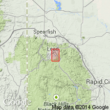
A name applied to the lowest unit of the Poorman Formation. Name derived from the Yates shaft in the Homestake Mine area, Lawrence Co, SD in the Midcontinent region. Main body is under Paleozoic and Tertiary cover. Forms an elongate north-south trending mass. Extends along strike from north to south of Lead for at least 10 km. Is characteristically dark green, massive to faintly banded, fine-grained, moderately well lineated hornblende-plagioclase schist. Has ubiquitous 2 m to 2 cm thick white calcite bands and veinlets. Strata intercalated with the schist include graphitic quartz-sericite phyllite, crudely banded grunerite-bearing iron-formation, coarse-grained amphibole-bearing units, and chert. Thought to have been a mix of tholeiitic basalt, tuffaceous and (or) epiclastic debris, and reworked material. The samples plot in the oceanic basalt field. Probably represents the infilling of the northern part of the basin during Early Proterozoic. Cross section. Stratigraphic diagram. Is 600 to 1200 m thick. Underlies upper part of Poorman.
Source: GNU records (USGS DDS-6; Denver GNULEX).
For more information, please contact Nancy Stamm, Geologic Names Committee Secretary.
Asterisk (*) indicates published by U.S. Geological Survey authors.
"No current usage" (†) implies that a name has been abandoned or has fallen into disuse. Former usage and, if known, replacement name given in parentheses ( ).
Slash (/) indicates name conflicts with nomenclatural guidelines (CSN, 1933; ACSN, 1961, 1970; NACSN, 1983, 2005, 2021). May be explained within brackets ([ ]).

