- Usage in publication:
-
- Yampa sandstone*
- Modifications:
-
- Original reference
- Dominant lithology:
-
- Sandstone
- AAPG geologic province:
-
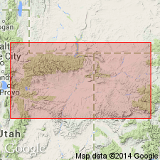
- Uinta uplift
Summary:
Geology of eastern portion of Uinta Mountains, [northeastern Utah], p. 41, 55. The Upper Aubrey group consists of sandstones and limestones, the latter cherty. To the north, there are 2 members of this group; the upper is cherty limestone, 100 to 200 feet thick, which we have called Bellerophon limestone. The lower, the Yampa sandstone, is very massive, rarely showing evidences of stratification; in some places obliquely laminated. [On p. 55 he says:] In Uinta Mountains we have a homogeneous gray sandstone which we call Yampa sandstone, from 1,000 to 1,200 feet thick, capped by a bed which is believed to be equivalent to the one at top of Upper Aubrey at junction of Grand and Green and varies in thickness from 150 to 200 feet. [According to Powell's map the canyon of Yampa River, in northwestern Colorado and northeastern Utah, is cut in his "Upper Aubrey group," which also forms most of Yampa Plateau.] Age is Pennsylvanian.
Source: US geologic names lexicon (USGS Bull. 896, p. 2381).
For more information, please contact Nancy Stamm, Geologic Names Committee Secretary.
Asterisk (*) indicates published by U.S. Geological Survey authors.
"No current usage" (†) implies that a name has been abandoned or has fallen into disuse. Former usage and, if known, replacement name given in parentheses ( ).
Slash (/) indicates name conflicts with nomenclatural guidelines (CSN, 1933; ACSN, 1961, 1970; NACSN, 1983, 2005, 2021). May be explained within brackets ([ ]).

