

- Usage in publication:
-
- Yakutat group*
- Modifications:
-
- Redescribed
- Dominant lithology:
-
- Argillite
- Graywacke
- Shale
- Sandstone
- Limestone
- Conglomerate
- AAPG geologic province:
-
- Alaska Southern region
Summary:
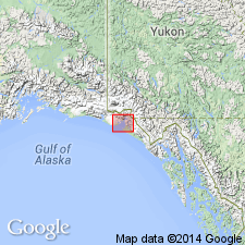
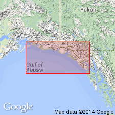
Yakutat system of Russell (1891; 1893) is redescribed as Yakutat group. Unit exposed about Yakutat Bay as shown on geologic reconnaissance map of Yakutat Bay region. Consists of graywacke (in part, at least, a tuff), very fragile and fissile black shale, alternating thin-bedded black shale and sandstone, blue limestone in one or two places, and two different kinds of conglomerate (massive conglomerate and basal black conglomeratic argillite). Unconformably overlies greenstone and white marble basement rocks. Intruded by diabase dikes. Age is probably Mesozoic(?) based on stratigraphic position.
Source: GNU records (USGS DDS-6; Menlo GNULEX).
- Usage in publication:
-
- Yakutat group*
- Modifications:
-
- Areal extent
- Age modified
- AAPG geologic province:
-
- Alaska Southern region
Summary:
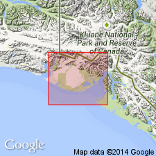
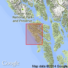
Unit exposed in Malaspina district in large area extending from Disenchantment Bay to eastern part of Samovar Hills and in narrow belt extending along southern base of St. Elias Mountains from Seward Glacier to Tyndall Glacier. Also forms major part of coastal mountains between Disenchantment Bay and Dry Bay. Sequence is probably 1000's of ft thick; exact estimate is not possible. Unconformably underlies Tertiary rocks. On basis of scanty fossil evidence and similarity in lithology and degree of metamorphism of rocks of known Cretaceous age, Yakutat is probably or entirely of Late(?) Cretaceous age.
Source: GNU records (USGS DDS-6; Menlo GNULEX).
- Usage in publication:
-
- Yakutat Group*
- Modifications:
-
- Age modified
- Biostratigraphic dating
- AAPG geologic province:
-
- Alaska Southern region
Summary:
Contains sparse megafossil fauna of INOCERAMUS and BUCHIA that indicate Late Jurassic(?) and Early Cretaceous age (D.L. Jones, written commun., Sept. 28, 1961). Map legend gives age as Late Jurassic(?) and Cretaceous.
Source: GNU records (USGS DDS-6; Menlo GNULEX).
- Usage in publication:
-
- Yakutat Group*
- Modifications:
-
- Geochronologic dating
- AAPG geologic province:
-
- Alaska Southern region
Summary:
Melange facies of Yakutat Group thought to be correlative of Kelp Bay Group. Dioritic rocks in Yakutat have yielded age of 160 +/-3.5 Ma. [overall age of Yakutat Group not discussed].
Source: GNU records (USGS DDS-6; Menlo GNULEX).
For more information, please contact Nancy Stamm, Geologic Names Committee Secretary.
Asterisk (*) indicates published by U.S. Geological Survey authors.
"No current usage" (†) implies that a name has been abandoned or has fallen into disuse. Former usage and, if known, replacement name given in parentheses ( ).
Slash (/) indicates name conflicts with nomenclatural guidelines (CSN, 1933; ACSN, 1961, 1970; NACSN, 1983, 2005, 2021). May be explained within brackets ([ ]).