- Usage in publication:
-
- Yahoo Clay*
- Modifications:
-
- Named
- Reference
- Dominant lithology:
-
- Clay
- AAPG geologic province:
-
- Snake River basin
Summary:
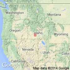
Named as a formation in Snake River Group for Yahoo Creek. Formerly mapped as Bruneau Formation, a term now limited to area downstream and west of Bliss. Type locality designated in secs. 3, 4, and 5, T. 8 S., R. 13 E., at mouth of Yahoo Creek 4 mi south-southwest of Hagerman, Twin Falls Co, ID in Snake River basin. Eleven reference localities designated: 1) 2,675 to 2,800 ft elev. in right abutment of dam; 2) SW corner sec. 7, T. 6 S., R. 13 E., Bliss quadrangle; 3) SE corner sec. 7, T. 6 S., R. 13 E., Bliss quadrangle; 4) NW corner sec. 8, T. 6 S., R. 13 E., Bliss quadrangle; 5) SW corner sec. 20, T. 6 S., R. 13 E., Bliss quadrangle; 6) SW corner sec. 27, T. 6 S., R. 13 E., Hagerman quadrangle; 7) NW corner sec. 19, T. 7 S., R. 14 E., Tuttle quadrangle; 8) NW corner sec. 2, T. 7 S., R. 13 E., Hagerman quadrangle, 9) NW corner sec. 6, T. 8 S., R. 14 E., Tuttle quadrangle; 10) Thousand Springs to Melon Valley; and 11) Canyon wall west and southwest of Hagerman. Composed of pink-white to yellow-brown, laminated clay and sparse silty clay. Is up to 90 ft thick. Overlies McKinney Basalt; underlies Crowsnest Gravel. Is of Pleistocene age (fossil pollen and mollusks).
Source: GNU records (USGS DDS-6; Denver GNULEX).
For more information, please contact Nancy Stamm, Geologic Names Committee Secretary.
Asterisk (*) indicates published by U.S. Geological Survey authors.
"No current usage" (†) implies that a name has been abandoned or has fallen into disuse. Former usage and, if known, replacement name given in parentheses ( ).
Slash (/) indicates name conflicts with nomenclatural guidelines (CSN, 1933; ACSN, 1961, 1970; NACSN, 1983, 2005, 2021). May be explained within brackets ([ ]).

