The National Geologic Map Database is migrating to a new infrastructure. We apologize for any service disruptions during this process.
|
|---|


- Usage in publication:
-
- Wymps Gap Limestone Member
- Modifications:
-
- Named
- Dominant lithology:
-
- Limestone
- Shale
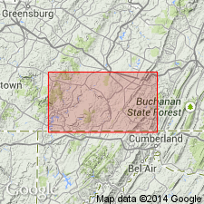
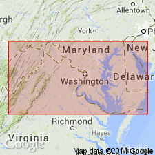
- AAPG geologic province:
-
- Appalachian basin
Summary:
Name Wymps Gap Limestone Member given to a marine limestone bed in the Mauch Chunk of southwestern PA that has long been referred to as "Greenbrier limestone." This bed is just a thin north finger of the much thicker Greenbrier Series of WV and it seems advisable to assign new name to unit. Maximum thickness about 40 ft, the lower half being massive limestone and upper half interbedded limestone and calcareous shale; commonly 15 to 20 ft in southern Somerset County [this report]. In Negro Mountain area, the Wymps Gap lies about 175 ft above base of formation. This interval thins westward to 30 ft at Youghioheny River Gap in Laurel Hill and to as little as 5 ft in Wymps Gap area. Has been quarried at type locality.
Source: GNU records (USGS DDS-6; Reston GNULEX).
- Usage in publication:
-
- Wymps Gap Member
- Modifications:
-
- Overview
- Areal extent
- AAPG geologic province:
-
- Appalachian basin
Summary:
Greenbrier Formation in western MD and adjacent area is here revised. Subdivided into (ascending) Loyalhanna Limestone, Deer Valley Limestone, Savage Dam (new name), and Wymps Gap Limestone Members. In western MD, the Wymps Gap increases in thickness from the northeast to southwest. In western Allegany Co., unit is less than 10 ft, but increases to 40 ft at Sang Run, Garrett Co. At Rowlesburg, WV, unit is greater than 60 ft. Consists of three general lithofacies at Sang Run. Basal 15 ft is characterized by interbedded gray fossiliferous lime wackestones to grainstones and dark-gray, calcareous, brittle shale. Middle lithofacies consists of medium-bedded, dark-gray to black, fossiliferous, argillaceous lime wackestone, which grades into a light-gray, locally cross-bedded, coated grainstone toward the northeast. Uppermost 9 ft at Sang Run consists of interbedded light-green-gray sparsely fossiliferous, lime wackestone and green-gray to red-brown, silty shale. Wymps Gap Limestone Member is the most diversely fossiliferous Mississippian unit in MD containing brachiopods, bryozoans, mollusks, and pelmatozoans. Correlates with Haney, Hardinsburg, and Glen Dean Formations of upper Mississippi Valley and Alderson Limestone of Randolph Co., WV.
Source: GNU records (USGS DDS-6; Reston GNULEX).

- Usage in publication:
-
- Wymps Gap Member*
- Modifications:
-
- Biostratigraphic dating
- AAPG geologic province:
-
- Appalachian basin
Summary:
Conodonts recovered from the Wymps Gap Member of the Greenbrier Limestone in the Winchester 30 X 60 minute quadrangle suggest a Late Mississippian (Chesterian) age.
Source: GNU records (USGS DDS-6; Reston GNULEX).
For more information, please contact Nancy Stamm, Geologic Names Committee Secretary.
Asterisk (*) indicates published by U.S. Geological Survey authors.
"No current usage" (†) implies that a name has been abandoned or has fallen into disuse. Former usage and, if known, replacement name given in parentheses ( ).
Slash (/) indicates name conflicts with nomenclatural guidelines (CSN, 1933; ACSN, 1961, 1970; NACSN, 1983, 2005, 2021). May be explained within brackets ([ ]).