The National Geologic Map Database is migrating to a new infrastructure. We apologize for any service disruptions during this process.
|
|---|


- Usage in publication:
-
- Wygal Sandstone Member*
- Modifications:
-
- Biostratigraphic dating
- AAPG geologic province:
-
- California Coast Ranges province
Summary:
Fauna of Wygal Sandstone Member is of late Oligocene, pre "Vaqueros" (early Miocene) age. Evidence based on biostratigraphic dating of marine mollusks.
Source: GNU records (USGS DDS-6; Menlo GNULEX).
- Usage in publication:
-
- Wygal Sandstone Member*
- Modifications:
-
- Areal extent
- AAPG geologic province:
-
- California Coast Ranges province
Summary:
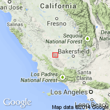
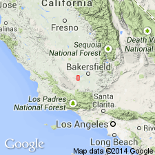
Wygal Sandstone Member was drilled in well 532-25Z, about a mile to west-northwest of wells 526-30R and 555-30R, which are both located in Elk Hills Oil Field, Kern Co, CA.
Source: GNU records (USGS DDS-6; Menlo GNULEX).
- Usage in publication:
-
- Wygal Sandstone Member*
- Modifications:
-
- Named
- Dominant lithology:
-
- Sandstone
- AAPG geologic province:
-
- California Coast Ranges province
Summary:
Named for Wygal Spring [NE 1/4 sec.23, T28S R19E] as second from lowermost unit of Temblor Formation. Type section designated as exposures at Zemorra Creek, sec.9 T29S R20E, Carneros Rocks quad, Temblor Range, Kern Co, CA. Lowermost sandstone member of Temblor Formation in Chico Martinez Creek area is commonly known as "Phacoides reef" (Kleinpell, 1938; Goudkoff, 1943; Curran, 1943) or "Phacoides Sand" (Foss, and Blaisdell, 1968). Since these names are not valid because they refer to a fossil rather than a locality, unit is renamed Wygal Sandstone Member. Composed of gray, sandstone with glauconitic and fossiliferous calcareous beds. Thickness is 75 ft (23 m) at type and ranges to over several hundred ft thick in subsurface. Conformably overlies Cymric Shale Member (new) (Temblor Formation) and laps onto Point of Rocks Sandstone. Conformably underlies Santos Shale Member (Temblor Formation). Contains molluscan fauna of early "Vaqueros age", late Oligocene (W.U. Addicott, oral commun., 1968). Tentatively assigned to "Vaqueros Stage".
Source: GNU records (USGS DDS-6; Menlo GNULEX).
For more information, please contact Nancy Stamm, Geologic Names Committee Secretary.
Asterisk (*) indicates published by U.S. Geological Survey authors.
"No current usage" (†) implies that a name has been abandoned or has fallen into disuse. Former usage and, if known, replacement name given in parentheses ( ).
Slash (/) indicates name conflicts with nomenclatural guidelines (CSN, 1933; ACSN, 1961, 1970; NACSN, 1983, 2005, 2021). May be explained within brackets ([ ]).