The National Geologic Map Database is migrating to a new infrastructure. We apologize for any service disruptions during this process.
|
|---|


- Usage in publication:
-
- Wyemaha formation*
- Modifications:
-
- Named
- Dominant lithology:
-
- Sand
- Alluvium
- AAPG geologic province:
-
- Great Basin province
Summary:
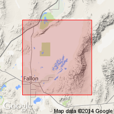
Named for Wyemaha Valley as next to oldest formation in Lahontan Valley group (new). Type area designated as western end of Wyemaha Valley [Churchill Co, NV]. Comprises eolian sand and alluvium which reach lowest parts of basin floor and intertongue with shallow-lake deposits of sand to clay. Thickness is 100 ft, locally more than 150 ft in subsurface. Most of unit conformably lies between Eetza formation (new) (Lahontan Valley group) and middle Lake Lahontan soil which in turn is overlain by intertonguing Indian Lakes and Sehoo formations (new) (of Lahontan Valley group). Age given as late Pleistocene.
Source: GNU records (USGS DDS-6; Menlo GNULEX).
- Usage in publication:
-
- Wyemaha formation*
- Modifications:
-
- Adopted
- Overview
- AAPG geologic province:
-
- Great Basin province
Summary:
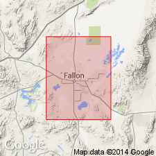
Type locality designated in saddle between Sehoo and Eetza Mountains at western end of Wyemaha Valley E/2 sec.21 T18N R30E, Carson Desert [Carson Lake 15' quad] near Fallon, Churchill Co, NV. Report includes detailed description of unit and its fossils. Unit shown on geologic maps of Fallon, Stillwater, and Carson Lake 15' quads. Age given as Pleistocene.
Source: GNU records (USGS DDS-6; Menlo GNULEX).
- Usage in publication:
-
- Wyemaha Alloformation
- Modifications:
-
- Principal reference
- Redescribed
- AAPG geologic province:
-
- Great Basin province
Summary:
Wyemaha Formation of Morrison (1961) redescribed as Wyemaha Alloformation as defined in 1983 North American Stratigraphic Code.
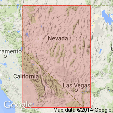
Principal reference locality: in Wadsworth Amphitheatre, in E/2 sec. 15, T. 21 N., R. 2 E., Wadsworth 15-min quadrangle, Washoe Co., NV.
Source: GNU records (USGS DDS-6; Menlo GNULEX).
For more information, please contact Nancy Stamm, Geologic Names Committee Secretary.
Asterisk (*) indicates published by U.S. Geological Survey authors.
"No current usage" (†) implies that a name has been abandoned or has fallen into disuse. Former usage and, if known, replacement name given in parentheses ( ).
Slash (/) indicates name conflicts with nomenclatural guidelines (CSN, 1933; ACSN, 1961, 1970; NACSN, 1983, 2005, 2021). May be explained within brackets ([ ]).