- Usage in publication:
-
- Wyalusing Formation
- Modifications:
-
- Named
- Dominant lithology:
-
- Loam
- AAPG geologic province:
-
- Wisconsin arch
Summary:
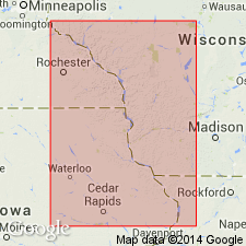
Here formally named, probably for local park. Type section designated at corehole site CR3 (Bridgeport Section) located on an interstream divide at mouth of Wisconsin River Valley near Wyalusing State Park, 43 deg 27'36"N and 90 deg 26'04"W, center of North Line of the NE1/4 NW1/4 sec 10, T6N,R6W, Bridgeport 7.5-min quad, Crawford Co, southwestern WI. Has been observed at 4 (of 60) corehole sites (Leigh, unpublished data) and at recent excavations along U.S. Hwy 151 near Kieler, WI. Consists of moderate to fine platy loam; white silt caps on platy ped faces; noncalcareous; few small manganese nodules; ped structure gradually stronger with depth; clear boundary at base. Typically occurs as a brown silt loam with faint red hue that exhibits weak pedogenic expression throughout its thickness. Pedogenesis is expressed by weak to moderate platy and blocky peds and very fine root pores throughout; illuvial clay films are lacking and the overall pedologic appearance resembles cambic-B to cumulic-A and -E horizon morphology. The Wyalusing is darker colored and more pedogenically altered than the overlying C horizon of Pleistocene Loveland Formation (revised). Lithic characteristics are very similar to those of Pleistocene Roxana Formation (redescribed). Maximum thickness is about 2.0 m. Overlies unnamed diamicton, which consists of loam to sandy loam with pebbles scattered throughout. Underlies the Loveland, from which it is distinguished by a clear boundary. Age is middle Pleistocene (Illinoian, or older(?)), based on Illinoian age assigned to the Loveland. Jacobs and Knox (1994) found that two different loess-derived units beneath the Loveland have normal remanent magnetism, which suggests that the Wyalusing was deposited after the Bruhnes-Matuyama magnetostratigraphic boundary (ca. 790,000 yr B.P.). Report includes geochemical and mineralogical data.
Source: GNU records (USGS DDS-6; Reston GNULEX).
For more information, please contact Nancy Stamm, Geologic Names Committee Secretary.
Asterisk (*) indicates published by U.S. Geological Survey authors.
"No current usage" (†) implies that a name has been abandoned or has fallen into disuse. Former usage and, if known, replacement name given in parentheses ( ).
Slash (/) indicates name conflicts with nomenclatural guidelines (CSN, 1933; ACSN, 1961, 1970; NACSN, 1983, 2005, 2021). May be explained within brackets ([ ]).

