- Usage in publication:
-
- Wristen Formation
- Modifications:
-
- Named
- Dominant lithology:
-
- Limestone
- Dolomite
- Shale
- AAPG geologic province:
-
- Permian basin
Summary:
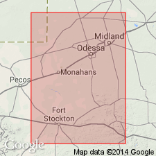
Name applied to a unit that occurs only in subsurface. Known in West TX, Permian basin. These rocks known as "Silurian shale," "Upper Silurian," and "Green Silurian" by earlier workers. Type section is in the Gulf Oil Corp. 5-SI Wristen Brothers, sec 18, Blk 5, H and TC Survey, Wickett field, Ward Co. Identified also in subsurface of Ector, Winkler, Andrews, Pecos, and Upton Cos. Overlies Fusselman Formation. Unconformably underlies newly named Thirtyone Formation. Divided into Wink Member, newly named at base, and Frame Member, newly named at top. Wink occurs between 6,956 and 6,870 ft in Wristen type well where it is composed of soft olive-gray limestone (90 percent); dark-gray calcareous shale (10 percent). The Frame occurs between 6,870 and 6,730 ft in Wristen type well where it consists of gray shaly limestone (60 percent) and gray calcareous shale (40 percent). Both members have dolomite in other wells. Cross sections. E-logs. Thickest section 700 ft is in Andrews Co. Correlation chart; correlated with Henryhouse Formation, upper part of Fusselman, and part of Caballos Novaculite. Assigned to Late Silurian (fig 6), and to late Middle and Late Silurian (abs). Fossils: gastropods, ostracods, crinoids, brachiopods, trilobites, corals, stromatoporoids.
Source: GNU records (USGS DDS-6; Denver GNULEX).
For more information, please contact Nancy Stamm, Geologic Names Committee Secretary.
Asterisk (*) indicates published by U.S. Geological Survey authors.
"No current usage" (†) implies that a name has been abandoned or has fallen into disuse. Former usage and, if known, replacement name given in parentheses ( ).
Slash (/) indicates name conflicts with nomenclatural guidelines (CSN, 1933; ACSN, 1961, 1970; NACSN, 1983, 2005, 2021). May be explained within brackets ([ ]).

