- Usage in publication:
-
- Worland limestone member
- Modifications:
-
- Principal reference
- Revised
- AAPG geologic province:
-
- Forest City basin
Summary:
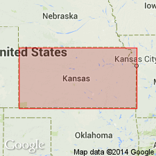
Revised to uppermost member (of 3) of Altamont limestone of Marmaton group. Is the most persistent limestone bed in the Altamont and is known from Oklahoma to Iowa. In Kansas, Worland limestone member is massive and light gray, making a somewhat prominent outcrop. Thickness ranges from about 3 to 13 feet; 8 feet would be an average thickness across Kansas. Measured sections in Bates County, Missouri (Forest City basin) and Linn County, Kansas (Forest City basin). At type exposure, consists of about 4.5 feet of gray-brown-weathering, massive limestone containing large fusulinids, overlying a few inches of dark, platy shale. Overlies Lake Neosho shale member (new) of Altamont limestone of Marmaton group; underlies Nowata shale of Marmaton. Age is Pennsylvanian (Des Moines). Report includes cross section.
Type exposure designated along the Kansas City Southern railway, just north of the grade crossing northeast of Worland, Bates Co., MO, in Forest City basin.
Source: Modified from GNU records (USGS DDS-6; Denver GNULEX).
For more information, please contact Nancy Stamm, Geologic Names Committee Secretary.
Asterisk (*) indicates published by U.S. Geological Survey authors.
"No current usage" (†) implies that a name has been abandoned or has fallen into disuse. Former usage and, if known, replacement name given in parentheses ( ).
Slash (/) indicates name conflicts with nomenclatural guidelines (CSN, 1933; ACSN, 1961, 1970; NACSN, 1983, 2005, 2021). May be explained within brackets ([ ]).

