The National Geologic Map Database is migrating to a new infrastructure. We apologize for any service disruptions during this process.
|
|---|


- Usage in publication:
-
- Woodville Member
- Modifications:
-
- Principal reference
- Dominant lithology:
-
- Till
- Sand
- Silt
- Clay
- AAPG geologic province:
-
- Wisconsin arch
Summary:
Pg. vi (chart), 10-13. Woodville Member of Pierce Formation. Formal definition. (Follows informal usage of R.W. Baker, 1984, Wisconsin Geol. Nat. Hist. Survey Gdbk, no. 11.) Gray to dark gray, unbedded, structureless, strongly calcareous till. Occurs in subsurface. Thickness at type section 4.5 m. Lies below Hersey Member of Pierce Formation, which has reversed remanent magnetism, and above Eau Galle Member of Pierce Formation; the upper and lower contacts are abrupt and sharp. Color, grain size, and mineralogy suggest Woodville correlates with Aurora Member of Wolf Creek Formation in eastern Iowa (citing Hallberg, 1980, Iowa Geol. Survey Tech. Inf. Ser., no. 10, 168 p.). Age is considered Pleistocene (pre-Illinoian), based on stratigraphic position.
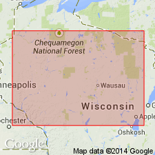
Type section (subsurface; =Eau Galle Member type section): drillhole at reference section for the Hersey Member, along Chicago and Northwestern RR in town of Woodville, in SE/4 NW/4 NW/4 sec. 35, T. 29 N., R. 16 W., [approx. Lat. 44 deg. 57 min. 26 sec. N., Long. 92 deg. 17 min. 43 sec. W.], Baldwin East 7.5-min quadrangle, St. Croix Co., western WI.
Named from Eau Galle River in St. Croix, Pierce, and Dunn Cos., western WI; name credited to Robert W. Baker.
[Additional locality information from USGS historical topographic map collection TopoView, accessed on June 9, 2018.]
Source: Publication.
For more information, please contact Nancy Stamm, Geologic Names Committee Secretary.
Asterisk (*) indicates published by U.S. Geological Survey authors.
"No current usage" (†) implies that a name has been abandoned or has fallen into disuse. Former usage and, if known, replacement name given in parentheses ( ).
Slash (/) indicates name conflicts with nomenclatural guidelines (CSN, 1933; ACSN, 1961, 1970; NACSN, 1983, 2005, 2021). May be explained within brackets ([ ]).