

- Usage in publication:
-
- Woodstock stage
- Modifications:
-
- First used
- AAPG geologic province:
-
- Atlantic Coast basin
Summary:
According to this report, the upper beds of Eocene of middle Atlantic slope may be designated Woodstock stage, and lower beds may be designated Aquia Creek stage. Fossils of Woodstock stage are closely related to "Claiborne" types and those of Aquia Creek stage are "Lignitic."
Source: GNU records (USGS DDS-6; Reston GNULEX).
- Usage in publication:
-
- Woodstock stage*, fauna*
- Modifications:
-
- Overview
- Dominant lithology:
-
- Greensand
- AAPG geologic province:
-
- Atlantic Coast basin
Summary:
Woodstock stage or fauna described as fossiliferous greensand, 40 ft thick, forming top division of Pamunkey formation. Separated from underlying Aquia Creek stage or fauna of Pamunkey formation by 117 ft of greensands and argillaceous sands.
Source: GNU records (USGS DDS-6; Reston GNULEX).
- Usage in publication:
-
- Woodstock member*, substage*
- Modifications:
-
- Named
- Dominant lithology:
-
- Greensand
- Marl
- AAPG geologic province:
-
- Atlantic Coast basin
Summary:
Woodstock member or substage assigned to top of Nanjemoy formation. Unit is characterized by fine homogeneous greensands and greensand marls, less argillaceous than Potapaco member. Upper part consists of 80 ft of greensand with OSTREA SELLAEFORMIS and other fossils; lower part consists of 40 ft of greensand with few fossils, chiefly VENERICARDIA POTAPACOENSIS. Overlies Potapaco or lower member of Nanjemoy formation. Named for an old estate a short distance above Mathia Point on bank of Potomac, King George Co., VA.
Source: GNU records (USGS DDS-6; Reston GNULEX).
- Usage in publication:
-
- Woodstock greensand marl member*
- Modifications:
-
- Revised
- AAPG geologic province:
-
- Atlantic Coast basin
Summary:
Name changed to Woodstock greensand marl member. Top member of Nanjemoy formation. Overlies Potapaco clay member.
Source: GNU records (USGS DDS-6; Reston GNULEX).
- Usage in publication:
-
- Woodstock greensand marl member
- Modifications:
-
- Age modified
- AAPG geologic province:
-
- Atlantic Coast basin
Summary:
Uppermost member of formation. Overlies Potapaco clay member. Age modified to middle Eocene (Claibornian).
Source: GNU records (USGS DDS-6; Reston GNULEX).
- Usage in publication:
-
- Woodstock Member*
- Modifications:
-
- Revised
- Age modified
- AAPG geologic province:
-
- Atlantic Coast basin
Summary:
Name of unit changed from Woodstock Greensand Marl Member to Woodstock Member. Age changed from middle Eocene, only, to early and middle Eocene. In the report area of Woodstock, however, unit remains early Eocene only.
Source: GNU records (USGS DDS-6; Reston GNULEX).
- Usage in publication:
-
- Woodstock Member*
- Modifications:
-
- Principal reference
- Age modified
- AAPG geologic province:
-
- Atlantic Coast basin
Summary:
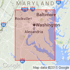
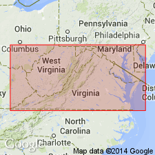
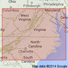
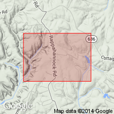
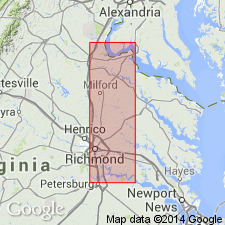
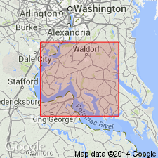
The section at the center of the bluff at Woodstock, VA, described by Clark and Martin (1901, p. 70), Section IX, is herein designated the principal reference section (lectostratotype) of the Woodstock since a type section was never established. It is located on the right bank of the Potomac River 1.65 mi above Mathias Point, King George Co., VA, Mathias Point 7.5-min quad., USGS Locality 26396. Member consists of lithic zones 16 and 17 of Clark and Martin (1901). Composed of olive-black, very fine, well sorted, silty, glauconitic sand, with a fine-textured, micaceous, massive appearance. Unconformably underlies either the Piney Point Formation or younger beds. Unconformably overlies the Potapaco Member. Age is changed from early and middle Eocene to early Eocene, only, based principally on dinoflagellate and calcareous nannofossil assemblages that indicate an approximate equivalence with Nannofossil Zone NP 12.
Source: GNU records (USGS DDS-6; Reston GNULEX).
- Usage in publication:
-
- Woodstock Member
- Modifications:
-
- Biostratigraphic dating
- AAPG geologic province:
-
- Atlantic Coast basin
Summary:
Woodstock Member of the Nanjemoy Formation at Popes Creek, Charles Co., MD, contains a well preserved dinoflagellate cyst assemblage containing approximately 115 species. Analysis suggests that the Woodstock belongs to NP12 and to an unknown part of NP13, while the Potapaco Member belongs to NP11, according to studies by Costa and Downie (1976). The Nanjemoy, therefore, is early to late Ypresian.
Source: GNU records (USGS DDS-6; Reston GNULEX).
For more information, please contact Nancy Stamm, Geologic Names Committee Secretary.
Asterisk (*) indicates published by U.S. Geological Survey authors.
"No current usage" (†) implies that a name has been abandoned or has fallen into disuse. Former usage and, if known, replacement name given in parentheses ( ).
Slash (/) indicates name conflicts with nomenclatural guidelines (CSN, 1933; ACSN, 1961, 1970; NACSN, 1983, 2005, 2021). May be explained within brackets ([ ]).