

- Usage in publication:
-
- Woodford chert*
- Modifications:
-
- First used
- Dominant lithology:
-
- Chert
- Shale
- AAPG geologic province:
-
- Ouachita folded belt
- South Oklahoma folded belt
Summary:
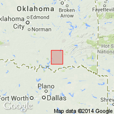
First published use in Atoka quad, Johnston and Atoka Cos, OK, South Oklahoma folded belt and Ouachita tectonic belt provinces. Intent to name not stated; probably named for town of Woodford, Carter Co, OK. No type locality designated. Exposed in northwestern part of Atoka quad. Forms low ridges and hills, Composed of thin strata of dark chert, cherty shale, and black, fissile, bituminous shale aggregating 500-700 ft in thickness. Is variable as to thickness and position of beds. Locally, chert makes up large part of the formation; elsewhere it is largely siliceous black shale. Concretions of flint found near base. Some cherty beds approach siliceous limestone. Conformably overlies Hunton limestone (new); underlies Caney shale. Geologic map. Columnar section. Age is Devonian, based on stratigraphic position and fossils.
Source: GNU records (USGS DDS-6; Denver GNULEX).
- Usage in publication:
-
- Woodford Formation
- Modifications:
-
- Contact revised
- AAPG geologic province:
-
- Permian basin
Summary:
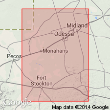
Lower contact revised in subsurface of part of Permian basin of TX in that Woodford overlies the newly named Thirtyone Formation. Thirtyone identified in Winkler, Andrews, Ward, Ector, Pecos, Crane, and Upton Cos. Locally in this area, the Woodford and part of the Thirtyone have been eroded. Cross sections. E-logs. Correlation chart. Of Late Devonian age.
Source: GNU records (USGS DDS-6; Denver GNULEX).
For more information, please contact Nancy Stamm, Geologic Names Committee Secretary.
Asterisk (*) indicates published by U.S. Geological Survey authors.
"No current usage" (†) implies that a name has been abandoned or has fallen into disuse. Former usage and, if known, replacement name given in parentheses ( ).
Slash (/) indicates name conflicts with nomenclatural guidelines (CSN, 1933; ACSN, 1961, 1970; NACSN, 1983, 2005, 2021). May be explained within brackets ([ ]).