- Usage in publication:
-
- Woodbridge fire clay
- Modifications:
-
- Original reference
- Dominant lithology:
-
- Clay
- AAPG geologic province:
-
- Atlantic Coast basin
Summary:
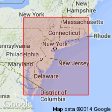
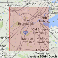
Woodbridge fire clay. Economic term for a bed of clay, 50 to 80 feet thick, in lower part of Raritan formation in northeastern New Jersey. Lies 15 to 35 feet higher than Raritan fire-clay bed. Worked south of Woodbridge. [Age is Cretaceous.]
See also G.H. Cook, 1878, New Jersey Geol. Survey report on clays, p. 34.
Source: US geologic names lexicon (USGS Bull. 896, p. 2364).

- Usage in publication:
-
- Woodbridge fire clay
- Modifications:
-
- Areal extent
- AAPG geologic province:
-
- Atlantic Coast basin
Summary:
Pg. 66, 103-104. Woodbridge fire clay in Raritan formation. Overlies Farrington sand member (new); underlies Sayreville sand member (new). Thickness 50 to 90 feet. [Age is Cretaceous.]
Source: US geologic names lexicon (USGS Bull. 1200, p. 4288).

- Usage in publication:
-
- Woodbridge Clay Member*
- Modifications:
-
- Revised
- Adopted
- AAPG geologic province:
-
- Atlantic Coast basin
Summary:
Woodbridge Clay of Cook and Smock (1877) adopted as Woodbridge Clay Member of Raritan Formation. Recognized in northeastern New Jersey. Overlies Farrington Sand Member of Raritan; underlies Sayreville Sand Member of Raritan. Age is Late Cretaceous.
Source: Changes in stratigraphic nomenclature, 1974 (USGS Bull. 1405-A, p. A24-A25).

- Usage in publication:
-
- Woodbridge Clay Member*
- Modifications:
-
- Age modified
- AAPG geologic province:
-
- Atlantic Coast basin
Summary:
Woodbridge Clay and Sayreville Sand Members of the Raritan Formation in NJ and the Raritan equivalent on the eastern shore of VA are assigned to early Turonian.
Source: GNU records (USGS DDS-6; Reston GNULEX).
For more information, please contact Nancy Stamm, Geologic Names Committee Secretary.
Asterisk (*) indicates published by U.S. Geological Survey authors.
"No current usage" (†) implies that a name has been abandoned or has fallen into disuse. Former usage and, if known, replacement name given in parentheses ( ).
Slash (/) indicates name conflicts with nomenclatural guidelines (CSN, 1933; ACSN, 1961, 1970; NACSN, 1983, 2005, 2021). May be explained within brackets ([ ]).

