The National Geologic Map Database is migrating to a new infrastructure. We apologize for any service disruptions during this process.
|
|---|


- Usage in publication:
-
- Wood River formation*
- Modifications:
-
- Named
- Dominant lithology:
-
- Limestone
- Sandstone
- Shale
- AAPG geologic province:
-
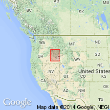
- Snake River basin
Summary:
Named provisionally [probably for the Wood River which flows through Blaine Co, ID in the Snake River basin]. No type locality designated. Mapped on either side of the Wood River and to west of some Neocene lavas. Geologic map. Is the oldest unit in mapped area. Overlain by post-Carboniferous granite and by the Neocene lava. Consists of calcareous banded gray and black shale, some slaty rocks, a few gray limestone beds and red, gray or brown quartzitic sandstone whose thickness is difficult to determine because of deformation. Is at least several thousand ft thick. Fossils, though rare, are crinoid stems, corals, fusulinids, MYALINA, SCHIZODUS, ALLORISMA, SCAPHIOCRINUS. Probably late Carboniferous age.
Source: GNU records (USGS DDS-6; Denver GNULEX).
- Usage in publication:
-
- Wood River formation*
- Modifications:
-
- Revised
- AAPG geologic province:
-
- Snake River basin
- Idaho Mountains province
Summary:
Restricted to upper part of unit designated Wood River formation by Lindgren (1900). Lower part of original Wood River named Milligen formation in this report. Occurs in large area of quad especially in the central part in both Blaine Co, ID in the Snake River basin, and in adjoining Custer Co, ID in the Idaho Mountains province. No single complete section found. Columnar section based on composite of several sections. Thought to be 7,700 ft thick. As restricted, Wood River consists of a massive brownish quartzitic conglomerate at base overlain by dark-blue sandy limestone that has an abundant coral and brachiopod fauna. Black, impure, thin-bedded limestone overlies the blue limestone. The rest, and greater part, of the formation is thick-bedded (4 to 10 ft thick), even bedded, usually cross-bedded calcareous, argillaceous, and siliceous, fine-grained sandstone separated by shaly layers that weather rusty brown to gray. Fossils: fusulinids, gastropod, corals. Fossils listed. Assigned to the Pennsylvanian. Geologic maps.
Source: GNU records (USGS DDS-6; Denver GNULEX).
- Usage in publication:
-
- Wood River Formation*
- Modifications:
-
- Revised
- AAPG geologic province:
-
- Snake River basin
Summary:
Wood River Formation revised in that it intertongues with the newly named Copper Basin Formation in south-central ID in the Snake River basin. Age of rocks called Wood River in this report inferred to be Pennsylvanian and Permian.
Source: GNU records (USGS DDS-6; Denver GNULEX).
- Usage in publication:
-
- Wood River Formation*
- Modifications:
-
- Revised
- Overview
- AAPG geologic province:
-
- Snake River basin
Summary:
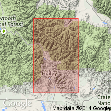
Restricted to seven units--the Hailey Conglomerate Member (first published description), at base and 6 overlying units --designated units 2 through 7. An overlying sequence of noncalcareous siltstone, shale, and siltstone originally included in the Wood River is removed and left unnamed at the present time. Is in fault contact with the older Milligen Formation. Measured sections. Chart lists fusulinids found and their occurrence in Wood River by unit or member. Is 9,800 ft thick. The Hailey is 395 ft thick; consists of chert pebble conglomerate interbedded with brown limestone; is Des Moinesian age. Unit 2 is gray to white fossiliferous (crinoids, bryozoans, brachiopods) limestone, 47 ft thick, and of Des Moinesian age. Unit 3 is 711 ft thick pink to gray, silty to shaly limestone, Des Moinesian age. Unit 4 is gray calcareous, fine-grained sandstone 694 ft thick of Virgilian age. Unit 5 is 545 ft thick brown, fine-grained quartzite of Virgilian age. Unit 6 is 5,694 ft thick gray, calcareous sandstone, gray fine-grained limestone, and gray to brown quartzite of Virgilian and Wolfcampian age. Unit 7 is 1,730 ft thick gray sandy limestone with black chert beds and gray chert of Wolfcampian and Leonardian? age.
Source: GNU records (USGS DDS-6; Denver GNULEX).
- Usage in publication:
-
- Wood River Formation*
- Modifications:
-
- Overview
- AAPG geologic province:
-
- Snake River basin
- Idaho Mountains province
Summary:
Mapped on upper plate of Pioneer thrust fault system within western and southern part of map area in Blaine and Custer Cos, ID, Snake River basin and Idaho Mountains province. Divided into basal Hailey Conglomerate Member overlain by (ascending) units 2-6, in turn overlain by an upper unit. Wood River is youngest Paleozoic unit; younger than Copper Basin Formation. Base of unit is a thrust fault. Hailey assigned Middle Pennsylvanian age based on its interfingering with overlying unit 2; unit 2 assigned Middle Pennsylvanian age based on fusulinids and nonfusuline calcareous foraminifers (Des Moinesian) and brachiopods (late Atokan or Des Moinesian); unit 3 assigned Middle Pennsylvanian age based on Des Moinesian fusulinids and nonfusuline calcareous foraminifers and algae; units 4-5 assigned Late Pennsylvanian age based on fusulinids; unit 6 assigned Late Pennsylvanian and Early Permian age based on Virgilian through Wolfcampian fusulinids; and upper unit assigned Early Permian age (tentatively Leonardian-Wordian; may include Wolfcampian rocks elsewhere in map area) based on limited and poorly preserved fauna of scaphopods and gastropods, and fragments of pelecypods, bryozoans, and corals.
Source: GNU records (USGS DDS-6; Denver GNULEX).
- Usage in publication:
-
- Wood River Formation*
- Modifications:
-
- Areal extent
- AAPG geologic province:
-
- Idaho Mountains province
Summary:
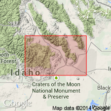
Exposures in the Hailey 1 degree x 2 degree quad, Camas and Blaine Cos, ID in the Snake River basin formerly mapped as part of Wood River Formation, are assigned to Dollarhide Formation (a new name). Exposures in Challis 1 degree x 2 degree quad in Custer Co, ID in the Idaho Mountains province formerly mapped as part of Wood River Formation, are assigned to Grand Prize Formation (a new name). Structurally overlies the Paleozoic Salmon River assemblage. Structurally underlies Dollarhide Formation (new). Ranges in age from Middle Pennsylvanian (Desmoinesian) to Early Permian (Wolfcampian and Leonardian?).
Source: GNU records (USGS DDS-6; Denver GNULEX).
- Usage in publication:
-
- Wood River Formation*
- Modifications:
-
- Revised
- Overview
- AAPG geologic province:
-
- Snake River basin
- Idaho Mountains province
Summary:
Assigned to the newly named Sun Valley Group in south-central ID, Blaine Co, Snake River basin and Custer Co, Idaho Mountains province, as one of three coeval, laterally contiguous, genetically related, and separately mapped formations of the late Paleozoic Wood River basin. Occupies the central part of the Wood River basin. Its age = rocks assigned to the Sun River Group are the Grand Prize Formation in north part of basin and Dollarhide Formation in south part of basin. Stratigraphic charts and sections. Unconformably overlies Milligen Formation or Salmon River assemblage. Unconformably underlies Challis Volcanic Group or other Eocene rocks. Divided into Hailey Member at base which is revised to include the Hailey Conglomerate Member and unit 2 of Wood River of Hall and others (1974); Eagle Creek (new); and Wilson Creek (new) Members. Eagle Creek formerly called units 3, 4, 5, 6 by Hall and others. Wilson Creek formerly called units 7, 8 by Hall and others. Principal reference designated as section measured by Hall and others 4.3 km east of Bellevue (1-6) and Quigley Creek drainage (units 7, 8). Reference sections: Lake Creek and on ridge crest northeast of head of Lake Creek. Desmoinesian to Leonardian age. Fossils listed.
Source: GNU records (USGS DDS-6; Denver GNULEX).
- Usage in publication:
-
- Wood River Formation*
- Modifications:
-
- Mapped 1:24k
- AAPG geologic province:
-
- Snake River basin
Summary:
Eagle Creek and Wilson Creek Members of Wood River separately mapped. Wood River is part of Sun Valley Group. Eagle Creek (Lower Permian to Middle Pennsylvanian) outcrops over much of quad, primarily in north half; consists of interbedded calcareous sandstone, sandy and silty limestone, quartzite, quartzite breccia, and minor mudstone; forms steep uniform slopes and a few ledges and craggy ridges and cliffs; gradational lower contact (base not exposed) with underlying Hailey Member (not exposed) of Wood River; minimum thickness is 1,640 ft. Wilson Creek (Lower Permian) is poorly exposed in northwestern part of quad; consists of interbedded silty micritic limestone, sandstone, laminated and cross-bedded carbonaceous siltstone, and minor mud-chip conglomerate; neither base nor top present; gradational contact with underlying Eagle Creek; minimum thickness about 700 ft. Wood River unconformably overlies Milligen Formation; unconformably underlies Late Cretaceous rocks of Idaho batholith. Sediments of Wood River were deposited in basin-margin, open-marine environment and graded westward into coeval euxinic basinal or slope sediments of Dollarhide Formation of Sun Valley. Deer Creek thrust placed Middle Pennsylvanian part of Dollarhide over Upper Pennsylvanian to Lower Permian part of Wood River. Maximum age of thrusting is Early Permian; minimum age is Late Cretaceous (90 Ma). Wood River is Middle Pennsylvanian to Early Permian age.
Source: GNU records (USGS DDS-6; Denver GNULEX).
For more information, please contact Nancy Stamm, Geologic Names Committee Secretary.
Asterisk (*) indicates published by U.S. Geological Survey authors.
"No current usage" (†) implies that a name has been abandoned or has fallen into disuse. Former usage and, if known, replacement name given in parentheses ( ).
Slash (/) indicates name conflicts with nomenclatural guidelines (CSN, 1933; ACSN, 1961, 1970; NACSN, 1983, 2005, 2021). May be explained within brackets ([ ]).