

- Usage in publication:
-
- Wood shale member*
- Modifications:
-
- [Principal reference]
- Dominant lithology:
-
- Shale
- AAPG geologic province:
-
- Snake River basin
Summary:
Pg. 32, 41; Washington Acad. Sci. Jour., v. 5, p. 492, 1915. Wood shale member of Nugget sandstone. Bright-red shale that weathers to red soil. Thickness 200 to 250 feet. Member of Nugget sandstone in Fort Hall Indian Reservation. Underlies main sandstone member of Nugget and overlies Deadman limestone member. [Age is Triassic(?).]
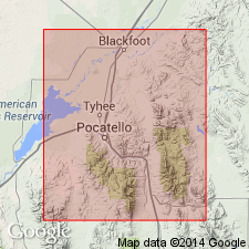
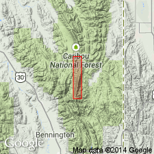
Named from Wood Creek, in T. 3 S., R. 38 E., Boise meridian, in northeastern part of reservation, which cuts across entire Nugget formation, [Bingham Co., southeastern ID].
Source: US geologic names lexicon (USGS Bull. 896, p. 2364).
- Usage in publication:
-
- Wood shale*
- Modifications:
-
- Revised
- AAPG geologic province:
-
- Snake River basin
Summary:
Assigned formation rank. Name applied to the bright red shale 200 to 250 ft thick that overlies Deadman limestone and unconformably? underlies Nugget sandstone. Wood no longer assigned as member of Nugget. Name Nugget restricted to the former upper member of Nugget, a 1,500 ft thick sandstone. The Wood is less resistant to erosion than either of its adjacent units; it occupies depressions or gullies. Locally, pieces of gypsum lie on the surface. Mapped (geologic map) in east part of map area, north and south of Wood Creek from Ts 2-4 S, Rs 37 and 38 E, Bingham Co., ID in the Snake River basin. Stratigraphic table. Assigned a Triassic? age; could be Middle or Upper Triassic, or of a later age. History of nomenclature chart.
Source: GNU records (USGS DDS-6; Denver GNULEX).
- Usage in publication:
-
- Wood shale*
- Modifications:
-
- Principal reference
- AAPG geologic province:
-
- Snake River basin
Summary:
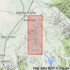
Pg. 17, 35, pl. 1. Wood shale. Type locality designated. Mapped in Ammon and Paradise Valley quadrangles where rock is primarily bright-red sandy shale or shaly sandstone. Locally contains purplish and green shale in addition to red beds. [Age is Late Triassic.]
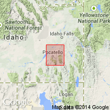
Type locality: on Wood Creek, from which unit takes its name, in T. 3 S., R. 38 E., less than 2 mi west of Paradise Valley quadrangle, ID.
Source: US geologic names lexicon (USGS Bull. 1200, p. 4286-4287).
- Usage in publication:
-
- Wood shale tongue*
- Modifications:
-
- Revised
- AAPG geologic province:
-
- Snake River basin
- Wasatch uplift
Summary:
Red shale and siltstone 200 to 250 ft thick in the Fort Hall Indian Reservation, ID in Bingham and Bannock Cos in the Snake River basin and Caribou Co on the Wasatch uplift, lie above the Deadman limestone and beneath the Nugget sandstone and are assigned to the Wood shale tongue of Ankareh Formation. The Wood was formerly considered to be of formation rank. The Wood is considered a westward extending tongue of the Ankareh. Is recognized at Fort Hall and Grays Range, and east of Bear Lake, ID. Correlated to east with upper part of Stanaker member of Ankareh and with upper part of Chinle formation and upper part of Popo Agie member of Chugwater formation. Cross sections. Correlation chart. Late Triassic age.
Source: GNU records (USGS DDS-6; Denver GNULEX).
- Usage in publication:
-
- Wood shale tongue*
- Modifications:
-
- Areal extent
- AAPG geologic province:
-
- Wasatch uplift
Summary:
Pg. 42-45, pls. (geol. maps, columnar section). Author follows Kummel's (1954) nomenclature. Wood shale tongue of Ankareh formation. In this area it is a moderate red shale and dense pale-red dolomite, 200 to 400 feet thick, at top of Ankareh formation. As mapped, includes Kummel's Deadman limestone, which is too thin and its contacts too poorly defined to make it a practical mapping unit. Is separated from Lanes tongue of Ankareh formation by nearly 600 feet of strata assigned to the Triassic Thaynes formation. Overlies Timothy sandstone member of Thaynes formation; outside of study area the Timothy is overlain by Kummel's Higham grit (absent from this area possibly due to faulting). Underlies Jurassic Nugget sandstone. Top of Wood shale tongue provisionally placed at Triassic-Jurassic boundary. Age of Ankareh is considered Triassic.
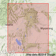
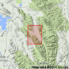
Measured section on ridge on north side of Preuss Creek, in sec. 15, T. 11 S., R. 45 E., Caribou Co., ID.
[GNC remark (July 25, 2016): Although the rank and lithologic terms are lower case, these are formal names.]
Source: Publication.
- Usage in publication:
-
- Wood Shale Tongue*
- Modifications:
-
- Overview
- AAPG geologic province:
-
- Wasatch uplift
Summary:
Mapped as the youngest part of the Ankareh Formation above the Deadman Limestone and beneath the Nugget Sandstone in the northeast part of the quad., Caribou Co., ID on the Wasatch uplift. Consists of 200 to 250 ft of reddish-orange to reddish-brown shale and siltstone that are interbedded with fine grained, reddish-brown sandstone near the top. Late Triassic age.
Source: GNU records (USGS DDS-6; Denver GNULEX).
- Usage in publication:
-
- Wood Shale*
- Modifications:
-
- Overview
- AAPG geologic province:
-
- Snake River basin
Summary:
Name applied to a poorly exposed red, thin-bedded, noncalcareous siltstone and shale. Ranges between 200-250 ft thick. Overlies Deadman Limestone and underlies Nugget Sandstone. Mapped in east-central part of quad. in Bingham Co., ID in the Snake River basin. Assigned to the Upper Triassic.
Source: GNU records (USGS DDS-6; Denver GNULEX).
For more information, please contact Nancy Stamm, Geologic Names Committee Secretary.
Asterisk (*) indicates published by U.S. Geological Survey authors.
"No current usage" (†) implies that a name has been abandoned or has fallen into disuse. Former usage and, if known, replacement name given in parentheses ( ).
Slash (/) indicates name conflicts with nomenclatural guidelines (CSN, 1933; ACSN, 1961, 1970; NACSN, 1983, 2005, 2021). May be explained within brackets ([ ]).