

- Usage in publication:
-
- Wolverine Canyon limestone member*
- Modifications:
-
- Named
- Dominant lithology:
-
- Limestone
- Oolite
- AAPG geologic province:
-
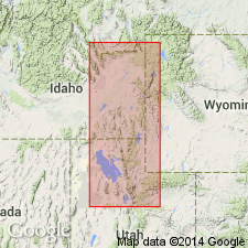
- Snake River basin
Summary:
Named as a member of Preuss sandstone for exposures on north slope of Wolverine Canyon, sec 27, T1S, R39E, Bingham Co, ID in Snake River basin. Is widespread west of the Bannock overthrust. Consists of yellowish-gray, sandy, thin- to medium-bedded limestone. Has a prominent cliff-forming oolite in type measured section where member is 193 ft thick. Lies 240 ft above base of Preuss and 600 ft below top of Preuss. Contains numerous gastropods, corals, pelecypods. Is of marine origin, a unit of middle Callovian or Late Jurassic age.
Source: GNU records (USGS DDS-6; Denver GNULEX).

- Usage in publication:
-
- Wolverine Canyon Limestone Member*
- Modifications:
-
- Age modified
- AAPG geologic province:
-
- Snake River basin
Summary:
Age changed from Late Jurassic to Middle Jurassic because Callovian Stage (to which Wolverine Canyon belongs) removed from Upper Jurassic Series and placed in Middle Jurassic Series as its uppermost stage. A sandy limestone member at base of Preuss in the Wasatch Mountains may be equivalent to Wolverine Canyon.
Source: GNU records (USGS DDS-6; Denver GNULEX).
For more information, please contact Nancy Stamm, Geologic Names Committee Secretary.
Asterisk (*) indicates published by U.S. Geological Survey authors.
"No current usage" (†) implies that a name has been abandoned or has fallen into disuse. Former usage and, if known, replacement name given in parentheses ( ).
Slash (/) indicates name conflicts with nomenclatural guidelines (CSN, 1933; ACSN, 1961, 1970; NACSN, 1983, 2005, 2021). May be explained within brackets ([ ]).