

- Usage in publication:
-
- Wolsey shale zone*
- Modifications:
-
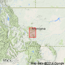
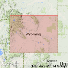
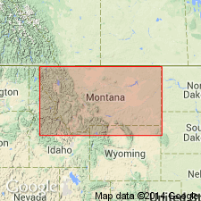
- Areal extent
- AAPG geologic province:
-
- Sweetgrass arch
Summary:
Wolsey shale. Micaceous shale containing small limestone concretions near base and interbedded calcareous shales higher up. Overlies Flathead quartzite and underlies Meagher limestone, all included in Barker formation. [Age is Middle Cambrian.]
Source: US geologic names lexicon (USGS Bull. 896, p. 2362).
- Usage in publication:
-
- Wolsey shale*
- Modifications:
-
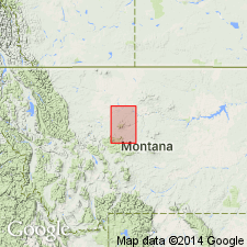
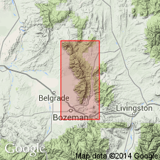
- Areal extent
- Dominant lithology:
-
- Shale
- AAPG geologic province:
-
- Sweetgrass arch
Summary:
Wolsey shale. Purple and green micaceous shales holding small limestone nodules containing fossils. Thickness 125 feet. Rests on Flathead sandstone and underlies Meagher limestone, all included in Barker formation. [Age is Middle Cambrian.]
Source: US geologic names lexicon (USGS Bull. 896, p. 2388).
- Usage in publication:
-
- Wolsey shale*
- Modifications:
-
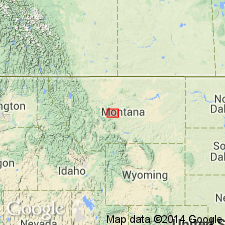
- Original reference
- AAPG geologic province:
-
- Sweetgrass arch
- Montana folded belt
Summary:
Pg. 285. See also Weed (1899, USGS Geol. Atlas of the US, Fort Benton folio, no. 55). Wolsey shale. Dark-gray or greenish, often micaceous shale, carrying oval concretions of limestone, a few inches thick and seldom over 6 inches long. Contains Middle Cambrian fossils (trilobites identified by C.D. Walcott). Average thickness 150 feet. Mapped as 2nd from base (of 7) subdivisions collectively referred to as Barker formation. Individual units could not be mapped at scale used. Overlies Flathead sandstone (revised); underlies Meagher limestone (revised). Report includes list of fossils, correlation of measured sections.
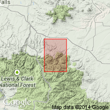
Well exposed at old dam on Sheep Creek near Wolsey, Meagher Co. (Montana folded belt province), also in Keegan Butte and on hill south of it [South Hill], which rises above the open and nearly level surface of Belt Park (Sweetgrass arch).
Source: US geologic names lexicon (USGS Bull. 896, p. 2362); supplemental information from GNU records (USGS DDS-6; Denver GNULEX).
- Usage in publication:
-
- Wolsey shale
- Modifications:
-
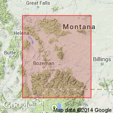
- Principal reference
- Revised
- Dominant lithology:
-
- Shale
- Sandstone
- AAPG geologic province:
-
- Central Montana uplift
- Montana folded belt
- Sweetgrass arch
- Yellowstone province
Summary:
Pg. 1276, 1328-1330, stratigraphic sections. Wolsey shale. Weed's original definition emended; new type section designated [since] exposure referred to by Weed, near dam on Sheep Creek, is now covered. Conformably overlies Flathead sandstone (emended) wherever these formations are exposed in Montana and Yellowstone National Park; underlies Meagher limestone (emended). Deposit clearly transitional between subjacent and superjacent formations. Lower part is dominantly dull-green to greenish-gray shale, interbedded with thin lenses of sandstone; worm trails, GRUZIANA, and borings common. Middle part of formation is nearly pure micaceous paper-thin shale and occasional thin platy intercalated beds of rusty-weathering sandstone, which in upper part is often slightly calcareous and usually contains worm borings; several zones of chocolate-brown fissile shales interbedded with the characteristically green shales; intercalated limestone lenses. Upper third consists of fissile shales, dominantly chocolate- to maroon-brown in upper part; intercalated thin beds of gray crystalline limestone, which contain iron and glauconite; fossils present in the limestone lenses and in fissile maroon and green shales, and are largely concentrated into two zones. In type section, upper of these two zones occurs 10 to 24 feet below top of Wolsey, and lower occurs 25 to 50 feet below upper zone. Thickness at type section 174 feet. Total thickness of Wolsey ranges from 363 feet on Beaver Creek, Big Belt Mountains, Lewis and Clark County, to 150 feet on Crowfoot Ridge, Gallatin Range, Yellowstone National Park, where unit is best exposed. Age is Middle Cambrian. Report includes fossil list. Plate 2 shows tentative correlation of revised Cambrian units at type sections.
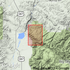
Type localities reexamined and sections remeasured at Keegan Butte, in central part of sec. 15, T. 14 N., R. 7 E., near northern edge of Little Belt Mountains quadrangle, and isolated hill immediately to south, called South Hill, near Neihart, in central part of sec. 15, T. 14 N., R. 7 E., Cascade County, Montana, in Little Belt Mountains (Sweetgrass arch). Both are from 4 to 6 mi west of Belt Creek section. [See Flathead Quartzite.] Additional sections remeasured in central and southern MT (Montana folded belt province, Central Montana uplift) and in Yellowstone National Park (Yellowstone province). Best exposure is on Crowfoot Ridge, Yellowstone National Park.
Type section of emended Wolsey is on south end of South Hill in Belt Park, in sec. 15, T. 14 N., R. 7 E. Field evidence indicates Weed meant South Hill to be type locality of Wolsey, but that he took name Wolsey from post office of that name at a ranch on Sheep Creek, near Wolsey, Meagher Co., MT. Post office no longer in existence.
Source: US geologic names lexicon (USGS Bull. 1200, p. 4283-4285); supplemental information from GNU records (USGS DDS-6; Denver GNULEX).

- Usage in publication:
-
- Wolsey shale
- Modifications:
-
- Not used
- AAPG geologic province:
-
- Montana folded belt
- North Western Overthrust
Summary:
Pg. 1089. [Wolsey shale not used in Lewis and Clark Range area, Flathead, Powell, and Lewis and Clark Counties, Montana.] Deiss (Montana Bur. Mines and Geol. Mem., no. 6, 1933) divided Cambrian rocks of northwestern Montana into 11 formations. Second in sequence was Wolsey shale. This sequence is here revised, and Walcott's name Gordon is used instead of Wolsey for shale which lies upon Flathead sandstone and underlies Damnation limestone (redefined).
Source: US geologic names lexicon (USGS Bull. 1200, p. 4283-4285); supplemental information from GNU records (USGS DDS-6; Denver GNULEX).
- Usage in publication:
-
- Wolsey shale
- Modifications:
-
- Revised
- AAPG geologic province:
-
- Bighorn basin
- Green River basin
- Wind River basin
- Yellowstone province
Summary:
Chart 2 (footnote). Gros Ventre group in western Wyoming includes three mappable formations (ascending): Wolsey shale, Death Canyon limestone, and Park shale. Age of Wolsey is Middle Cambrian (Albertan).
Source: US geologic names lexicon (USGS Bull. 1200, p. 4283-4285); supplemental information from GNU records (USGS DDS-6; Denver GNULEX).
- Usage in publication:
-
- Wolsey formation
- Modifications:
-
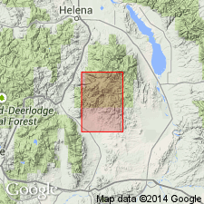
- Areal extent
- AAPG geologic province:
-
- Montana folded belt
Summary:
Pg. 1388-1390 (table 1), 1393. Wolsey formation. In Bridger Range, Gallatin County, Montana, consists of gray-green to maroon, fissile, micaceous shale interbedded with thin, rusty-brown, laminated, fine-grained glauconitic and micaceous sandstones. Locally contains conglomeratic arkosic limestone and arkose. Thickness 152 to 210 feet. Overlies Flathead formation and underlies Meagher formation. Age is Middle Cambrian (citing Deiss, 1936).
Source: Publication.
- Usage in publication:
-
- Wolsey shale member
- Modifications:
-
- Revised
- AAPG geologic province:
-
- Yellowstone province
Summary:
Pg. 12-13. Wolsey shale member of Gros Ventre formation. In this report, the Wolsey is considered basal member of Gros Ventre formation. Underlies Meagher limestone member; overlies Flathead sandstone. Thicknesses: 86 feet, Gros Ventre Range; 134 feet, Teton Range; 607 feet, Snake River Range.
Source: US geologic names lexicon (USGS Bull. 1200, p. 4283-4285).
- Usage in publication:
-
- Wolsey shale*
- Modifications:
-
- Areal extent
- AAPG geologic province:
-
- Montana folded belt
Summary:
Pg. 8, pls. 1, 2, 3. Wolsey shale. Five lowest natural Cambrian map units in southern Elkhorn Mountains are lithologically similar to Flathead sandstone, Wolsey shale, Meagher limestone, Park shale, and Pilgrim dolomite of nearby areas, as redefined by Deiss (1936), and these formational names have been adopted. Wolsey shale is 368 feet thick; underlies Meagher limestone, and overlies Flathead quartzite. Upper half of unit is interbedded gray argillaceous limestone and greenish- and yellowish-gray calcareous mudstone and shale; lower half is greenish-gray and drab shale with some interbeds of sandstone and limestone; many beds micaceous, some glauconitic. [Age is Middle Cambrian.]
Source: US geologic names lexicon (USGS Bull. 1200, p. 4283-4285).
- Usage in publication:
-
- Wolsey Shale*
- Modifications:
-
- Mapped
- AAPG geologic province:
-
- Sweetgrass arch
Summary:
Wolsey Shale. Shaly siltstone and shale, green to dark-green, glauconitic, micaceous, thin-bedded; altered to black hornfels near large intrusions. About 200 feet thick. Lies above Flathead Sandstone and below Meagher Limestone. Age is Middle Cambrian.
Source: Publication.
- Usage in publication:
-
- Wolsey Formation
- Modifications:
-
- Revised
- Redescribed
- Dominant lithology:
-
- Shale
- Limestone
- Sandstone
- Siltstone
- AAPG geologic province:
-
- Montana folded belt
Summary:
Wolsey Formation. Study area is west of Three Forks, in Madison, Jefferson, and Gallatin Counties, Montana. Generally fossiliferous, gray-green, fissile, micaceous shale. Upper part includes numerous thin silty sparites and intrasparites. Middle part is a very prominent, thinly bedded, silty sparite referred to informally as Silver Hill limestone or middle limestone or middle Wolsey limestone. Thin quartz arenite and siltstone beds common near base. Total thickness 65 to 120 m. Overlies Flathead Formation and underlies Meagher Formation; both contacts gradational. Age is Middle Cambrian. Report includes cross section.
Source: Modified from GNU records (USGS DDS-6; Denver GNULEX).
- Usage in publication:
-
- Wolsey Formation*
- Modifications:
-
- Redescribed
- Mapped 1:24k
- Dominant lithology:
-
- Sandstone
- Siltstone
- Shale
- AAPG geologic province:
-
- Montana folded belt
Summary:
Wolsey Formation. Mapped in north-central part of quadrangle, Madison County, Montana; also mapped undivided with Flathead Sandstone in central part of quadrangle. Consists mostly of thin-bedded, greenish-gray, olive-drab, gray, and grayish-brown, micaceous sandstone, siltstone, and shale. Sandstone beds wavy, bioturbated, contain green and gray mottled shale interbeds, and generally weather brown; animal trails common; locally glauconitic. Near middle is a 10 to 15 m thick, dark-gray, thin-bedded, argillaceous limestone interbedded with lesser amount of sandstone and shale; weathers brown. Upper 5 m is interbedded gray, wavy-laminated, thin-bedded limestone and gray, micaceous siltstone. Total thickness 30 to 65 m. Conformably overlies Flathead Sandstone; conformably underlies Meagher Limestone. Age is Middle Cambrian.
Source: Modified from GNU records (USGS DDS-6; Denver GNULEX).
For more information, please contact Nancy Stamm, Geologic Names Committee Secretary.
Asterisk (*) indicates published by U.S. Geological Survey authors.
"No current usage" (†) implies that a name has been abandoned or has fallen into disuse. Former usage and, if known, replacement name given in parentheses ( ).
Slash (/) indicates name conflicts with nomenclatural guidelines (CSN, 1933; ACSN, 1961, 1970; NACSN, 1983, 2005, 2021). May be explained within brackets ([ ]).