- Usage in publication:
-
- Wissahickon mica gneiss
- Modifications:
-
- Named
- Dominant lithology:
-
- Gneiss
- Schist
- AAPG geologic province:
-
- Piedmont-Blue Ridge province
Summary:
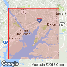
The gneisses of Philadelphia belt of crystallines (Chestnut Hill, Manayunk, and Philadelphia schist and gneisses) are divisible into a mica gneiss of sedimentary origin and several presumably intrusive igneous bodies--peridotites and pyroxenites, largely represented now by serpentines, gabbro, and norite, and two granite gneisses. The formation into which these igneous rocks have been intruded is a mica gneiss, provisionally named Wissahickon gneiss, from creek along banks of which it is finely exposed.
Source: GNU records (USGS DDS-6; Reston GNULEX).
- Usage in publication:
-
- Wissahickon Group
- Modifications:
-
- Revised
- AAPG geologic province:
-
- Piedmont-Blue Ridge province
Summary:
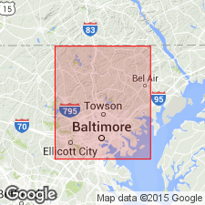
Wissahickon Formation raised in rank to Wissahickon Group and encompassing Glenarm raised to Supergroup in MD. Wissahickon subdivided into Loch Raven Schist (new), Oella Formation (new), Piney Run Formation (new), Sykesville Formation (revised), Pleasant Grove Schist (new), and Prettyboy Schist (new). Wissahickon overlies Cockeysville Marble and Setters Formation, also of Glenarm. Age is Cambrian to Ordovician(?).
Source: GNU records (USGS DDS-6; Reston GNULEX).
- Usage in publication:
-
- Wissahickon Formation*
- Modifications:
-
- Geochronologic dating
- AAPG geologic province:
-
- Piedmont-Blue Ridge province
Summary:
Pg. 27, geologic time scale (inside front cover). Wissahickon Formation. Sample from Fox Croft quarry, Philadelphia area, [approx.] Lat. 39 deg. 59 min. N., Long. 75 deg. 23 min. W., Media quadrangle, Delaware County, Pennsylvania, yielded a Pb-alpha age of 710 +/-80 Ma (zircon) [Precambrian Z]. Age calculated using decay constants of Steiger and Jager, 1977 (Earth Planet. Sci. Letters, v. 36, p. 359-362).
Source: Publication.
- Usage in publication:
-
- Wissahickon Group
- Modifications:
-
- Overview
- AAPG geologic province:
-
- Piedmont-Blue Ridge province
Summary:
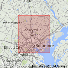
Age of Wissahickon is uncertain and depends on structural interpretation. The following limits apply: Sykesville is younger than 520 my and Loch Raven and Morgan Run are older than 469 my. If rocks are in original stratigraphic order, then the Wissahickon is probably Ordovician. If the Wissahickon is thrusted over the Cockeysville, then the lower Wissahickon is Cambrian. Limits could be even wider. Wissahickon includes the Loch Raven Schist at its base, the Sykesville Formation, which is a diamictite to the southeast, the Morgan Run Formation and the Peters Creek Schist, which are both metagraywackes in the central region, and the Pleasant Grove Formation, a quartz schist, in the northwest.
Source: GNU records (USGS DDS-6; Reston GNULEX).
- Usage in publication:
-
- Wissahickon Group
- Modifications:
-
- Revised
- AAPG geologic province:
-
- Piedmont-Blue Ridge province
Summary:
First use of Wissahickon at group rank in VA. No subdivisions listed. [According to the code, a group should include at least one named unit of formation rank or it must be indicated that divisions will be named in the future.]
Source: GNU records (USGS DDS-6; Reston GNULEX).
- Usage in publication:
-
- Wissahickon
- Modifications:
-
- Not used
- AAPG geologic province:
-
- Piedmont-Blue Ridge province
Summary:
Use of terms Wissahickon Group and Glenarm Supergroup discontinued in MD. Baltimore terrane cover sequence is described using individual formation names.
Source: GNU records (USGS DDS-6; Reston GNULEX).
- Usage in publication:
-
- Wissahickon Group
- Modifications:
-
- Overview
- AAPG geologic province:
-
- Piedmont-Blue Ridge province
Summary:
Detailed analysis of field relations at five locations near Doe Run reveal that Wissahickon Group consistently lies above, and with angular contact upon, an overturned stratigraphic sequence of Grenville-aged gneiss above Setters Formation, which lies above Cockeysville Marble, all three assigned here to the Brandywine terrane. Evidence supports the theory that the Wissahickon Group was emplaced after peak metamorphism. Identification of the Doe Run thrust fault at the base of the Wissahickon contradicts the previous assumption of stratigraphic continuity throughout the Glenarm Supergroup of southeastern PA and DE.
Source: GNU records (USGS DDS-6; Reston GNULEX).
For more information, please contact Nancy Stamm, Geologic Names Committee Secretary.
Asterisk (*) indicates published by U.S. Geological Survey authors.
"No current usage" (†) implies that a name has been abandoned or has fallen into disuse. Former usage and, if known, replacement name given in parentheses ( ).
Slash (/) indicates name conflicts with nomenclatural guidelines (CSN, 1933; ACSN, 1961, 1970; NACSN, 1983, 2005, 2021). May be explained within brackets ([ ]).

