

- Usage in publication:
-
- Winslow shales
- Modifications:
-
- Original reference
- Dominant lithology:
-
- Shale
- AAPG geologic province:
-
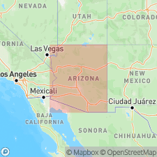
- Black Mesa basin
Summary:
Pg. 250, 339. Winslow shales. Name is given to 3rd shale bed of Ward's Moenkopian series, exposed in Rio Chiquito Colorado Valley, at mouth of Rio Puerco, Navajo and Coconino Counties, northeastern Arizona. Thickness 200 feet.
Origin of name not stated. Mouth of Rio Puerco is in Navajo Co., near Holbrook, a considerable distance east of Winslow, AZ.
Source: US geologic names lexicon (USGS Bull. 896, p. 2354).
For more information, please contact Nancy Stamm, Geologic Names Committee Secretary.
Asterisk (*) indicates published by U.S. Geological Survey authors.
"No current usage" (†) implies that a name has been abandoned or has fallen into disuse. Former usage and, if known, replacement name given in parentheses ( ).
Slash (/) indicates name conflicts with nomenclatural guidelines (CSN, 1933; ACSN, 1961, 1970; NACSN, 1983, 2005, 2021). May be explained within brackets ([ ]).