The National Geologic Map Database is migrating to a new infrastructure. We apologize for any service disruptions during this process.
|
|---|


- Usage in publication:
-
- Winooski marble
- Modifications:
-
- Original reference
- Dominant lithology:
-
- Marble
- AAPG geologic province:
-
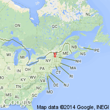
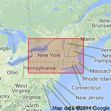
- New England province
Summary:
E. Hitchcock, v. 1. Winooski marble. Designated the basal 40 feet of his Red Sandrock series as Winooski marble, "not to multiply local designations, but to designate a peculiar variety of the Red Sandrock series, using the name by which it is known in economic geology." Subsequent reports on geology of Vermont frequently contained references to Winooski marble.
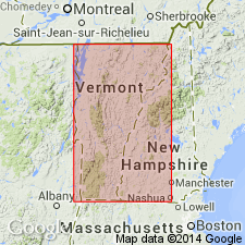
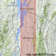
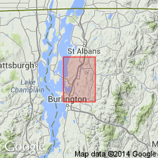
Probably named for exposures along Winooski River in town of Burlington, Chittendon Co., northwestern VT.
Source: US geologic names lexicon (USGS Bull. 896, p. 2353-2354); supplemental information from GNU records (USGS DDS-6; Reston GNULEX).
- Usage in publication:
-
- Winooski marble*
- Modifications:
-
- Overview
- Biostratigraphic dating
- AAPG geologic province:
-
- New England province
Summary:
Winooski marble type locality given as along Winooski River in Burlington, VT, where it was quarried. Consists mainly of red or pink mottled dolomite. Contains interbeds of coarsely crystalline, light-gray dolomite. All dolomite is dense and has conchoidal fracture. Is very resistant to erosion and forms long ledges over hollows and slopes. Base of formation is interbedded with quartzite for about 50 ft, forming a transition to underlying Monkton quartzite (new). Top of formation is marked by red, buff, and purple quartzite layers exhibiting ripple marks, mudcracks, and annelid trails. Top is well exposed at Winooski Falls in Burlington. Although fossils found in this unit were assigned to the Silurian (by James Hall in 1847) and to the Potsdam (by Billings), Walcott (1883) found Lower Cambrian fossils in the pink dolomite.
Source: GNU records (USGS DDS-6; Reston GNULEX).
- Usage in publication:
-
- Winooski dolomite
- Modifications:
-
- Revised
- AAPG geologic province:
-
- New England province
Summary:
Revised as Winooski dolomite. Unit is restricted to dolomite beds at Winooski Falls or Winooski village in Colchester Township. Other localities near Mallet Bay, in vicinity of Ethan Allen Park in Burlington, and along the lower Winooski River are in a distinctly lower stratigraphic zone. Top of Winooski never identified but is placed beneath lowest bed of typical Upper Cambrian Danby quartzite. Bottom contact with Monkton quartzite also hard to identify but placed where quartzite beds are over 1 ft thick and are separated by less than 25 ft. Thickness ranges from 100 to at least 800 ft.
Source: GNU records (USGS DDS-6; Reston GNULEX).
- Usage in publication:
-
- Winooski Dolostone*
- Modifications:
-
- Revised
- Age modified
- AAPG geologic province:
-
- New England province
Summary:
Revised as Winooski Dolostone. Age changed from Early Cambrian to Early and Middle Cambrian. Shown on plate 2 as occurring in east limb of Middlebury syncline in southwest VT.
Source: GNU records (USGS DDS-6; Reston GNULEX).
- Usage in publication:
-
- Winooski Formation
- Modifications:
-
- Revised
- Age modified
- AAPG geologic province:
-
- New England province
Summary:
Revised as Winooski Formation in northwestern VT and assigned a Middle Cambrian age. [No explanation given for revisions to name or age.]
Source: GNU records (USGS DDS-6; Reston GNULEX).

- Usage in publication:
-
- Winooski Dolomite*
- Modifications:
-
- Areal extent
- AAPG geologic province:
-
- New England province
Summary:
Stratigraphic succession in Middlebury synclinorium in north-central part of Glens Falls quad consists of (ascending) Late Proterozoic Dalton Formation and Pinnacle Formation, Lower Cambrian Cheshire Quartzite, Lower and Middle Cambrian dolomites (Rutland Dolomite, Dunham Dolomite as used by Cady (1945), Winooski Dolomite) with minor quartzite (Monkton Formation), and Upper Cambrian Danby Formation. Middlebury synclinorium is considered a parautochthonous shelf sequence.
Source: GNU records (USGS DDS-6; Reston GNULEX).
- Usage in publication:
-
- Winooski Dolomite*
- Modifications:
-
- Age modified
- AAPG geologic province:
-
- New England province
Summary:
Winooski Dolomite mapped in southwestern VT and given an Early Cambrian age. [Overall age for Winooski is Early and Middle Cambrian and may be time transgressive from south to north; see Dorsey and Stanley (1982) for northwestern VT.]
Source: GNU records (USGS DDS-6; Reston GNULEX).
For more information, please contact Nancy Stamm, Geologic Names Committee Secretary.
Asterisk (*) indicates published by U.S. Geological Survey authors.
"No current usage" (†) implies that a name has been abandoned or has fallen into disuse. Former usage and, if known, replacement name given in parentheses ( ).
Slash (/) indicates name conflicts with nomenclatural guidelines (CSN, 1933; ACSN, 1961, 1970; NACSN, 1983, 2005, 2021). May be explained within brackets ([ ]).