The National Geologic Map Database is migrating to a new infrastructure. We apologize for any service disruptions during this process.
|
|---|


- Usage in publication:
-
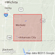
- Winfield concretionary limestone
- Modifications:
-
- Original reference
- Dominant lithology:
-
- Limestone
- AAPG geologic province:
-
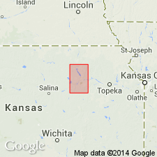
- Nemaha anticline
Summary:
Pg. 64-68. Winfield concretionary limestone. Limestone, 13 feet thick, heretofore called Marion concretionary limestone. Top member of Chase formation. Age is Permian.
Named from exposures around Winfield, Cowley Co., eastern KS.
Source: US geologic names lexicon (USGS Bull. 896, p. 2350-2351).
- Usage in publication:
-
- Winfield formation*
- Modifications:
-
- Revised
- Dominant lithology:
-
- Limestone
- Shale
- AAPG geologic province:
-
- Nemaha anticline
Summary:
Pg. 715. Winfield formation. Massive concretionary limestone [Winfield concretionary limestone of previous reports] at top; yellowish shales in middle; and cherty limestone [†Marion flint] at base. Thickness 25 feet. Overlies Doyle shales and underlies Marion formation. [Age is Permian.]
[This expanded definition of Winfield limestone was followed by Kansas Geol. Survey and the USGS until 1929.]
Source: US geologic names lexicon (USGS Bull. 896, p. 2350-2351).
- Usage in publication:
-
- Winfield limestone*
- Modifications:
-
- Revised
- Dominant lithology:
-
- Limestone
- AAPG geologic province:
-
- Nemaha anticline
Summary:
Pg. 87. Winfield limestone. Applied name to 10 or 11 feet of massive limestone in Cowley County, eastern Kansas, which "probably corresponds to the 'massive concretionary limestone' of Prosser, which he described as occurring at the top of his Winfield formation. The lower part of his Winfield formation may then correspond to upper part of Doyle shale as herein described, the basal cherty limestone ('Marion flint') being absent in southern Kansas." [Age is Permian.]
Source: US geologic names lexicon (USGS Bull. 896, p. 2350-2351).

- Usage in publication:
-
- Winfield formation
- Modifications:
-
- Revised
- AAPG geologic province:
-
- Nemaha anticline
Summary:
Winfield formation of Chase group. Divided Winfield formation into 3 members (descending) Cresswell ("concretionary limestone" of early reports), Grant shale, and Stovall limestone, with a combined thickness of 28 feet, apparently following Prosser's definition. They also divided underlying Doyle formation into 3 named members, aggregating 66 feet in thickness. Age is Permian (Big Blue).
[GNC remark (ca. 1936, US geologic names lexicon, USGS Bull. 896, p. 2351): these recent reports (which apparently follow Prosser's 1902 definitions of Winfield and Doyle) have not yet been considered by the USGS for its publications.]
Source: US geologic names lexicon (USGS Bull. 896, p. 2350-2351); GNC KS-NE Permian Corr. Chart, Oct. 1936.
- Usage in publication:
-
- Winfield limestone
- Modifications:
-
- Revised
- AAPG geologic province:
-
- Nemaha anticline
Summary:
Pg. 12. Treated Luta limestone as top member of Winfield limestone and treated Condra's members of Doyle shale as formations, dropping Doyle.
[GNC remark (ca. 1936, US geologic names lexicon, USGS Bull. 896, p. 2351): these recent reports (which apparently follow Prosser's 1902 definitions of Winfield and Doyle) have not yet been considered by the USGS for its publications.]
Source: US geologic names lexicon (USGS Bull. 896, p. 2350-2351).
- Usage in publication:
-
- Winfield limestone
- Modifications:
-
- Areal extent
- AAPG geologic province:
-
- Nemaha anticline
Summary:
Pg. 82-88. Winfield limestone of Chase group. Although name Winfield was applied because of exposures near Winfield in Cowley County, eastern Kansas, Prosser's original type exposure [Marion concretionary limestone] near Marion, in Marion County, should still be regarded as typical for formation. When formation was first named and when name was changed to Winfield, the formation included three members (ascending): Stovall limestone, Grant shale, and Cresswell limestone. Kansas Geological Survey now includes a fourth member, the Luta, above the Cresswell. Overlies Doyle shale; underlies Odell shale. [Age is Permian.]
Source: US geologic names lexicon (USGS Bull. 1200, p. 4260).

- Usage in publication:
-
- Winfield limestone
- Modifications:
-
- Revised
Summary:
Pg. 41-44. Winfield limestone of Chase group. Comprises (ascending) Stovall limestone, Grant shale, and Cresswell limestone members. "Luta" limestone included in Cresswell. Thickness about 25 feet. Individual members not identified in southern Kansas. [Age is Permian.]
Source: US geologic names lexicon (USGS Bull. 1200, p. 4260).
- Usage in publication:
-
- Winfield limestone
- Modifications:
-
- Areal extent
- AAPG geologic province:
-
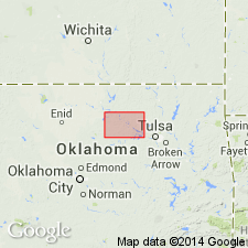
- Chautauqua platform
Summary:
Pg. 116-119. Winfield limestone is uppermost Permian unit exposed in Pawnee County, central northern Oklahoma. In the western part of county, red sandstones and shales of the Doyle are capped by about 7 feet of thin-bedded sandstone, which contains thin lenticular beds of light-colored nonfossiliferous calcareous sandstone and sandy limestone. This section has been correlated with and mapped as Winfield limestone. Possibility exists that Pawnee correlative of the Winfield is the brown fossiliferous limestone in upper part of Doyle. Southern extent of formation not known. Wolfcamp series.
Source: US geologic names lexicon (USGS Bull. 1200, p. 4260).
- Usage in publication:
-
- Winfield Limestone*
- Modifications:
-
- Areal extent
- AAPG geologic province:
-
- Chautauqua platform
Chaplin, J.R., 2010, Stratigraphic analysis of the Permian Chase Group in northern Oklahoma; Outcrop analogs of reservoir rocks in the Hugoton embayment of northwestern Oklahoma and southwestern Kansas: Oklahoma Geological Survey Guidebook, no. 36, 109 p., Prepared for 2nd day of field trip (Apr. 2009) co-sponsored by Oklahoma City Geol. Soc. and Kansas Geol. Soc.
Summary:
For more information, please contact Nancy Stamm, Geologic Names Committee Secretary.
Asterisk (*) indicates published by U.S. Geological Survey authors.
"No current usage" (†) implies that a name has been abandoned or has fallen into disuse. Former usage and, if known, replacement name given in parentheses ( ).
Slash (/) indicates name conflicts with nomenclatural guidelines (CSN, 1933; ACSN, 1961, 1970; NACSN, 1983, 2005, 2021). May be explained within brackets ([ ]).