

- Usage in publication:
-
- Windy Hill Sandstone Member*
- Modifications:
-
- Named
- Dominant lithology:
-
- Sandstone
- AAPG geologic province:
-
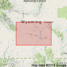
- Green River basin
- Wind River basin
Summary:
Named as upper member of Sundance Formation for Windy Hill, 4 mi west of type section in Freezeout Mountains, Carbon Co, WY in Greater Green River basin. Recognized along line of section from Dallas anticline, Fremont Co, WY in Wind River basin south to Freezeout Mountains and into Carbon Co and Greater Green River basin. Consists principally in central and southern WY of very fine to fine-grained, limy, oolitic, sparsely fossiliferous sandstone that weathers grayish white to brownish gray. The sandstone is fine to coarse grained calcite cemented sparsely oolitic, rarely fossiliferous sandstone with green to gray shale partings locally. Some current ripple marks. Is about 30 ft thick at type. Ranges from 5 ft at Connant Creek (secs 23, 25 and 26, T33N, R94W) to 57 ft at Seminoe Mountain (sec 20, T25N, R84W). Averages 5 ft thick. Rests disconformably (a regional disconformity) on Redwater Shale Member of Sundance. Underlies Morrison Formation. May locally intertongue with Morrison. Is a marine unit (oolites, oysters, belemnites) of Jurassic age. Cross sections.
Source: GNU records (USGS DDS-6; Denver GNULEX).
- Usage in publication:
-
- Windy Hill Sandstone Member*
- Modifications:
-
- Areal extent
- AAPG geologic province:
-
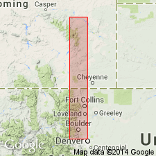
- Denver basin
- Powder River basin
Summary:
As upper member of Jurassic Sundance Formation, extends from Douglas, Converse Co, WY, southern Powder River basin, to vicinity of Fort Collins, Larimer Co, CO in Denver basin. Cannot be recognized at Loveland, CO. Assigned to Sundance because it has a marine or brackish-water fauna more closely related to Sundance than to terrestrial Morrison Formation, which gradationally overlies it. Lower contact with Pine Butte Member of Sundance is an unconformity. Is of [Late] Jurassic age. Measured sections shown graphically.
Source: GNU records (USGS DDS-6; Denver GNULEX).

- Usage in publication:
-
- Windy Hill Sandstone Member*
- Modifications:
-
- Revised
- Overview
- AAPG geologic province:
-
- Chadron arch
- Powder River basin
- Williston basin
Summary:
Made part of Sundance Formation in the Black Hills region in Crook and Weston Cos, WY (northeastern Powder River basin) and in Fall River Co, SD (northwestern Chadron arch). Unconformably overlies Redwater Shale Member (revised); conformably? overlain by Morrison Formation in the Black Hills. Is Late Jurassic (Oxfordian) in age. Summarizes lithology, basis for dating, distribution, and correlation.
Source: GNU records (USGS DDS-6; Denver GNULEX).
- Usage in publication:
-
- Windy Hill Sandstone Member*
- Modifications:
-
- Areal extent
- AAPG geologic province:
-
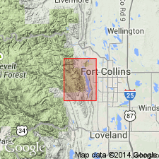
- Denver basin
Summary:
Mapped as part of Upper and Middle Jurassic Sundance Formation. Is uppermost member of Sundance in map area. Unconformably overlies Pine Butte Member of Sundance. Unconformably underlies Morrison Formation. Thickness about 10 ft at north edge of Horsetooth Reservoir quadrangle, but wedges out near south edge; Larimer Co, CO in the Denver basin.
Source: GNU records (USGS DDS-6; Denver GNULEX).
- Usage in publication:
-
- Windy Hill Member*
- Modifications:
-
- Age modified
- Revised
- AAPG geologic province:
-
- Green River basin
- Uinta basin
Summary:
Is reassigned from upper member of the Sundance Formation to basal member of the Morrison Formation. "The Windy Hill Member was originally called the Windy Hill Sandstone Member and included in the Sundance Formation, which is largely but not entirely a marine formation. The extensive erosion surface at the base of the Windy Hill and its interfingering relations with lower Morrison strata indicate that it is more closely related to the Morrison than to the Sundance, even though it is a marine deposit. For these reasons, the Windy Hill Sandstone Member is here removed from the Sundance Formation, the lithologic name (sandstone) is deleted for simplicity and ease of use, and the member is reassigned to the Morrison Formation as the Windy Hill Member. This stratigraphic reassignment allows a clearer understanding, not only of the stratigraphic relations of the Windy Hill and correlative units in the Morrison, but also of the genesis of beds immediately above the J-5 unconformity." Age modified following series and stage assignment (without comment) as shown on correlation chart (fig. 3), which shows Windy Hill above the J-5 unconformity, overlying the Redwater Member (Oxfordian) of the Sundance Formation and assigns the Windy Hill to both the upper Oxfordian and lower Kimmeridgian.
Source: GNU records (USGS DDS-6; Denver GNULEX).
For more information, please contact Nancy Stamm, Geologic Names Committee Secretary.
Asterisk (*) indicates published by U.S. Geological Survey authors.
"No current usage" (†) implies that a name has been abandoned or has fallen into disuse. Former usage and, if known, replacement name given in parentheses ( ).
Slash (/) indicates name conflicts with nomenclatural guidelines (CSN, 1933; ACSN, 1961, 1970; NACSN, 1983, 2005, 2021). May be explained within brackets ([ ]).