- Usage in publication:
-
- Windrock sandstone
- Modifications:
-
- Named
- Dominant lithology:
-
- Sandstone
- AAPG geologic province:
-
- Appalachian basin
Summary:
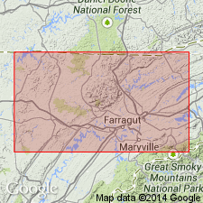
Windrock sandstone exposed in cross-country sections from Windrock to America Knob. Occurs at top of Anderson formation. Consists of sandstone containing occasional gritty quartz pebbles the size of wheat grains. On American Knob, top of sandstone is 18 ft below summit. Thickness is 40 ft.
Source: GNU records (USGS DDS-6; Reston GNULEX).
For more information, please contact Nancy Stamm, Geologic Names Committee Secretary.
Asterisk (*) indicates published by U.S. Geological Survey authors.
"No current usage" (†) implies that a name has been abandoned or has fallen into disuse. Former usage and, if known, replacement name given in parentheses ( ).
Slash (/) indicates name conflicts with nomenclatural guidelines (CSN, 1933; ACSN, 1961, 1970; NACSN, 1983, 2005, 2021). May be explained within brackets ([ ]).

