

- Usage in publication:
-
- Willows Diorite
- Modifications:
-
- Named
- Geochronologic dating
- Dominant lithology:
-
- Diorite
- AAPG geologic province:
-
- Santa Maria basin
Summary:
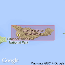
[Probably named for Willows Anchorage] Type area is exposures along Willows Fault north of Willows Anchorage, west Santa Cruz Island, off southern coast of CA. Composed of quartz-hornblende-diorite, hornblende-diorite, hornblendite serpentinized hornblendite, and complimentary dikes of acid and basic rocks. Most is unstrained and very little weathered, and considerably fractured. Is in fault contact with Santa Cruz Island Schist [new]. K-Ar age determination gave 145 +/-5 Ma. Sample collected from upper Laguna Canyon.
Source: GNU records (USGS DDS-6; Menlo GNULEX).
For more information, please contact Nancy Stamm, Geologic Names Committee Secretary.
Asterisk (*) indicates published by U.S. Geological Survey authors.
"No current usage" (†) implies that a name has been abandoned or has fallen into disuse. Former usage and, if known, replacement name given in parentheses ( ).
Slash (/) indicates name conflicts with nomenclatural guidelines (CSN, 1933; ACSN, 1961, 1970; NACSN, 1983, 2005, 2021). May be explained within brackets ([ ]).