The National Geologic Map Database is migrating to a new infrastructure. We apologize for any service disruptions during this process.
|
|---|


- Usage in publication:
-
- Willis formation
- Modifications:
-
- Original reference
- Dominant lithology:
-
- Sand
- AAPG geologic province:
-
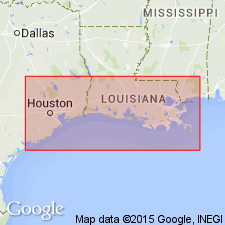
- Gulf Coast basin
Summary:
Pg. 655, 656, 660. Willis formation. Proposed by writer for the formation of sand and gravelly sand occurring at or near base of post-Fleming group in southeastern Texas and southern Louisiana. Called "unnamed Pliocene sand" and "Upper Citronelle sand" by Plummer, in Univ. Texas Bull. 3232, 1933, p. 530 and 749-763. Is in general red sand, coarse and gravelly in part, and slightly indurated. Exposed in a dissected hilly belt 15 to 20 miles wide, paralleling and just south of Fleming belt of outcrop. Rests unconformably on clay beds which are in part Fleming and which may be in part Goliad. Highly probable the Willis is younger than Goliad sand, but upper member of Goliad (the Labahia) may be = lowest member of the Willis, the Willis gravel. Is overlapped unconformably by Lissie formation and locally by the [later] Beaumont and Recent. Divided into 3 members (all of which are present in both southeastern Texas and southwestern and southeastern Louisiana), named (descending): (1) Hockley Mound sand member, 20 to 25 feet; (2) Willis ferruginous sand member, 30 to 60 feet; and (3) Willis gravelly sand member, 30 to 40 feet. No fossils. Age is late Pliocene or early Pleistocene. Tentatively correlated with upper part of Citronelle formation.
Named from town of Willis, 10 mi north of Conroe, Montgomery Co., southeastern TX, which is located on top of north end of a ridge held up by the formation.
[GNC remark (ca. 1936, US geologic names lexicon, USGS Bull. 896, p. 2341-2342): Willis sand adopted by the USGS for use in its publications. †Willis ferruginous sand member and †Willis gravelly sand member abandoned. The USGS does not apply the name of a formation to its members.]
Source: US geologic names lexicon, USGS Bull. 896, p. 2341-2342).
- Usage in publication:
-
- Willis sand*
- Modifications:
-
- Areal extent
- AAPG geologic province:
-
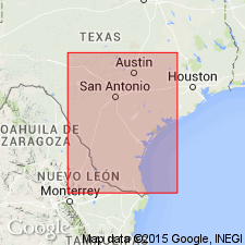
- Gulf Coast basin
Summary:
Pg. 1695 (fig. 1), 1702-1703. Willis sand. Discussed with Quaternary deposits of Texas Coastal Plain. Unconformably overlies sandstone and clay beds of Pliocene and late Miocene age. Underlies terrace deposit herein named Gay Hill. Age of Willis not determined from fossil evidence but is here considered to be Pleistocene.
Source: US geologic names lexicon (USGS Bull. 1200, p. 4248).
- Usage in publication:
-
- Citronelle-Willis formation
- Modifications:
-
- Revised
- AAPG geologic province:
-
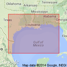
- Gulf Coast basin
Summary:
Pg. 1822. Citronelle formation of south Mississippi and Alabama, which was considered to be, in part, a residual formation is now recognized to be equivalent of Willis formation of Texas and Louisiana. Name Citronelle has priority and is here used for combined Citronelle-Willis in newly proposed classification of Gulf Coast. Age is Pleistocene.
Source: US geologic names lexicon (USGS Bull. 1200, p. 4248).
- Usage in publication:
-
- Willis Formation
- Modifications:
-
- Mapped 1:250k
- Dominant lithology:
-
- Clay
- Silt
- Sand
- Gravel
- AAPG geologic province:
-
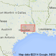
- Gulf Coast basin
Summary:
Pamphlet [p. 2]. Willis Formation. Clay, silt, sand, and siliceous gravel of granule to pebble size, including some petrifed wood; sand coarser than in younger rocks, noncalcareous; mostly deeply weathered and lateritic, indurated by clay and cemented by iron oxide locally, iron oxide concretions abundant and locally used as road material in coastward belt of outcrop, Qwc, iron oxide concretions less abundant and amount of weathering decreases eastward in landward belt of outcrop, Qwl; coastward edge of base of a outcrop is mostly at a lower elevation than base of landward edge of Qwc, indicating that the two outcrop belts may be of different ages. Forms scarps on landward side. Fluviatile. Thickness 100+/- feet. Lies above Fleming Formation (Miocene) and below Lissie Formation (Pleistocene) [mapped as Montgomery and Bentley formations in 1968 edition]. [Equivalent to Williana Formation of Louisiana.] Age is Pleistocene.
[Mapped in Grimes, Harris, Jasper, Montgomery, Newton, Polk, San Jacinto, Tyler, Walker, and Waller Cos., TX.]
Source: Publication; GNU records (USGS DDS-6; Denver GNULEX).

- Usage in publication:
-
- Willis Formation
- Modifications:
-
- Mapped 1:250k
- Dominant lithology:
-
- Gravel
- Sand
- Silt
- Clay
- AAPG geologic province:
-
- Gulf Coast basin
Summary:
Willis Formation. Gravel, sand, silt, and clay; mostly gravel inland decreasing to a minor amount coastward, mostly siliceous, locally cobble-size quartz and chert, some petrified wood; sand, fine to very coarse, poorly sorted; clay, silty, light yellowish gray, deeply weathered, indurated by mottled red and light gray clay; iron oxide concretions locally abundant, some beds highly indurated by iron-oxide cement; fluviatile. Thickness about 100 feet in southeastern area, thins to northwest. May correlate with Uvalde Gravel (Pliocene or Pleistocene) mapped in San Antonio Sheet to the west. Overlies Goliad Formation (Pliocene); underlies Lissie Formation (Pleistocene). Age is Pleistocene; is basal Pleistocene unit in this map sheet.
Mapped in De Witt, Victoria, Lavaca, Colorado, Fayette, Austin, and Waller Cos., southeastern TX.
Source: Modified from GNU records (USGS DDS-6; Denver GNULEX).
- Usage in publication:
-
- Willis Formation*
- Modifications:
-
- Mapped
- Dominant lithology:
-
- Sand
- Gravel
- Silt
- Clay
- AAPG geologic province:
-
- Gulf Coast basin
Summary:
Willis Formation. Subdivided into: (1) alluvial pebble gravel and sand (channel facies), 10 to 60 m thick; and (2) alluvial silt and clay (overbank facies), 5 to 50+ m thick. Unconformably overlies Tertiary sediments. Age is considered Pleistocene by some; others correlate the Willis with the Goliad Formation which carries a Pliocene vertebrate fauna.
Source: Publication.
For more information, please contact Nancy Stamm, Geologic Names Committee Secretary.
Asterisk (*) indicates published by U.S. Geological Survey authors.
"No current usage" (†) implies that a name has been abandoned or has fallen into disuse. Former usage and, if known, replacement name given in parentheses ( ).
Slash (/) indicates name conflicts with nomenclatural guidelines (CSN, 1933; ACSN, 1961, 1970; NACSN, 1983, 2005, 2021). May be explained within brackets ([ ]).