- Usage in publication:
-
- Williamsburg Granodiorite*
- Modifications:
-
- Overview
- AAPG geologic province:
-
- New England province
Summary:
Used as Williamsburg Granodiorite of Devonian age. Intrudes Goshen, Waits River, Gile Mountain, Littleton, and Erving Formations.
Source: GNU records (USGS DDS-6; Reston GNULEX).

- Usage in publication:
-
- Williamsburg Granodiorite*
- Modifications:
-
- Age modified
- AAPG geologic province:
-
- New England province
Summary:
Age of the Williamsburg Granodiorite is Middle(?) Devonian. It intrudes Lower Devonian metasedimentary rocks.
Source: GNU records (USGS DDS-6; Reston GNULEX).

- Usage in publication:
-
- Williamsburg Granodiorite
- Modifications:
-
- Geochronologic dating
- AAPG geologic province:
-
- New England province
Summary:
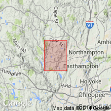
Unit occurs as numerous pegmatitic and aplitic dikes and sills of granodiorite and granite in Silurian to Devonian formations of the Connecticut Valley synclinorium. Contains plagioclase, microcline, quartz, biotite, and muscovite. Granodiorite contains abundant xenoliths of pelitic and mafic schist resembling the surrounding formations. Authors believe that the Williamsburg intruded after the main phase of Acadian deformation and that it is most likely entirely post-tectonic, though it is possible that it intruded during the late stages of the Acadian Orogeny as suggested by Hatch and Stanley (1988). Zircons separated from the Williamsburg Granodiorite are dated at 373+/-5 Ma by evaporation analyses. This is compatible with the age of the Belchertown pluton and provides a valuable constraint on the end of deformation.
Source: GNU records (USGS DDS-6; Reston GNULEX).
For more information, please contact Nancy Stamm, Geologic Names Committee Secretary.
Asterisk (*) indicates published by U.S. Geological Survey authors.
"No current usage" (†) implies that a name has been abandoned or has fallen into disuse. Former usage and, if known, replacement name given in parentheses ( ).
Slash (/) indicates name conflicts with nomenclatural guidelines (CSN, 1933; ACSN, 1961, 1970; NACSN, 1983, 2005, 2021). May be explained within brackets ([ ]).

