

- Usage in publication:
-
- Williamsburg pseudobuhr
- Modifications:
-
- Named
- Dominant lithology:
-
- Sand
- AAPG geologic province:
-
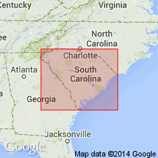
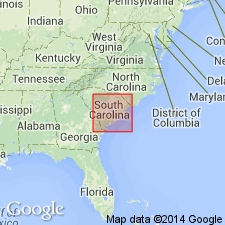
- Atlantic Coast basin
Summary:
Named as part of Black Mingo phase. Named for exposures in Williamsburg Co., near Rhems, SC, but more extensively as mantle covering ridge between Black River and Santee River, notably on scarp of swamp southwest of Gourdin Station and on crest of ridge, 3 miles north of Salters. Black Mingo phase divided into (descending order): Lang Syne beds, Upper Black Mingo (including Williamsburg pseudobuhr and Rhems shale, here named) and Lower or Black Mingo shale. Includes all strata of lower Eocene age east of Santee River, SC.
Source: GNU records (USGS DDS-6; Reston GNULEX).
- Usage in publication:
-
- Williamsburg pseudobuhr†
- Modifications:
-
- Abandoned
- AAPG geologic province:
-
- Atlantic Coast basin
Summary:
Black Mingo formation used to replace Sloan's (1908) Black Mingo phase. Extended to include all Eocene strata in South Carolina older than the McBean formation. Abandons Williamsburg pseudobuhr, Rhems shale, Upper Black Mingo, Lower Black Mingo, and Lang Syne beds, all part of the phase. [Correlation chart in this report shows correlation of Black Mingo with Tuscahoma sand, but text (p. 42) states that species COELOHELIA WAGNERIA Vaughan and HAIMESIASTRAEA CONFERTA Vaughan occur in Black Mingo (known before only in Midway and Wilcox groups of Alabama) as does OSTREA ARROSIS Aldrich (known only to be in Nanafalia formation of Wilcox group). Text makes no mention of correlation with Tuscahoma.]
Source: GNU records (USGS DDS-6; Reston GNULEX).

- Usage in publication:
-
- Williamsburg Formation
- Modifications:
-
- Reinstated
- Revised
- AAPG geologic province:
-
- Atlantic Coast basin
Summary:
The name, Williamsburg, first defined by Sloan (1908) and abandoned by Cooke (1936) is reinstated as the Williamsburg Formation of the Black Mingo Group (here raised in rank from a formation to group based on Sloan's Black Mingo "phase"). Previously called Williamsburg pseudobuhr (Sloan, 1908). Composed of arenaceous shale, fullers earth, and fossiliferous, argillaceous sands of the Lower Bridge Member (new) and fossiliferous, argillaceous sands and mollusk-rich, bioclastic limestones of the Chicora Member (new). Composite stratotype consists of outcrops at Lower Bridge on Black River and along the Santee River, just downstream from Wilson's Landing. Age of Williamsburg is Paleocene (Sabinian, Thanetian).
Source: GNU records (USGS DDS-6; Reston GNULEX).
- Usage in publication:
-
- Williamsburg Formation*
- Modifications:
-
- Biostratigraphic dating
- AAPG geologic province:
-
- Atlantic Coast basin
Summary:
Dinocyst flora from the St. Stephens rediversion canal pit are sparse and poorly preserved but do give keys to the age of the Williamsburg and Rhems Formations in the Black Mingo Group. Dinocyst flora indicate an early Paleocene age for the Rhems Formation and suggest correlation with upper part of Clayton Formation or Porters Creek Formation, AL and GA, unit P1 of Prowell and others (1985) in GA, and the Ellenton Formation of SC Coastal Plain. Samples are close in age to Brightseat Formation in MD. Equivalent to nannofossil zones NP 3 and 4. Dinocyst flora indicate a late Paleocene age for samples in the lower part of the Williamsburg Formation of the Black Mingo Group and late Paleocene or early Eocene(?) age for a sample from its upper part. Lower samples suggest correlation with Aquia Formation in MD and VA, the Nanafalia or Tuscahoma Formations in AL, and unit P2 of Prowell and others (1985) in GA). Equivalent to nannofossil zones NP 8 and 9. Dinocyst flora from upper part of Williamsburg correspond to late Paleocene species in Nanafalia Formation, but in Europe they would correspond to early Eocene.
Source: GNU records (USGS DDS-6; Reston GNULEX).
For more information, please contact Nancy Stamm, Geologic Names Committee Secretary.
Asterisk (*) indicates published by U.S. Geological Survey authors.
"No current usage" (†) implies that a name has been abandoned or has fallen into disuse. Former usage and, if known, replacement name given in parentheses ( ).
Slash (/) indicates name conflicts with nomenclatural guidelines (CSN, 1933; ACSN, 1961, 1970; NACSN, 1983, 2005, 2021). May be explained within brackets ([ ]).