The National Geologic Map Database is migrating to a new infrastructure. We apologize for any service disruptions during this process.
|
|---|


- Usage in publication:
-
- Wilkins Peak member*
- Modifications:
-
- Named
- Dominant lithology:
-
- Sandstone
- Shale
- Dolomite
- AAPG geologic province:
-
- Green River basin
Summary:
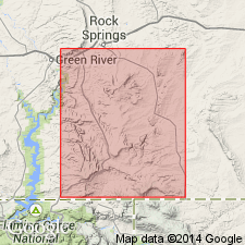
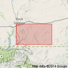
Named as a member of the Green River formation for exposures (the type locality) at Wilkins Peak, T18N, R106W, Sweetwater Co, WY in Greater Green River basin. Beds called Wilkins Peak in this report were misassigned to the younger Laney shale member of the Green River. These beds are older than type Laney. Is 900 ft thick at its type. Rests on Tipton shale member of Green River formation on east side of Bridger basin. Does not crop out on west side of basin. Is overlain everywhere by Laney shale member of Green River. Rocks assigned to Wilkins Peak are predominantly white dolomitic marlstones, oil shale, or greenish-gray dolomite. Lacks fossils, algal deposits, and oolites. Differs from type Laney in having a thick, extensive saline facies--beds of trona and other minerals. Of Eocene age.
Source: GNU records (USGS DDS-6; Denver GNULEX).
- Usage in publication:
-
- Wilkins Peak Member*
- Modifications:
-
- Revised
- AAPG geologic province:
-
- Green River basin
Summary:
Revised to include the newly named Firehole Bed, a tuff bed that lies about 95 ft above the base of the Wilkins Peak Member (of the Green River Formation) in Little, Middle, and South Firehole Canyons, Ts16 and 17N, Rs106 and 107W, Sweetwater Co, WY in the Greater Green River basin. Term Firehole replaces first tuff of Culbertson (1961). Member contains more than 35 thin widespread radioactive zones; 25 are uraniferous and phosphatic. Measured section; geologic map; stratigraphic table. Member overlies Tipton Shale Member and underlies Laney Shale Member. Is transitional in age between late early and middle Eocene.
Source: GNU records (USGS DDS-6; Denver GNULEX).
- Usage in publication:
-
- Wilkins Peak Member
- Modifications:
-
- Areal extent
- AAPG geologic province:
-
- Green River basin
Summary:
Areal limits map (fig 2) shows Wilkins Peak Lake to have extended over an area of 9500 sq mi which includes much of Green River Basin, Rock Springs uplift, and parts of Great Divide and Washakie Basins, all within Greater Green River basin. Previous workers have believed that lake was restricted to Green River Basin west of Rock Springs uplift. Nearly half of type locality for Tipton Shale Member of Green River Formation includes rocks belonging to lower and (or) middle part of Wilkins Peak. Wilkins Peak is one of five members of Green River Formation which consists of (ascending): Ramsey Ranch Member (new), Luman Member or Tongue, Tipton, Wilkins Peak, and Laney Shale Member. Chart showing previous nomenclature; restored section. Eocene age.
Source: GNU records (USGS DDS-6; Denver GNULEX).
- Usage in publication:
-
- Wilkins Peak Member*
- Modifications:
-
- Areal extent
- AAPG geologic province:
-
- Green River basin
Summary:
Geographically extended as a member of the Green River Formation into the Washakie basin of the Greater Green River basin. Strata mapped by Schultz (1920) in Canyon Creek in T12N, R102W, Sweetwater Co, WY, Greater Green River basin, as part Tipton Shale Member of Green River, are removed from the Tipton and reassigned to the Wilkins Peak. The reassigned rocks in Canyon Creek are conglomerate of limestone, sandstone, and chert, and represent a remnant of an alluvial fan. Graphic section; cross section. Overlies Tipton Shale Member. Underlies Cathedral Bluffs Tongue of Wasatch Formation. Eocene age.
Source: GNU records (USGS DDS-6; Denver GNULEX).
- Usage in publication:
-
- Wilkins Peak Member*
- Modifications:
-
- Areal extent
- AAPG geologic province:
-
- Green River basin
Summary:
Name recognized in Moffat Co, CO, Greater Green River basin, where it is mapped with (but nowhere separately mapped) Tipton Tongue of Green River Formation. The two units combined overlie Niland Tongue of Wasatch Formation and underlie Cathedral Bluffs Tongue of Wasatch.
Source: GNU records (USGS DDS-6; Denver GNULEX).
- Usage in publication:
-
- Wilkins Peak Member*
- Modifications:
-
- Contact revised
- AAPG geologic province:
-
- Green River basin
Summary:
Lower contact revised in that the Eocene Wilkins Peak Member of Green River Formation overlies the newly named Alkali Creek Tongue of Wasatch Formation in the vicinity of Fontenelle Creek, western part of Greater Green River basin. Rocks assigned to Alkali Creek were assigned to New Fork Tongue of Wasatch in earlier reports on this area. In the Table Rock field in the Washakie basin and at White Mountain on the Rock Springs uplift, eastern and central parts respectively, in the Greater Green River basin. The Wilkins Peak overlies Rife Bed (new) of Tipton Shale Member of Green River. Rocks of the Rife were assigned to an unnamed upper part of Tipton in earlier reports. Use of Wilkins Peak at White Mountain on the Rock Springs uplift follows usage of Bradley (1959) and Culbertson (1980). Stratigraphic diagrams.
Source: GNU records (USGS DDS-6; Denver GNULEX).
- Usage in publication:
-
- Wilkins Peak Member*
- Modifications:
-
- Areal extent
- Overview
- AAPG geologic province:
-
- Green River basin
Summary:
Isopach maps (figs 24-26) of lower, middle, and upper parts show areal extent within Greater Green River basin, WY and CO. Lower part deposited in east-west depression that conforms to Uinta Mountain trough; lake in which it was deposited was 135 mi long by 75 mi wide; locally thickness is 200 ft in southern part of Green River basin and in southwest part of Washakie basin. Middle part generally restricted to Green River basin and Rock Springs uplift areas after lake in which it was deposited had retreated from Great Divide, Washakie, and Sand Wash basins due to tectonic activity along eastern margins of Greater Green River basin; lake was irregularly circular and 85-100 mi across; thickness is 800 ft in area of Uinta Mountain trough and thins abruptly southward toward Uinta Mountains and less abruptly to north, east, and west across Green River basin, Rock Springs uplift, and eastern part of Wyoming thrust belt. Upper part was deposited as lake increased in size a second time; maximum thickness is 100 ft in central and southern Green River basin and in southwest Washakie and west Sand Wash basins; not deposited in Great Divide basin; equivalent to basal part of LaClede Bed of Laney Member of Green River in northern Green River and western Washakie and Sand Wash basins. Stratigraphic chart; cross sections. Eocene age.
Source: GNU records (USGS DDS-6; Denver GNULEX).

- Usage in publication:
-
- Wilkins Peak Member*
- Modifications:
-
- Overview
- AAPG geologic province:
-
- Green River basin
Summary:
Paleogeographic maps of lower part (fig. 67), middle part (fig. 68), and upper part (fig. 70) of this member of Green River Formation showing depositional environments in Greater Green River basin. Lake Gosiute expanded and contracted 77 times during Wilkins Peak time. Oil shale was deposited during expansions and mudstones during contractions. During time of deposition of lower part, lake occupied up to 8,700 sq mi. During time of deposition of middle part, lake occupied 12,000 sq mi; movements along Wind River and Sparks Ranch thrust faults caused tilting of basin and evacuation of lake from Great Divide, Washakie, and Sand Wash basins; alluvial fan deposits occurred along Uinta Mountains; intertongues with Cathedral Bluffs Tongue of Wasatch. During time of deposition of upper part, lake occupied about 8,800 sq mi; laterally equivalent to lower part of Laney Member of Green River in northern Green River, southwestern Washakie, and western Sand Wash basins; Lake Gosiute connected to Lake Uinta during this time. Lake surrounded by flood-plain deposits of Wasatch Formation; in northeast part of basin arkosic sediments of Battle Spring Formation were being deposited. Overlies Rife Bed of Tipton Shale Member of Green River. Generalized stratigraphic chart (fig. 41). Mapped (fig. 1), combined with Rife, in Vermilion Creek area, northwest CO. Eocene age.
Source: GNU records (USGS DDS-6; Denver GNULEX).
For more information, please contact Nancy Stamm, Geologic Names Committee Secretary.
Asterisk (*) indicates published by U.S. Geological Survey authors.
"No current usage" (†) implies that a name has been abandoned or has fallen into disuse. Former usage and, if known, replacement name given in parentheses ( ).
Slash (/) indicates name conflicts with nomenclatural guidelines (CSN, 1933; ACSN, 1961, 1970; NACSN, 1983, 2005, 2021). May be explained within brackets ([ ]).