- Usage in publication:
-
- Wilkie Ranch Formation
- Modifications:
-
- Named
- Dominant lithology:
-
- Marlstone
- Limestone
- Conglomerate
- AAPG geologic province:
-
- Permian basin
Summary:
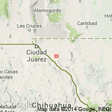
Name formally applied to some rocks informally designated "Leonard series (undivided)" by Albritton and Smith (1965) and informally "Wilkie Ranch formation" by Cys (1975). Named for the Wilkie Ranch in the western Finlay Mountains, Hudspeth Co, TX, Permian basin. Basal part not exposed; therefore type section is the interval between 0 and 230 ft in the Gulf 1 J. Burner-State "B" well. Location map. Columnar section showing rocks in the Finlay Mountains. Consists on outcrop in Finlay Mountains (from Albritton, Smith) of gray dolomitic fossiliferous--fusulinids, bryozoans, brachiopods, leaves, sponges, pelecypods, gastropods, cephalopods, corals, etc.--marlstone; conglomerate of well-rounded pebbles, cobbles, boulders of limestone and scattered pebbles of chert in a sandy matrix; and gray crystalline limestone; predominant lithology is marlstone; many of the limestone beds are crinoidal. Is 1,653 ft in the outcrop section, a section representative of shelf edge deposition between Marfa basin and Diablo platform. Is distinctive, mappable. Ranges between 1,675 and 1,750 ft thick. Unconformably overlies Hueco Limestone. Unconformably underlies Cretaceous rocks. Fossils of Leonard age.
Source: GNU records (USGS DDS-6; Denver GNULEX).
For more information, please contact Nancy Stamm, Geologic Names Committee Secretary.
Asterisk (*) indicates published by U.S. Geological Survey authors.
"No current usage" (†) implies that a name has been abandoned or has fallen into disuse. Former usage and, if known, replacement name given in parentheses ( ).
Slash (/) indicates name conflicts with nomenclatural guidelines (CSN, 1933; ACSN, 1961, 1970; NACSN, 1983, 2005, 2021). May be explained within brackets ([ ]).

