- Usage in publication:
-
- Wildhorse Mountain formation
- Modifications:
-
- Named
- Dominant lithology:
-
- Sandstone
- Shale
- AAPG geologic province:
-
- Ouachita folded belt
Summary:
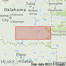
Named as basal formation (of 4) of Jackfork group (raised in rank) of Pushmataha series (new) of Bendian period; name taken from Wildhorse Mountain. Type locality given north of town of Moyers in T2S, R16E, Pushmataha Co, OK in Ouachita tectonic belt province. A "second type locality" selected in secs 25 and 26, T1S, R12W. Found in southeast OK in the Ouachita Mountains. Consists of a massive ridge-forming sandstone near the base which forms escarpments up to 15 ft high, generally succeeded by thin-bedded sandstones and intercalated green shales and tan argillaceous siltstone. The massive bed near the base consists of tan-colored, fine to coarse, rounded to subangular argillaceous sandstone; about 62 ft above this sandstone is 8 ft of sandstone--green with maroon mottling, very hard, very fine to medium, with subrounded to subangular grains. At top of formation is a very massive solid sandstone about 60 ft thick, the most prominent ridge maker in the Ouachita Mountains. Thickness varies from west to east; at type locality, approximates 3,600 ft; in Ts1 and 2S, R12E, is about 1,000 ft. Overlies Chickasaw Creek siliceous shale (new) of Stanley group (raised in rank) of Pushmataha series of Bendian period; underlies Prairie Mountain formation (new) of Jackfork group of Pushmataha series of Bendian period. Contains many plant fossils; SIGILLARIA and CALAMITES very common. Correlation chart. Cross section. Carboniferous age.
Source: GNU records (USGS DDS-6; Denver GNULEX).
For more information, please contact Nancy Stamm, Geologic Names Committee Secretary.
Asterisk (*) indicates published by U.S. Geological Survey authors.
"No current usage" (†) implies that a name has been abandoned or has fallen into disuse. Former usage and, if known, replacement name given in parentheses ( ).
Slash (/) indicates name conflicts with nomenclatural guidelines (CSN, 1933; ACSN, 1961, 1970; NACSN, 1983, 2005, 2021). May be explained within brackets ([ ]).

