- Usage in publication:
-
- Wilder formation*
- Modifications:
-
- Named
- Dominant lithology:
-
- Basalt
- Lava
- Tuff
- AAPG geologic province:
-
- Basin-and-Range province
Summary:
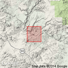
Named for exposures on Wilder Creek [not on geologic map base], on west wall of Boulder Canyon and on east margin of Bozarth Mesa, northwest part of Bagdad area, Yavapai Co, AZ in the Basin-and-Range province. No type locality designated. Small outcrops occur southeast of Hillside mine. Is intercalated with the older Gila? conglomerate and with the younger Sanders basalt (new) in Wilder Canyon. Ranges from 200 to 300 ft thick; 400 ft is exposed in Contreras Wash. Composed of lava flows, intrusive plugs, pyroclastic cones, and horizontally bedded tuffaceous rocks. Lava is blue gray, contains coarse phenocrysts of black augite, and small phenocrysts of black augite. Reddish pyroclastic basaltic "material" exposed on walls of Bozarth Mesa, on Wilder Creek, and east of Hillside mine. Assigned a late Tertiary? and Pleistocene? age. [Probably stratigraphic relations with Gila?, but no explanation given.] Geologic map.
Source: GNU records (USGS DDS-6; Denver GNULEX).
For more information, please contact Nancy Stamm, Geologic Names Committee Secretary.
Asterisk (*) indicates published by U.S. Geological Survey authors.
"No current usage" (†) implies that a name has been abandoned or has fallen into disuse. Former usage and, if known, replacement name given in parentheses ( ).
Slash (/) indicates name conflicts with nomenclatural guidelines (CSN, 1933; ACSN, 1961, 1970; NACSN, 1983, 2005, 2021). May be explained within brackets ([ ]).

