The National Geologic Map Database is migrating to a new infrastructure. We apologize for any service disruptions during this process.
|
|---|


- Usage in publication:
-
- Wildcat Lake Member
- Modifications:
-
- Principal reference
- Dominant lithology:
-
- Till
- AAPG geologic province:
-
- Wisconsin arch
Summary:
Pg. vi (chart), 49-52. Wildcat Lake Member of the Copper Falls Formation. (Follows informal usage of Attig and others, 1985, GSA Bull., v. 96, 1585-1593; Attig, 1985, Wisconsin Geol. Nat. Hist. Survey Inf. Circ., no. 50; Attig, 1984, Univ. Wisconsin PhD dissert.) Till, and associated debris flow and stream sediment. Till described as reddish brown, uniform, compact, slightly gravelly loamy sand to sandy loam. Pebble fabric strongly developed; long axes lie parallel to ice flow and plunges upglacier. Thickness in subsurface up to 6 m. Underlies debris flow and stream sediment [of Wildcat Lake] with sharp contact. Overlies gravelly sand; contact is abrupt. Equivalent to informal Bass Lake till of Nelson (Univ. Wisconsin MS thesis, 1973). Interpreted as having been deposited by advance of southwest-flowing Wisconsin Valley Lobe (Ontonagon Lobe). Probably nearly age-equivalent of Nashville Member of Copper Falls Formation in Langlade Lobe area. Age is considered Pleistocene (late Wisconsinan).
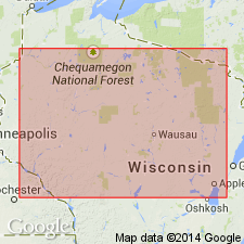
Type section: gravel pit on southeast side of County Trunk Highway M, about 0.5 km southwest of its intersection with County Trunk Highway B, in NW/4 NW/4 NE/4 sec. 34, T. 43 N., R. 7 E., [approx. Lat. 46 deg. 10 min. 08 sec. N., Long. 89 deg. 36 min. 19 sec. W.], Tenderfoot Lake 7.5-min quadrangle, Vilas Co., northern WI.
Named from Wildcat Lake, [northwest of type section], western edge Tenderfoot Lake 7.5-min quadrangle, Vilas Co., northern WI; name credited to John W. Attig.
Reference section: in power-auger hole near crest of drumlin on south side of North Creek Road, in NW/4 NW/4 NW/4 sec. 36, T. 42 N., R. 6 E., [approx. Lat. 46 deg. 05 min. 00 sec. N., Long. 89 deg. 42 min. 02 sec. W.], Boulder Junction 7.5-min quadrangle, Vilas Co., northern WI.
[Additional locality information from USGS historical topographic map collection TopoView and Wisconsin Highways, www.wisconsinhighways.org; accessed on June 9, 2018.]
Source: Publication.
For more information, please contact Nancy Stamm, Geologic Names Committee Secretary.
Asterisk (*) indicates published by U.S. Geological Survey authors.
"No current usage" (†) implies that a name has been abandoned or has fallen into disuse. Former usage and, if known, replacement name given in parentheses ( ).
Slash (/) indicates name conflicts with nomenclatural guidelines (CSN, 1933; ACSN, 1961, 1970; NACSN, 1983, 2005, 2021). May be explained within brackets ([ ]).