- Usage in publication:
-
- Wilburn Rhyolite Member*
- Modifications:
-
- Named
- Dominant lithology:
-
- Rhyolite
- AAPG geologic province:
-
- Appalachian basin
Summary:
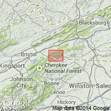
Named as uppermost member of Mount Rogers Formation in Mount Rogers volcanic center. Named for Wilburn Ridge in southeastern part of Whitetop Mountain 7.5-min quad, southwestern VA. Previously called unit A by Rankin (1967) and Rankin and others (1974). Consists of high-silica rhyolite with grayish-purple or maroon, aphanitic groundmass and 30 percent quartz and perthite phenocrysts. Basal 30 m has only 10 percent quartz and perthite phenocrysts. Basal part of member contains lithic clasts of Whitetop Rhyolite Member (new name), Buzzard Rock Member (new name), arfvedsonite-bearing Wilburn Rhyolite Member, coarsely porphyritic rhyolite, granite, and gneissic granite. Basal layer may be seen at elevation of about 4900 ft on southern extension of Wilburn Ridge in Whitetop Mountain quad (lat 36-deg, 38.19' N, long 81-deg, 30.94' W) and at an elevation of about 4500 ft on south side of Wilburn Ridge in Trout Dale quad, a short distance above Grayson Highlands State Park Rd (lat 36-deg, 38.27' N, long 81-deg, 29.80' W). Differs from underlying Buzzard Rock Member and Whitetop Rhyolite Member in that they are lava flows and Wilburn is a welded ash-flow tuff. Thickness is 760 m at Wilburn Ridge. Overlies Whitetop Rhyolite Member; unconformably underlies Konnarock Formation (new name) as seen in roadcut along County Rd 603 just west of highway bridge over Big Laurel Creek and about 400 m east of Konnarock-Whitetop Mountain quad boundary. Origin is probably an ash-flow sheet emplaced subaerially by later eruptions from Mount Rogers volcanic center, which probably led to a caldera collapse. Age is Late Proterozoic. Report includes geologic map.
Source: GNU records (USGS DDS-6; Reston GNULEX).
For more information, please contact Nancy Stamm, Geologic Names Committee Secretary.
Asterisk (*) indicates published by U.S. Geological Survey authors.
"No current usage" (†) implies that a name has been abandoned or has fallen into disuse. Former usage and, if known, replacement name given in parentheses ( ).
Slash (/) indicates name conflicts with nomenclatural guidelines (CSN, 1933; ACSN, 1961, 1970; NACSN, 1983, 2005, 2021). May be explained within brackets ([ ]).

