- Usage in publication:
-
- Wiggler Wash Member
- Modifications:
-
- Named
- Dominant lithology:
-
- Gypsum
- Siltstone
- Shale
- AAPG geologic province:
-
- Paradox basin
Summary:
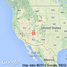
Named as a member of Carmel Formation of San Rafael Group for Wiggler Wash, Kane Co, UT in the Plateau sedimentary province. Type section measured 4 mi east of Kodachrome State Park, secs 17, 18, 19, and 20, T38S, R1W. Previously mapped as undifferentiated Winsor or Carmel. Exposed between Grosvenor Arch west to Mill Creek, Kane Co. At type composed predominately of white, green, thin- to thick-bedded, wavy-contorted gypsum in beds alternated with red siltstone, green shale, and sandstone. At type also includes lesser amounts of red, sandy gypsiferous siltstone and thin flat bed limestone where the member is 55.5 ft thick. Is 49 ft thick in Bull Valley, T38S, R4W. Overlies Winsor Member of Carmel; underlies Gunsight Butte Member (new) of Entrada. Assigned to the Late Jurassic. Measured sections. Cross sections.
Source: GNU records (USGS DDS-6; Denver GNULEX).
For more information, please contact Nancy Stamm, Geologic Names Committee Secretary.
Asterisk (*) indicates published by U.S. Geological Survey authors.
"No current usage" (†) implies that a name has been abandoned or has fallen into disuse. Former usage and, if known, replacement name given in parentheses ( ).
Slash (/) indicates name conflicts with nomenclatural guidelines (CSN, 1933; ACSN, 1961, 1970; NACSN, 1983, 2005, 2021). May be explained within brackets ([ ]).

