The National Geologic Map Database is migrating to a new infrastructure. We apologize for any service disruptions during this process.
|
|---|


- Usage in publication:
-
- Wicomico formation
- Modifications:
-
- Original reference
- Dominant lithology:
-
- Sand
- Loam
- Clay
- Gravel
- AAPG geologic province:
-
- Atlantic Coast basin
Summary:
Pg. 73-75. Wicomico formation of Columbia group. What has just been said regarding the materials which enter into underlying Sunderland formation applies equally well to those comprising Wicomico terrace, except that it possesses perhaps a larger proportion of sand and loam derived from its subterrane. In southern Maryland the base of Wicomico terrace lies at about 40 or 50 feet, and the top, where it borders its ancient sea cliff, at about 90 feet. Wicomico River, in St. Marys and Charles Counties, suggested the name for this formation. Separated from underlying Sunderland formation and from overlying Talbot formation by erosion unconformity. Is middle formation of Columbia group. [Age is Pleistocene.]
Source: US geologic names lexicon (USGS Bull. 896, p. 2331).
- Usage in publication:
-
- Wicomico formation
- Modifications:
-
- Areal extent
- AAPG geologic province:
-
- Atlantic Coast basin
Summary:
Pg. 171+. Wicomico formation. Clays, loam, sands, and gravels, 0 to 70+/- feet thick. Terrace and off-shore deposits. Older than Talbot formation, which extends from tide to 30 or 40 feet, and younger than Sunderland formation. Occupies entire surface of Eastern Shore of Maryland above 35 or 40 feet, and is developed as a terrace, usually a mile or more wide. Its limits are between 90 and 100 feet and 30 and 40 feet. [Age is Pleistocene.]
Source: US geologic names lexicon (USGS Bull. 896, p. 2331).
- Usage in publication:
-
- Wicomico formation*
- Modifications:
-
- Revised
- AAPG geologic province:
-
- Atlantic Coast basin
Summary:
Restricted Talbot formation to deposits on 40-foot level (Talbot terrace), restricted Wicomico formation to deposits on 100-foot level (Wicomico terrace), and recognized as a distinct formation the deposits on 70-foot level (Penholoway terrace). The deposits on 70-foot level were not then given a distinct formation name, but are now known as Penholoway formation. They have heretofore been included in Wicomico formation to north and in †Chowan formation (abandoned) to south. These restricted definitions have been adopted by the USGS. [Age is Pleistocene.]
Source: US geologic names lexicon (USGS Bull. 896, p. 2331).

- Usage in publication:
-
- Wicomico formation*
- Modifications:
-
- Overview
- AAPG geologic province:
-
- Atlantic Coast basin
Summary:
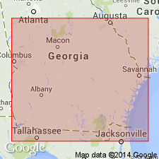
Wicomico formation of Columbia group. The terrace formations of the Columbia group (including the Wicomico) now [ca. 1936] recognized by Cooke from Delaware to southern Georgia, and probably into Florida, are enumerated herein under Columbia group. Age is Pleistocene.
Source: US geologic names lexicon (USGS Bull. 896, p. 2331).
- Usage in publication:
-
- Wicomico formation*
- Modifications:
-
- Areal extent
- AAPG geologic province:
-
- Florida platform
Summary:
Pg. 75-77, pls. 2, 3. Wicomico formation. In southern Florida, the Talbot, Penholoway, and Wicomico formations comprise a conformable sequence of deposits whose differentiation is based mainly on location of their respective shore lines --42, 70, and 100 feet above present sea level. Presumably, the Penholoway everywhere merges downward into deposits of Wicomico age, and the Talbot into Penholoway and Wicomico successively. The sequence unconformably overlies Caloosahatchee marls and is likewise separated by a stratigraphic break from the Pamlico which fringes it. [Age is Pleistocene.]
Source: US geologic names lexicon (USGS Bull. 1200, p. 4224).
- Usage in publication:
-
- Wicomico formation*
- Modifications:
-
- Areal extent
- AAPG geologic province:
-
- Atlantic Coast basin
Summary:
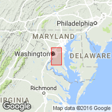
Pg. 48-50. Wicomico formation. In Prince Georges County, Maryland, and District of Columbia, consists of coarse gravel bed at base and finer sand and silt above; color of silt ranges from yellow to drab to dirty white; local basal deposits of carbonaceous clay contain tree stumps and other woody debris. Thickness rarely more than 30 feet. In Potomac Valley, follows meandering course cut in crystalline bedrock and the Potomac group; along Patuxent River, lies on Cretaceous, Eocene, and Miocene beds; is sunk below base of Sunderland formation, and separated from it by a slope exposing older rocks. Deposition is believed to have begun during second (Kansan) glacial stage and completed during second (Yarmouth) interglacial stage.
Source: US geologic names lexicon (USGS Bull. 1200, p. 4224).
- Usage in publication:
-
- "Wicomico" terrace
- Modifications:
-
- Redescribed
- AAPG geologic province:
-
- Atlantic Coast basin
Summary:
Concept of Wicomico Formation is invalid and should be abandoned in the lithostratigraphic sense along with Silver Bluff, Princess Anne, Pamlico, Penholoway, Talbot, Sunderland, Coharie, and Brandywine Formations. Though name is retained as a terrace, it is inappropriate because Wicomico was originally used as a formation name. "Wicomico" terrace is directly underlain by Cypresshead Formation (new name), which also underlies the "Talbot" and Penholoway terraces.
Source: GNU records (USGS DDS-6; Reston GNULEX).
- Usage in publication:
-
- Wicomico Formation
- Modifications:
-
- Not used
- AAPG geologic province:
-
- Atlantic Coast basin
Summary:
Authors believe that Wicomico is not appropriate as a lithostratigraphic unit as it was originally defined as a terrace. In study area, sediments previously mapped as Wicomico now called Charles City and Chuckatuck Formations (new names) and Windsor Formation (in part).
Source: GNU records (USGS DDS-6; Reston GNULEX).
- Usage in publication:
-
- Wicomico Formation
- Modifications:
-
- Not used
- AAPG geologic province:
-
- Atlantic Coast basin
Summary:
[This manuscript was reviewed by the GNU in 1973, but was not published until 1990. Nomenclature is this report is not necessarily current USGS usage.]
Strata in study area previously mapped as Wicomico, here referred to Pensauken Formation. In DE, similar deposits are mapped as Columbia Group.
Source: GNU records (USGS DDS-6; Reston GNULEX).
For more information, please contact Nancy Stamm, Geologic Names Committee Secretary.
Asterisk (*) indicates published by U.S. Geological Survey authors.
"No current usage" (†) implies that a name has been abandoned or has fallen into disuse. Former usage and, if known, replacement name given in parentheses ( ).
Slash (/) indicates name conflicts with nomenclatural guidelines (CSN, 1933; ACSN, 1961, 1970; NACSN, 1983, 2005, 2021). May be explained within brackets ([ ]).