The National Geologic Map Database is migrating to a new infrastructure. We apologize for any service disruptions during this process.
|
|---|


- Usage in publication:
-
- White Point Sandstone Member
- Modifications:
-
- Original reference
- Dominant lithology:
-
- Sandstone
- Siltstone
- AAPG geologic province:
-
- Paradox basin
Summary:
[Compilation from replacement copy, dated May 1971.] Pg. 25-26; App. p. 50-51 (Section 19, measured section of Hellmut Doelling, Utah Geol. and Min. Survey). White Point Sandstone Member of Summerville Formation of San Rafael Group. At type section, chiefly alternating beds of grayish-white sandstone and reddish-brown siltstone; basal 3 feet consists of gritstone, pebble conglomerate, and reworked poorly sorted pebble and grit sandstone. Thickness at type section 83+ feet. Overlies Entrada Sandstone; unconformably underlies Salt Wash Sandstone Member of Morrison Formation. Interpreted as a marginal facies of the Summerville. Previously mapped as undifferentiated part of Summerville, as part of Salt Wash, and as Bluff Sandstone. [Age is considered Late Jurassic.]
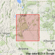
Type section (Section 19): south of Kane-Garfield Co. line, in north-central sec. 5 [unsurveyed], T. 38 S., R. 5 E., [approx. Lat. 37 deg. 32 min. 15 sec. N., Long. 111 deg. 23 min. 20 sec. W., Seep Flat 7.5-min quadrangle], Kane Co., central southern UT. Named from White Point, a geographic feature about 3 mi southeast of type section, in SW/4 sec. 11, T. 38 S., R. 5 E., [Sunset Flat 7.5-min quadrangle], Kane Co., central southern UT.
[Additional locality information from USGS historical topographic map collection TopoView, accessed February 6, 2023.]
Source: Publication; US geologic names lexicon (USGS Bull. 1520, p. 334); GNU records (USGS DDS-6; Denver GNULEX).
- Usage in publication:
-
- White Point Member
- Modifications:
-
- Not used
Summary:
Part of what is considered Tidwell Member (new) of Morrison Formation in this report was assigned by Thompson and Stokes (1970) to White Point Member of Summerville Formation in southeastern part of Kaiparowits basin, UT, Plateau sedimentary province. White Point was thought to be a southern extension of Summerville, actually contains a sequence of rocks that belong to the Morrison. Not recognized as a valid term in this report. [Age not discussed, but if member belongs in Morrison, it is Late Jurassic.]
Source: GNU records (USGS DDS-6; Denver GNULEX).
For more information, please contact Nancy Stamm, Geologic Names Committee Secretary.
Asterisk (*) indicates published by U.S. Geological Survey authors.
"No current usage" (†) implies that a name has been abandoned or has fallen into disuse. Former usage and, if known, replacement name given in parentheses ( ).
Slash (/) indicates name conflicts with nomenclatural guidelines (CSN, 1933; ACSN, 1961, 1970; NACSN, 1983, 2005, 2021). May be explained within brackets ([ ]).