The National Geologic Map Database is migrating to a new infrastructure. We apologize for any service disruptions during this process.
|
|---|


- Usage in publication:
-
- White Eagle rhyolite
- Modifications:
-
- Named
- Dominant lithology:
-
- Rhyolite
- AAPG geologic province:
-
- Basin-and-Range province
Summary:
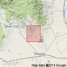
Named as a unit (1 of 9) in the "Lower volcanic series" for the White Eagle mine in sec. 34, T 19 S, R 9 W, northern Cooks Range, Grant Co., NM in the Basin-and-Range province. No type locality designated. Mapped (geologic map) in the Cooks Range and to south of range in secs. 3 and 10, T 20 S, R 9 W, Luna Co., MN in the Basin-and-Range province. Forms dikes in Precambrian granite as much as 1 mile long and 50 ft wide, and sills 56 ft thick. Flows cap Precambrian granite gneiss. The rhyolite is aphanitic, cream-colored, flow banded and flow folded with slickensides on surfaces of flow bands. Contains sparse phenocrysts of quartz and feldspar. Rounded inclusions of Precambrian granite gneiss in dikes and in bottom of flows. Zones of white spherulites as much as 3 ft thick mark the margins of most dikes and sills. Tertiary age assigned.
Source: GNU records (USGS DDS-6; Denver GNULEX).
For more information, please contact Nancy Stamm, Geologic Names Committee Secretary.
Asterisk (*) indicates published by U.S. Geological Survey authors.
"No current usage" (†) implies that a name has been abandoned or has fallen into disuse. Former usage and, if known, replacement name given in parentheses ( ).
Slash (/) indicates name conflicts with nomenclatural guidelines (CSN, 1933; ACSN, 1961, 1970; NACSN, 1983, 2005, 2021). May be explained within brackets ([ ]).